Passages that mention Huntsville, cut from the printed page as they were published.
History of Logan County and Ohio1880 · page 381Read the page →
Read the text
manufactories. The first of these was built by Hugh Bickham, early in the settlement; it was a hewed log structure and_ stood just south of Huntsville. The second was built by Edward Harper in 1845; this was quite a respectable building; it stood near the Instine grist-mill, but did not pay, and after some five years was closed. The third and
Text read by machine from the scan; it may contain errors.
History of Logan County and Ohio1880 · page 382Read the page →
Read the text
About one mile east of the present thriving village of Huntsville, on the Bellefontaine perhaps, one dozen dwellings, the. remains of the once promising village of Cherokee. The site of this town was formerly owned by Robert Edminston, Dr. Samuel A. Morton and Alexander Thompson, who, on March 19, 1852, by the aid of James W. Marmon,
Text read by machine from the scan; it may contain errors.
History of Logan County and Ohio1880 · page 383Read the page →
Read the text
The village of Huntsville was incorporated in December, 1865, and in April follovs^ing the first election of officers was held. Sidney B.
Text read by machine from the scan; it may contain errors.
History of Logan County and Ohio1880 · page 384Read the page →
Read the text
a few years, when the society having attained sufficient strength, a small frame meeting-house' was built at Cherokee. This the society occupied until the rise of Huntsville, when it was sold, and a more commodious structure erected in that village. This was built in 1866. The membership of this society is now numerous and its future encourag-
Text read by machine from the scan; it may contain errors.
Scans and text from the Internet Archive. Books published in 1930 or earlier, which are in the public domain.
Timeline
Huntsville, 1832 to 1913
Woven from the archive, old maps, post office records, the National Register and the people born here.
Nothing in the archives for these yearsWeddings on Main Street, storms, parades, school pictures, the old store. If it’s in your family album, it belongs here.
Founding dates: Wikidata, Wikipedia, the U.S. post office records of Blevins & Helbock (CC0) and the Census. Homes by year built: Census ACS 2020–24. National Register of Historic Places: National Park Service (list of May 22, 2026). Old photos, postcards and papers: Wikimedia Commons, the Library of Congress and other public archives, credited on each item’s page. Maps: U.S. Geological Survey historical topographic maps (via Esri) and Sanborn fire-insurance maps (Library of Congress). History text and census tables: Wikipedia (CC BY-SA 4.0). Places that used to be: USGS Geographic Names Information System (2021). How TownRatings grades history →
From Wikimedia Commons (12), Wikipedia, Wikidata and Wikipedia for famous people, U.S. Geological Survey historical maps, U.S. Census counts (via Wikipedia), the US Post Offices dataset (Blevins & Helbock), the USGS Geographic Names Information System and old county and town histories (Internet Archive). Archive images are copied here with their credits and licenses, shown on each photo’s page. Refreshed monthly.


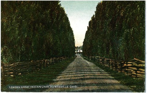 1905
 2015
 2009
 2009
 2009
 2009
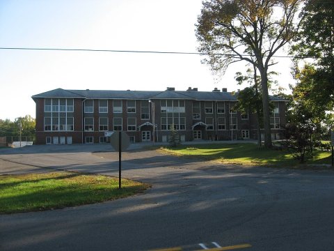 2009
 2009
 2008
 2004