Hillsboro dates to 1807, and 29% of its homes were built before 1940
More historic than 96% of U.S. towns · #51 of 993 in Ohio. What drives it
13 places in town are on the National Register, among them two historic districts with 148 buildings between them. Below: 1 old photo or paper, maps from 1887 on, and the census since 1810.
Founding year: Wikipedia. First post office: 1809.The full story ↓
History grade
What drives Hillsboro’s History grade
On its age, its old homes and the National Register, Hillsboro is more historic than 96% of U.S. towns, #51 of 993 in Ohio. All 3 inputs are above most U.S. towns; its National Register listings ranks highest and its age lowest.
A+
HistoryA character grade: shown, never part of Hillsboro’s overall grade.
Ohio towns list about as much on the Register as the country (a typical Ohio town has 2.9 per 10,000 residents, the U.S. 2.4), so Hillsboro’s 253 sits above most of its state (97% of Ohio towns have fewer) while its 165 historic buildings outnumber those of 92% of U.S. towns.
How sure. Graded on any two of the three inputs instead, the letter would range from A to A+. The pre-1940 share is a Census survey estimate (±6.0 points). Two sources give 1807.
Founding year: Wikipedia (other dates in Quick answers). Homes: Census ACS 2020–24. National Register: National Park Service, May 2026 list; each listing counted once (boundary changes and added documentation belong to their listing), and a historic district counts its contributing buildings. How TownRatings grades history →
What stands out about Hillsboro’s past
Read from the archive, the National Register and the record. The page puts what stands out first.
Hillsboro was platted in 1807, and most likely named for the hills near the original town site. One of the late 19th century's largest reform organizations, the Woman's Christian Temperance Union that went on to play important roles in achieving women's suffrage and prohibition, was founded in Hillsboro in 1873.
A 200-year old building on West Main Street collapsed on 3 June 2019.
east and west at Hillsboro were broken off, and "war" was declared. The promoters of the Cincinnati line proposed to extend their road east beyond Hillsboro through Piketon and Jackson to Parkersburg, and the pilomotors of the Marietta and Chillicothe road decided to build an independent line to Cincinnati by way of Blanchester. But the Hillsboro & Cincinnati, after completing its line from Loveland through Lynchburg to Hillsboro in 1853, stopped at Hillsboro, though it. sank nearly $450,000 in the effort at extension to Park-
Text read by machine from the scan; it may contain errors.
land county. He was born in Uniontown, Pa., in 1767, obtained his professional education at Philadelphia, and in 1797 came west to the new towTi of Franklinton, on the upper Scioto. Afterward he cast his fortunes with the town of Hillsboro, beginning his practice there before the village was platted, and continuing in active work until near the time of his death, which occurred in 1852. He was, however, a resideut of Hillsboro only about seventeen years, removing after that time to a farm on the Chillicothe pike, where he built the
Text read by machine from the scan; it may contain errors.
Hillsboro crusade sketches and family records1906 · page 64Read the page →
Read the text
Judge Thompson's account of this movement, taken from his History of the County of Highland: "The town of Hillsboro has always been noted for its interest in the encouragement of all systems of education, and few populations have excelled that of Hillsboro in the promotion of female education ; the result of which has been to establish a high standard of refinement of both
Text read by machine from the scan; it may contain errors.
Hillsboro crusade sketches and family records1906 · page 198Read the page →
Read the text
as she has always been "first in peace." It was freely said, that in Washington Court-house, where the Crusade broke out the day following its manifestation in Hillsboro, greater results were reached, and that hence the fire spread with a steady flame; but the women of Hillsboro were " in at the birth," and Hillsboro is the cradle, even as Washington Court-house is the
Text read by machine from the scan; it may contain errors.
Scans and text from the Internet Archive. Books published in 1930 or earlier, which are in the public domain.
Timeline
Hillsboro, 1807 to 1950
Woven from the archive, old maps, post office records, the National Register and the people born here.
Every edition of the U.S. Geological Survey’s map of Hillsboro. Tap a year, or press play to watch the town change.
1917Hillsboro sheet · 1:62,500
U.S. Geological Survey historical topographic maps (public domain), via Esri’s collection of the scans. The red ring marks the center of Hillsboro.
Every building
Hillsboro, building by building, 1887–1911
Fire insurance maps drew every building, what it was made of and what it was used for, so insurers could price the risk of fire. Pick a year, then a sheet.
US Post Offices dataset (Blevins & Helbock, CC0). Places and cemeteries from the USGS Geographic Names Information System (2021).
Questions about Hillsboro’s history
What year was Hillsboro founded?
In 1807, according to Wikipedia’s history of the town. Hillsboro’s post office opened in 1809, and the census of 1810 counted 220 people here.
How does Hillsboro rank for history?
Hillsboro is more historic than 96% of U.S. towns, #51 of 993 in Ohio. The History grade combines the town’s founding era, the share of homes built before 1940 and its National Register listings. It’s a character grade, so it isn’t part of the overall grade. How it works.
What is on the National Register in Hillsboro?
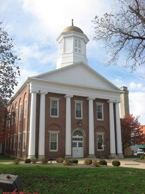
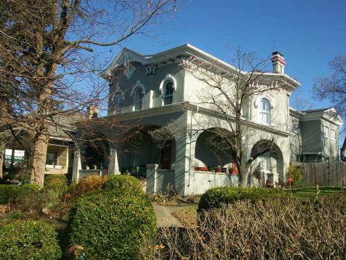
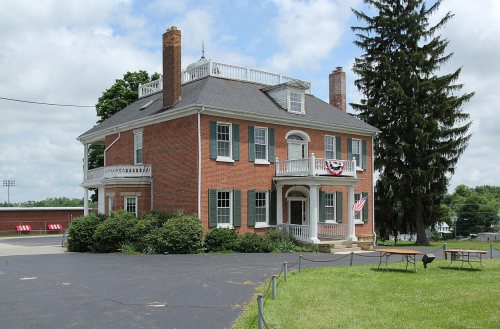
13 listings: 11 buildings, among them the Highland County Courthouse (listed 1978, the first), and 2 historic districts, the East Main Street Historic District and the Hillsboro Historic Business District, with 148 contributing buildings. 165 historic buildings in all.
How old are the homes in Hillsboro?
29% of Hillsboro’s homes were built before 1940 (Census estimate, ±6.0 points), against a typical 15% for an Ohio town; the median home was built in 1971.
Founding dates: Wikidata, Wikipedia, the U.S. post office records of Blevins & Helbock (CC0) and the Census. Homes by year built: Census ACS 2020–24. National Register of Historic Places: National Park Service (list of May 22, 2026). Old photos, postcards and papers: Wikimedia Commons, the Library of Congress and other public archives, credited on each item’s page. Maps: U.S. Geological Survey historical topographic maps (via Esri) and Sanborn fire-insurance maps (Library of Congress). History text and census tables: Wikipedia (CC BY-SA 4.0). Places that used to be: USGS Geographic Names Information System (2021).
From Wikimedia Commons (12), the National Register of Historic Places (13), Wikipedia, Wikidata and Wikipedia for famous people, U.S. Geological Survey historical maps, U.S. Census counts (via Wikipedia), the US Post Offices dataset (Blevins & Helbock), the USGS Geographic Names Information System, Sanborn fire insurance maps (Library of Congress) and old county and town histories (Internet Archive). Archive images are copied here with their credits and licenses, shown on each photo’s page. Refreshed monthly.






 2013
 2013
 2013
 2012
 2011
 2011
 2011
 2011
 2011
 2011
 2011


