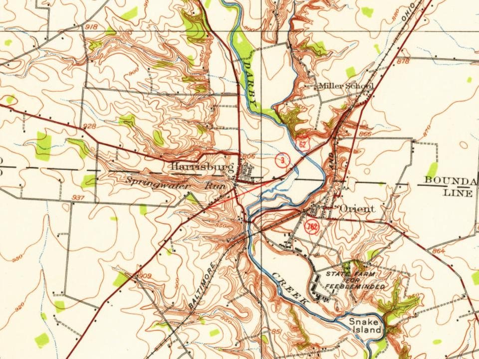
The Harrisburg post office opened in 1835, the earliest record of the town by name. Wikidata gives 1836. Two smaller post offices, Big Arby (1834) and Darby (1848), opened inside today’s town and later closed.
First census: 109 in 18502020 census: 315191 years
Founding year: the first Harrisburg post office (Blevins & Helbock, CC0). Wikidata: 1836.The full story ↓
What stands out about Harrisburg’s past
Read from the archive, the National Register and the record. The page puts what stands out first.
Harrisburg was founded in 1836 by Joseph Chenowith, and surveyed and platted by Frederick Cole. Prior to the laying out of the village, the area was known as Darby Cross Roads. The present name is after Harrisburg, Pennsylvania.
Prior to the establishment of the village of Harrisburg, the Big Darby Post Office had been established on March 13, 1834, and the name was changed to Harrisburgh Post Office on February 18, 1835. The post office was, for an unknown reason, discontinued or decommissioned on August 26, 1836, but was quickly re-established on October 21, 1836. The spelling was officially changed to "Harrisburg" on March 30, 1893.
Peaked at 556 in 1970; 315 people lived here in 2020.
18 censuses, 1850–2020.
U.S. Census Bureau decennial counts, from the census table on Harrisburg’s Wikipedia page.
From the old history books
What they wrote about Harrisburg in 1909
Passages that mention Harrisburg, cut from the printed page as they were published.
Centennial history of Columbus and Franklin County, Ohio1909 · page 408Read the page →
Read the text
In 1836, Joseph Chenowith founded the town of Harrisburg, Frederick Cole, being the "surveyor" who laid it out. Originally Darby Cross Roads, a postoffice had been established at the same point, but when Harrisburg was established, the name of the postoffice was changed to correspond. The first j)0stmaster was John Haines, appointed 1828, succeeded in 1833 by George Geiger and Abram Buckles, 1836; then followed Dr. T. Thompson, 1838; Henry Miller, 1841; J. W. Goetschius, 1841; and Henry Miller again who held the oflice to 1860, constituting the pioneer postmasters.
Text read by machine from the scan; it may contain errors.
Scans and text from the Internet Archive. Books published in 1930 or earlier, which are in the public domain.
Timeline
Harrisburg, 1833 to 1970
Woven from the archive, old maps, post office records, the National Register and the people born here.
Founding dates: Wikidata, Wikipedia, the U.S. post office records of Blevins & Helbock (CC0) and the Census. Homes by year built: Census ACS 2020–24. National Register of Historic Places: National Park Service (list of May 22, 2026). Old photos, postcards and papers: Wikimedia Commons, the Library of Congress and other public archives, credited on each item’s page. Maps: U.S. Geological Survey historical topographic maps (via Esri) and Sanborn fire-insurance maps (Library of Congress). History text and census tables: Wikipedia (CC BY-SA 4.0). Places that used to be: USGS Geographic Names Information System (2021). How TownRatings grades history →
From Wikimedia Commons (7), Wikipedia, Wikidata and Wikipedia for famous people, U.S. Geological Survey historical maps, U.S. Census counts (via Wikipedia), the US Post Offices dataset (Blevins & Helbock), the USGS Geographic Names Information System and old county and town histories (Internet Archive). Archive images are copied here with their credits and licenses, shown on each photo’s page. Refreshed monthly.


 2015
 2015
 2013
 2013
 2012
 2012
 2004