Green Township dates to 1809, and 3 of its places are on the National Register
More historic than 62% of U.S. towns · #510 of 993 in Ohio. What drives it
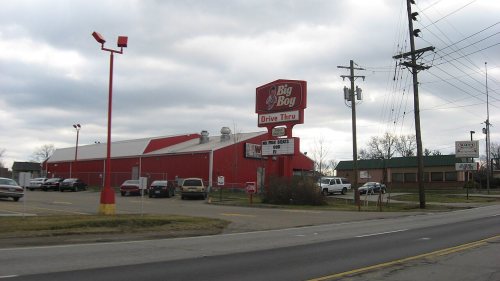
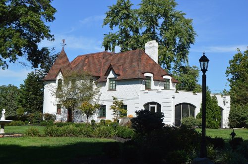
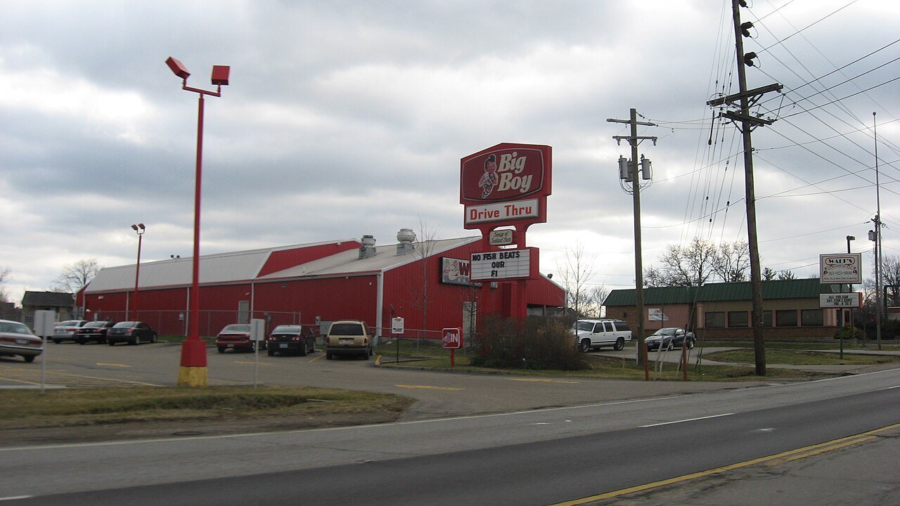
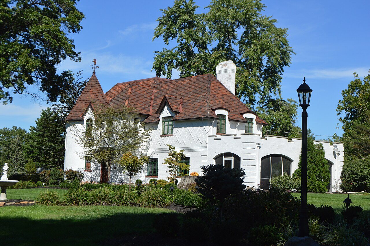
Most of Green Township was built recently: 7% of its homes predate 1940 and the median home dates from 1972. Its Register listings are the Old Gothic Barns, the Pine Meer and the Joseph and Cecilia Bappert House. Below: maps from 1914 on and the census since 1820.
Founding year: Wikipedia. First post office: 1843.The full story ↓
History grade
What drives Green Township’s History grade
On its age, its old homes and the National Register, Green Township is more historic than 62% of U.S. towns, #510 of 993 in Ohio. Its age holds the grade up; its share of homes from before 1940 pulls it down.
B
HistoryA character grade: shown, never part of Green Township’s overall grade.
Ohio towns list about as much on the Register as the country (a typical Ohio town has 2.9 per 10,000 residents, the U.S. 2.4), so Green Township’s 0.8 sits near the middle of its state (48% of Ohio towns have fewer) while its 5 historic buildings outnumber those of 70% of U.S. towns.
NoteThe founding year comes from Wikipedia alone; no second source gives 1809.
How sure. Graded on any two of the three inputs instead, the letter would range from B− to B+. The pre-1940 share (±1.1 points) is firm at this size.
Founding year: Wikipedia (other dates in Quick answers). Homes: Census ACS 2020–24. National Register: National Park Service, May 2026 list; each listing counted once (boundary changes and added documentation belong to their listing), and a historic district counts its contributing buildings. How TownRatings grades history →
What stands out about Green Township’s past
Read from the archive, the National Register and the record. The page puts what stands out first.
Bridgetown Post Officepost officeDent Post Officepost officeMack Post Officepost officeSchool Number 11schoolSchool Number 2schoolSchool Number 3schoolSchool Number 7schoolSchool Number 8school
10cemeteries and burying grounds inside Green Township
AsburyBrethrenBridgetown ProtestantCovedaleEbenezerGutzwillers GroveLingoSaint Aloysius Gonzaga CatholicSaint James CatholicTiferes
US Post Offices dataset (Blevins & Helbock, CC0). Places and cemeteries from the USGS Geographic Names Information System (2021).
Help out
Start Green Township’s collection
The first neighbors to add old photos shape how Green Township’s history is told.
Decades since 1900 with photos
00s10s20s30s40s50s60s70s80s90s
0 of 10 decades. The empty ones are waiting for someone’s album.
Every edition of the U.S. Geological Survey’s map of Green Township. Tap a year, or press play to watch the town change.
1914West Cincinnati sheet · 1:62,500
U.S. Geological Survey historical topographic maps (public domain), via Esri’s collection of the scans. The red ring marks the center of Green Township.
The township was originally held intact by John Cleves Symmes, with the apparent intent of naming it as the academy township for his purchase. In 1802 a court order awarded half the township to one of his Miami Company investors, Elias Boudinot. This became part of the disputes over the entire Symmes Purchase. The township is named after Nathanael Greene, a Revolutionary War general.
Passages that mention Green Township, cut from the printed page as they were published.
History of Cincinnati and Hamilton County, Ohio1894 · page 405Read the page →
Read the text
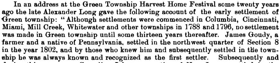
In an address at the Green Township Harvest Home Festival seme twenty years ago the late Alexander Long gave the following account of the early settlement of Green township: “Although settlements were commenced in Columbia, Cincinnati, Miami, Mill Creek, Whitewater and other townships in 1788 and 1796, no settlement was made in Green township until some thirteen years thereafter. James Goudy, a farmer and a native of Pennsylvania, settled in the northwest quarter of Section 8 in the year 1802, and by those who knew him and subsequently settled in the township he was always known and recognized as the first settler. Subsequently and
Text read by machine from the scan; it may contain errors.
History of Cincinnati and Hamilton County, Ohio1894Read the page →
Read the text
In an address at the Green Township Harvest Home Festival some twenty years ago the late Alexander Long gave the following account of the early settlement of •Green township: “Although settlements were commenced in Columbia, Cincinnati, Miami, Mill Creek, Whitewater and other townships in 1788 and 1796, no settlement was made in Green township until some thirteen years thereafter. James Goudy, a farmer and a native of Pennsylvania, settled in the northwest quarter of Section 8 in the year 1802, and by those who knew him and subsequently settled in the township he was always known and recognized as the first settler. Subsequently and
Text read by machine from the scan; it may contain errors.
Scans and text from the Internet Archive. Books published in 1930 or earlier, which are in the public domain.
Timeline
Green Township, 1809 to 1974
Woven from the archive, old maps, post office records, the National Register and the people born here.
In 1809, according to Wikipedia’s history of the town. Green Township’s post office opened in 1843, and the census of 1820 counted 1,456 people here.
How does Green Township rank for history?
Green Township is more historic than 62% of U.S. towns, #510 of 993 in Ohio. The History grade combines the town’s founding era, the share of homes built before 1940 and its National Register listings. It’s a character grade, so it isn’t part of the overall grade. How it works.
What is on the National Register in Green Township?
Three places: the Old Gothic Barns (listed 1976), the Pine Meer (1982) and the Joseph and Cecilia Bappert House (2016).
How old are the homes in Green Township?
7% of Green Township’s homes were built before 1940 (Census estimate, ±1.1 points), against a typical 15% for an Ohio town; the median home was built in 1972.
Founding dates: Wikidata, Wikipedia, the U.S. post office records of Blevins & Helbock (CC0) and the Census. Homes by year built: Census ACS 2020–24. National Register of Historic Places: National Park Service (list of May 22, 2026). Old photos, postcards and papers: Wikimedia Commons, the Library of Congress and other public archives, credited on each item’s page. Maps: U.S. Geological Survey historical topographic maps (via Esri) and Sanborn fire-insurance maps (Library of Congress). History text and census tables: Wikipedia (CC BY-SA 4.0). Places that used to be: USGS Geographic Names Information System (2021).
From Wikimedia Commons (6), the National Register of Historic Places (3), Wikipedia, Wikidata and Wikipedia for famous people, U.S. Geological Survey historical maps, U.S. Census counts (via Wikipedia), the US Post Offices dataset (Blevins & Helbock), the USGS Geographic Names Information System and old county and town histories (Internet Archive). Archive images are copied here with their credits and licenses, shown on each photo’s page. Refreshed monthly.





 2004
 2004
 2004
 2004
 2004
 2004