Fremont was first counted by the census in 1830, and 40% of its homes were built before 1940
More historic than 92% of U.S. towns · #123 of 993 in Ohio. What drives it
7 places in town are on the National Register, among them the Rutherford B. Hayes House, a National Historic Landmark. 7 places in town are on the National Register, among them the Rutherford B. Hayes House, a National Historic Landmark. Below: 11 old photos and papers, maps from 1884 on, and the census since 1830.
On its age, its old homes and the National Register, Fremont is more historic than 92% of U.S. towns, #123 of 993 in Ohio. All 3 inputs are above most U.S. towns; its share of homes from before 1940 ranks highest and its National Register listings lowest.
A
HistoryA character grade: shown, never part of Fremont’s overall grade.
Ohio towns list about as much on the Register as the country (a typical Ohio town has 2.9 per 10,000 residents, the U.S. 2.4), so Fremont’s 4.4 sits near the middle of its state (62% of Ohio towns have fewer) while its 7 listings outnumber those of 73% of U.S. towns.
How sure. Graded on any two of the three inputs instead, the letter would range from A− to A. The pre-1940 share is a Census survey estimate (±4.5 points).
Founding year: the first census (other dates in Quick answers). Homes: Census ACS 2020–24. National Register: National Park Service, May 2026 list; each listing counted once (boundary changes and added documentation belong to their listing), and a historic district counts its contributing buildings. How TownRatings grades history →
What stands out about Fremont’s past
Read from the archive, the National Register and the record. The page puts what stands out first.
Lost post offices, old corners, places now gone and burying grounds
Fremont’s post office has been open since 1849. Another post office, Lower Sandusky, opened and closed inside today’s town.
Lower Sandusky
1800–1849
Fremont
1849–today
18001910today
Hamlets and corners on the map
Berch Terrace Mobile Home ParkFremont Trailer ParkGolden Gate EstatesMill Mobile Home ParkRiviera Mobile ManorStony PrairieSunset Trailer CourtYoung's Colonial Acres
Gone or out of use
Fort Stephensonmilitary
4cemeteries and burying grounds inside Fremont
County HomeHayesSaint JosephsWhittlesey
US Post Offices dataset (Blevins & Helbock, CC0). Places and cemeteries from the USGS Geographic Names Information System (2021).
On the National Register
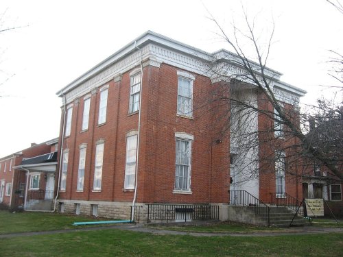
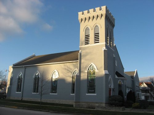
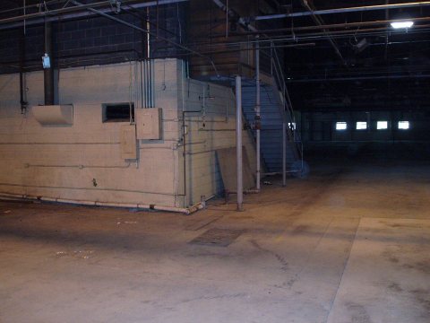
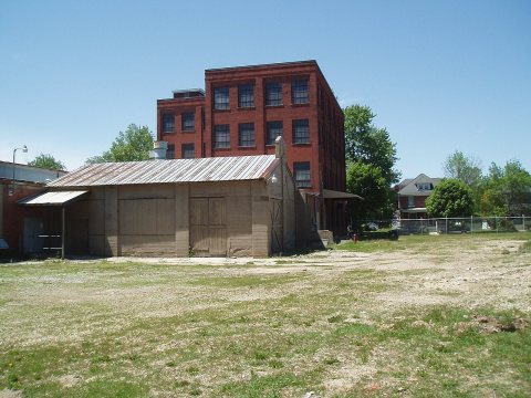
7 historic places in Fremont
The country’s official list of buildings and places worth saving. One is a National Historic Landmark, the highest tier.
National Park Service, National Register of Historic Places. Photos from Wikimedia Commons, credited on each place’s page.
Every building
Fremont, building by building, 1884–1914
Fire insurance maps drew every building, what it was made of and what it was used for, so insurers could price the risk of fire. Pick a year, then a sheet.
Fremont is located on the former site of Junquindundeh, a historic Wyandot village on the west bank of the lower Sandusky River, near the falls and about 15 miles (24 km) upstream from its mouth at Sandusky Bay. French merchants established a trading post there in the 1750s, but British forces took over the trading post and rest of the area after their victory in the French and Indian War.
Passages that mention Fremont, cut from the printed page as they were published.
a guide to the local history of fremont, ohio1905 · page 24Read the page →
Read the text
The road bed was made like a wooden sidewalk, 2-inch oak planks, 8 feet long, laid on stringers firmly embedded in the earth. Beginning in 1850, over fifty miles of Plank Roads were laid out of Fremont, extending to Tiffin, Fostoria and Green Spring. Citizens of Fremont spent over $40,000 in building such roads. Did the Plank Roads facilitate transportation ?
Text read by machine from the scan; it may contain errors.
Historical souvenir of the Fremont flood, March 25-28, 19131913 · page 23Read the page →
Read the text
Fremont and her people have reasons to be proud of their quick recovery for which many enconiums were pronunced by Governor Cox and the representatives of the Red Cross, and which has been a wonder to all the surrounding country. "Fremont, with a vim and vigor unsurpassed by any other city in the state, rehabilitated herself," said Director Bicknell of the Red Cross.
Text read by machine from the scan; it may contain errors.
Scans and text from the Internet Archive. Books published in 1930 or earlier, which are in the public domain.
Timeline
Fremont, 1800 to 1976
Woven from the archive, old maps, post office records, the National Register and the people born here.
Nothing in the archives for these yearsWeddings on Main Street, storms, parades, school pictures, the old store. If it’s in your family album, it belongs here.
The Fremont post office opened in 1830, the earliest record of the town by name (U.S. post office records).
How does Fremont rank for history?
Fremont is more historic than 92% of U.S. towns, #123 of 993 in Ohio. The History grade combines the town’s founding era, the share of homes built before 1940 and its National Register listings. It’s a character grade, so it isn’t part of the overall grade. How it works.
What is on the National Register in Fremont?
7 listings: 6 buildings, among them the Rutherford B. Hayes House (a National Historic Landmark since 1964), and 1 site.
How old are the homes in Fremont?
40% of Fremont’s homes were built before 1940 (Census estimate, ±4.5 points), against a typical 15% for an Ohio town; the median home was built in 1951.
Founding dates: Wikidata, Wikipedia, the U.S. post office records of Blevins & Helbock (CC0) and the Census. Homes by year built: Census ACS 2020–24. National Register of Historic Places: National Park Service (list of May 22, 2026). Old photos, postcards and papers: Wikimedia Commons, the Library of Congress and other public archives, credited on each item’s page. Maps: U.S. Geological Survey historical topographic maps (via Esri) and Sanborn fire-insurance maps (Library of Congress). History text and census tables: Wikipedia (CC BY-SA 4.0). Places that used to be: USGS Geographic Names Information System (2021).
From Wikimedia Commons (8), the Library of Congress (3), Wikidata (1), the National Register of Historic Places (7), Wikipedia, Wikidata and Wikipedia for famous people, U.S. Geological Survey historical maps, U.S. Census counts (via Wikipedia), the US Post Offices dataset (Blevins & Helbock), the USGS Geographic Names Information System, Sanborn fire insurance maps (Library of Congress) and old county and town histories (Internet Archive). Archive images are copied here with their credits and licenses, shown on each photo’s page. Refreshed monthly.


 ★ Landmark


 1863
 1890
 1899
 1899
 1899
 1899
 1899
 1899


