Fayetteville was founded in 1818 by an Irish immigrant named Cornelius McGroarty. It was later incorporated in 1868. In 1883, Fayetteville contained two churches, two schools, two hotels, several stores and saloons, and two drug stores.
Passages that mention Fayetteville, cut from the printed page as they were published.
the history of brown county ohio1883 · page 480Read the page →
Read the text
Edward and Nathan Bishop also came about this time. Edward held the office of Constable, and died in 1826. Nathan was also Constable for a number of years. He lived to an old age, and, at the time of his death, which occurred in 1876, was Mayor of the village of Fayetteville. Isaac MeCune, with his sons, Samuel and John, arrived about the same time. They moved afterward to Pike County, Ill.
Text read by machine from the scan; it may contain errors.
the history of brown county ohio1883 · page 490Read the page →
Read the text
District No. 3 is located on the Georgetown & Fayetteville Free Turnpike, south of the village of Fayetteville. The building is of brick. The district enumerates—males, 47; females, 54; total, 101. Anderson McQuillin, teacher. Wages, $40 per month.
Text read by machine from the scan; it may contain errors.
Scans and text from the Internet Archive. Books published in 1930 or earlier, which are in the public domain.
Timeline
Fayetteville, 1818 to 1980
Woven from the archive, old maps, post office records, the National Register and the people born here.
Founding dates: Wikidata, Wikipedia, the U.S. post office records of Blevins & Helbock (CC0) and the Census. Homes by year built: Census ACS 2020–24. National Register of Historic Places: National Park Service (list of May 22, 2026). Old photos, postcards and papers: Wikimedia Commons, the Library of Congress and other public archives, credited on each item’s page. Maps: U.S. Geological Survey historical topographic maps (via Esri) and Sanborn fire-insurance maps (Library of Congress). History text and census tables: Wikipedia (CC BY-SA 4.0). Places that used to be: USGS Geographic Names Information System (2021). How TownRatings grades history →
From Wikimedia Commons (24), Wikipedia, Wikidata and Wikipedia for famous people, U.S. Geological Survey historical maps, U.S. Census counts (via Wikipedia), the US Post Offices dataset (Blevins & Helbock), the USGS Geographic Names Information System and old county and town histories (Internet Archive). Archive images are copied here with their credits and licenses, shown on each photo’s page. Refreshed monthly.


 2013
 2013
 2013
 2013
 2013
 2013
 2013
 2013
 2013
 2013
 2013
 2013
 2013
 2013
 2013
 2012
 2012
 2012
 2012
 2012
 2012
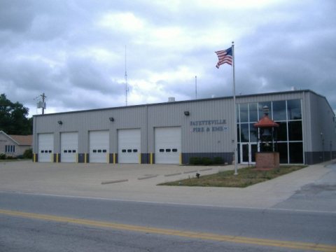 2012
 2008
 2004