Founding year: Wikidata; Wikipedia’s history section gives the same year. First post office: 1813.The full story ↓
History grade
What drives Eaton’s History grade
On its age, its old homes and the National Register, Eaton is more historic than 87% of U.S. towns, #202 of 993 in Ohio. All 3 inputs are above most U.S. towns; its share of homes from before 1940 ranks highest and its National Register listings lowest.
A
HistoryA character grade: shown, never part of Eaton’s overall grade.
Ohio towns list about as much on the Register as the country (a typical Ohio town has 2.9 per 10,000 residents, the U.S. 2.4), so Eaton’s 4.8 sits near the middle of its state (63% of Ohio towns have fewer) while its 4 listings outnumber those of 68% of U.S. towns.
How sure. Graded on any two of the three inputs instead, the letter would range from A− to A. The pre-1940 share is a Census survey estimate (±6.1 points). Two sources give 1806.
Founding year: Wikidata (other dates in Quick answers). Homes: Census ACS 2020–24. National Register: National Park Service, May 2026 list; each listing counted once (boundary changes and added documentation belong to their listing), and a historic district counts its contributing buildings. How TownRatings grades history →
What stands out about Eaton’s past
Read from the archive, the National Register and the record. The page puts what stands out first.
Fire insurance maps drew every building, what it was made of and what it was used for, so insurers could price the risk of fire. Pick a year, then a sheet.
Eaton was founded and platted in 1806 by William Bruce. The village derives its name from William Eaton, the U.S. Consul General to Tunis from 1797–1803 and commander of U.S. military forces in First Barbary War. In addition to the city of Eaton and the county of Preble, various streets in Eaton (including Barron, Decatur, Israel, Wadsworth, and Somers) were named in honor of heroes of the First Barbary War and Second Barbary War.
On the seventh of June, 1808, another meeting was held at which, among other transactions, it was ordered that “the courts shall be held up stairs in the house of Samuel Hawkins, in the town of Eaton, said Hawkins having agreed to give the use of said room and a table, without charge therefor.” It was also further ۵ that Samuel Hawkins be allowed to retain the use of public square in the town of Eaton, marked on the plan of said
Text read by machine from the scan; it may contain errors.
hé bought three quarter sections, includiug the eastern part of the present town site of Camden, and moved there in 1803. Here he remained until William Bruce laid out the town of Eaton. As soon as laid out, this point began to be talked of as the prospective countyseat for a new county to be erected from Montgomery.
Text read by machine from the scan; it may contain errors.
Lanier township. At the same time a furious downpour of rain fell over the whole county, continuing for hours and swelling the streams higher than ever known, sweeping away the old covered bridge and an iron bridge at Eaton, the Camden bridge and many other bridges large and small, until the damage to the bridges alone amounted to more than one hundred thousand dollars, besides much damage to individuals, in addition to the destruction of the roads of the county. The storm occurred from eight o'clock in the evening to about one o'clock next morning. While there have been
Text read by machine from the scan; it may contain errors.
The Eaton & Hamilton Railroad Company was organized in 1849, under a charter granted by the Legislature to build a railroad from Eaton to Hamilton by the most feasible route. Abner Haines and Joseph Hawkins were the attorneys for the company, composed of Lurton Dunham, of Camden, and Cornelius Vanausdal, Ellis Minshall, Alfred Denny, of Eaton, and some Hamilton men. Vanausdal was the first president, Jesse B. Stephens, secretary, and Josiah Campbell, treasurer. Abner Haines was president the second year, and John Woods, of Hamilton, president the
Text read by machine from the scan; it may contain errors.
Scans and text from the Internet Archive. Books published in 1930 or earlier, which are in the public domain.
By decade
Eaton, decade by decade
One decade in the archive so far: the 1900s. Scroll each row; tap a photo for its story.
Nothing in the archives for these yearsWeddings on Main Street, storms, parades, school pictures, the old store. If it’s in your family album, it belongs here.
In 1806, according to Wikidata and Wikipedia’s history of the town. Eaton’s post office opened in 1813, and the census of 1820 counted 255 people here.
How does Eaton rank for history?
Eaton is more historic than 87% of U.S. towns, #202 of 993 in Ohio. The History grade combines the town’s founding era, the share of homes built before 1940 and its National Register listings. It’s a character grade, so it isn’t part of the overall grade. How it works.
What is on the National Register in Eaton?
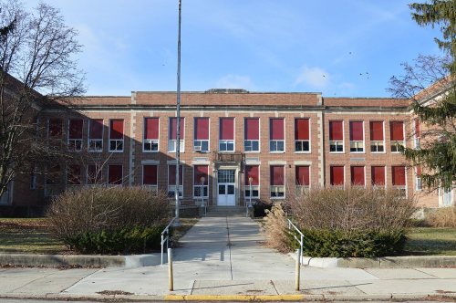
4 listings: 2 buildings, 1 site, and 1 structure.
How old are the homes in Eaton?
27% of Eaton’s homes were built before 1940 (Census estimate, ±6.1 points), against a typical 15% for an Ohio town; the median home was built in 1974.
Founding dates: Wikidata, Wikipedia, the U.S. post office records of Blevins & Helbock (CC0) and the Census. Homes by year built: Census ACS 2020–24. National Register of Historic Places: National Park Service (list of May 22, 2026). Old photos, postcards and papers: Wikimedia Commons, the Library of Congress and other public archives, credited on each item’s page. Maps: U.S. Geological Survey historical topographic maps (via Esri) and Sanborn fire-insurance maps (Library of Congress). History text and census tables: Wikipedia (CC BY-SA 4.0). Places that used to be: USGS Geographic Names Information System (2021).
From Wikimedia Commons (6), the Library of Congress (1), Wikidata (4), the National Register of Historic Places (4), Wikipedia, Wikidata and Wikipedia for famous people, U.S. Geological Survey historical maps, U.S. Census counts (via Wikipedia), the US Post Offices dataset (Blevins & Helbock), the USGS Geographic Names Information System, Sanborn fire insurance maps (Library of Congress) and old county and town histories (Internet Archive). Archive images are copied here with their credits and licenses, shown on each photo’s page. Refreshed monthly.




 1909
 Date?
 Date?
 Date?
 2010
 2008


