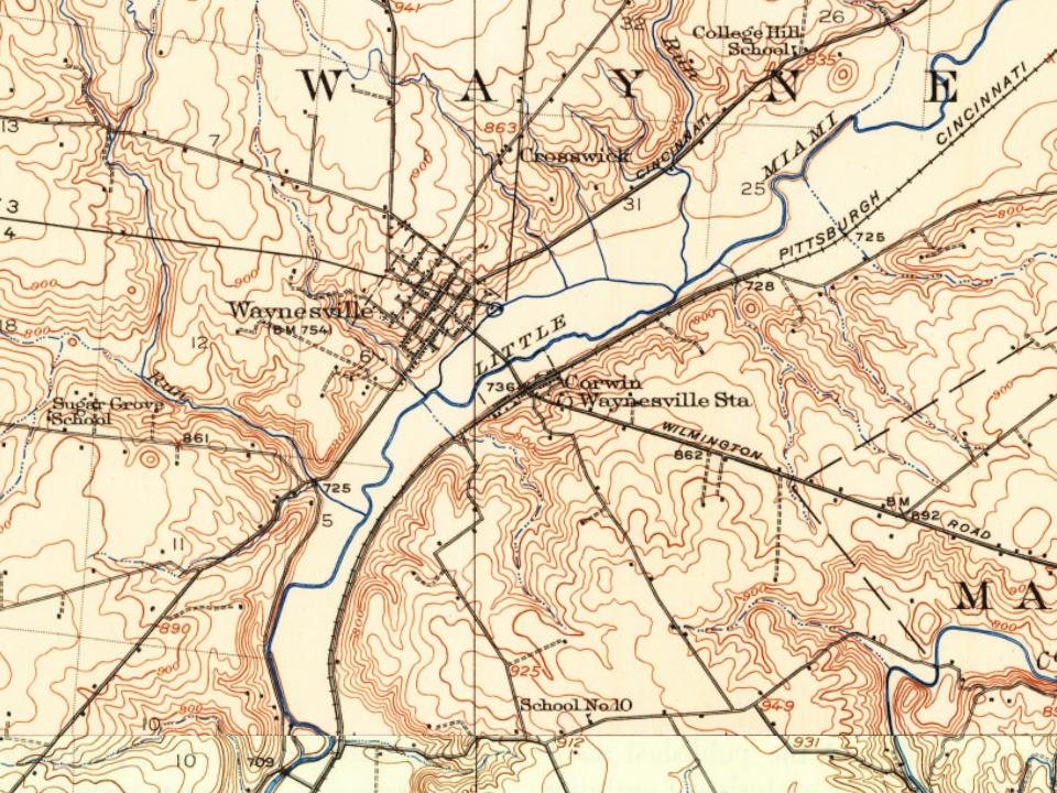
Most of Corwin was built recently: 3% of its homes predate 1940 and the median home dates from 2003. Below: 1 old photo or paper, maps from 1913 on, and the census since 1870.
Corwin began as a depot on the Little Miami Railroad. A post office called Corwin was established in 1898, and remained in operation until 1918. The village is named for Thomas Corwin, 15th Governor of Ohio.
Passages that mention Corwin, cut from the printed page as they were published.
The History of Warren County, Ohio1882 · page 575Read the page →
Read the text
Before 1819, the channel of the river on the road to Corwin was not as now, but where the bridge now is was in the bend of a horseshoe, the channel above and below the bridge having been made since. The crossing of the river was between High and Main streets, in Waynesville. When the water was high, there was a ferry used, and when low, a ford. About 1812, an effort was made to build a bridge at the ford. The abutments were raised and a superstructure was placed on trestles. A freshet in the river swept out the work and no further effort was made to build a bridge at that place. In 1817, a bridge was
Text read by machine from the scan; it may contain errors.
The History of Warren County, Ohio1882 · page 339Read the page →
Read the text
ident resided in the adjoining county of Hamilton. The bitter contest between the opposing parties began early in the spring, and was continued with increasing excitement until the Presidential election. Harrison and Tyler had been nominated at Harrisburg December 0, 1839. Corwin was nominated for Governor at a great mass meeting at Columbus, February 22, 1840. The public mind was soon put in commotion by mass meetings and mass conventions, some of which were of enormous size. A very large mass convention of the Whigs of the Fourth Congressional District, composed of the counties of Warren, Clin-
Text read by machine from the scan; it may contain errors.
Scans and text from the Internet Archive. Books published in 1930 or earlier, which are in the public domain.
Timeline
Corwin, 1898 to 2020
Woven from the archive, old maps, post office records, the National Register and the people born here.
Founding dates: Wikidata, Wikipedia, the U.S. post office records of Blevins & Helbock (CC0) and the Census. Homes by year built: Census ACS 2020–24. National Register of Historic Places: National Park Service (list of May 22, 2026). Old photos, postcards and papers: Wikimedia Commons, the Library of Congress and other public archives, credited on each item’s page. Maps: U.S. Geological Survey historical topographic maps (via Esri) and Sanborn fire-insurance maps (Library of Congress). History text and census tables: Wikipedia (CC BY-SA 4.0). Places that used to be: USGS Geographic Names Information System (2021). How TownRatings grades history →
From Wikimedia Commons (3), the Library of Congress (1), Wikidata (1), Wikipedia, U.S. Geological Survey historical maps, U.S. Census counts (via Wikipedia), the US Post Offices dataset (Blevins & Helbock), the USGS Geographic Names Information System and old county and town histories (Internet Archive). Archive images are copied here with their credits and licenses, shown on each photo’s page. Refreshed monthly.



 Date?
 2015
 2010
 2004


