Founding year: Wikidata. First post office: 1808.The full story ↓
History grade
What drives Conneaut’s History grade
On its age, its old homes and the National Register, Conneaut is more historic than 92% of U.S. towns, #116 of 993 in Ohio. All 3 inputs are above most U.S. towns; its share of homes from before 1940 ranks highest and its National Register listings lowest.
A
HistoryA character grade: shown, never part of Conneaut’s overall grade.
Ohio towns list about as much on the Register as the country (a typical Ohio town has 2.9 per 10,000 residents, the U.S. 2.4), so Conneaut’s 5.7 sits above most of its state (66% of Ohio towns have fewer) while its 7 listings outnumber those of 73% of U.S. towns.
How sure. Graded on any two of the three inputs instead, the letter would range from A− to A. The pre-1940 share is a Census survey estimate (±5.1 points). Two sources give 1799.
Founding year: Wikidata (other dates in Quick answers). Homes: Census ACS 2020–24. National Register: National Park Service, May 2026 list; each listing counted once (boundary changes and added documentation belong to their listing), and a historic district counts its contributing buildings. How TownRatings grades history →
What stands out about Conneaut’s past
Read from the archive, the National Register and the record. The page puts what stands out first.
US Post Offices dataset (Blevins & Helbock, CC0). Places and cemeteries from the USGS Geographic Names Information System (2021).
People over time
Conneaut, census by census
Lost two-thirds of its people between 1840 and 1850, then grew more than tenfold.
19 censuses, 1840–2020.
U.S. Census Bureau decennial counts, from the census table on Conneaut’s Wikipedia page.
Every building
Conneaut, building by building, 1884–1919
Fire insurance maps drew every building, what it was made of and what it was used for, so insurers could price the risk of fire. Pick a year, then a sheet.
Conneaut is located on an old Native American trail, later used by early westbound pioneers. The name comes from the Seneca language word "Koniyat" and is of disputed meaning. A Mississauga village was located at or near Conneaut in about 1747.
Passages that mention Conneaut, cut from the printed page as they were published.
History of Ashtabula County Ohio1924 · page 273Read the page →
Read the text
The early marine business of Conneaut Harbor reached its height between 1845 and 1852 and the village of Conneaut grew and prospered until the advent of the railroad in the latter year, then it received a decided setback as the overland means of transportation took the lion’s share of the east and west freightage as well as a goodly part of the matter to be transferred to the southern points and the general passenger traffic.
Text read by machine from the scan; it may contain errors.
History of Ashtabula County, Ohio1878 · page 154Read the page →
Read the text
Ashtabula County is the northeast corner county of the State of Ohio, and Conneaut is the northeast corner township of Ashtabula County. It is bounded on the north by Lake Erie, on the south by the township of Monroe, on the east by a portion of the State of Pennsylvania, and on the west by the township of Kingsville and the lake. It is composed of township No. 13 of the first range (except an area of two miles in width from the southern portion thereof, which strip was cut off and annexed to the township of Monroe), and of No. 14 of the first range, being Conneaut gore. The township contains a surface of about
Text read by machine from the scan; it may contain errors.
History of Ashtabula County Ohio1924 · page 265Read the page →
Read the text
Amboy.—Another settlement within the township of ‘Conneaut was, and still is, Amboy. That colony started about four miles west of the river on the North Ridge, and also had its palmy days, and was larger than South Ridge village. In addition to the advantages named for the neighbor on the south, Amboy had a tavern, one more church, a flouring mill, a cabinet shop, a cobbler’s shop, several cigar factories and a platform station on the line of the Lake Shore & Michigan Southern Railroad.
Text read by machine from the scan; it may contain errors.
History of Ashtabula County, Ohio1878 · page 162Read the page →
Read the text
The school has been, since August, 1868, under the control and management of the board of education of the incorporated village of Conneaut, they having at that time leased the buildiugs. grounds, and fixtures of the academy board for a period of ten years at least. During the past year (1877) the board of education has made further changes, establishing a system of graded schools in the village, making the principal of the academy or high school superintendent of all the schools of the village.
Text read by machine from the scan; it may contain errors.
Scans and text from the Internet Archive. Books published in 1930 or earlier, which are in the public domain.
Timeline
Conneaut, 1799 to 1970
Woven from the archive, old maps, post office records, the National Register and the people born here.
Nothing in the archives for these yearsWeddings on Main Street, storms, parades, school pictures, the old store. If it’s in your family album, it belongs here.
In 1799, according to Wikidata. Conneaut’s post office opened in 1808, and the census of 1840 counted 2,642 people here.
How does Conneaut rank for history?
Conneaut is more historic than 92% of U.S. towns, #116 of 993 in Ohio. The History grade combines the town’s founding era, the share of homes built before 1940 and its National Register listings. It’s a character grade, so it isn’t part of the overall grade. How it works.
What is on the National Register in Conneaut?
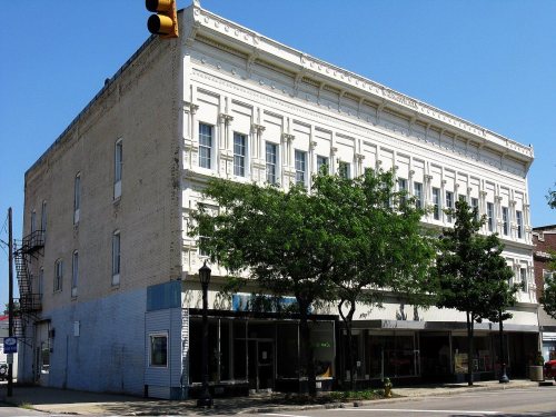
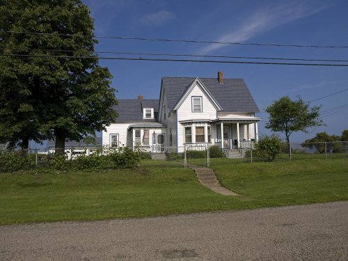
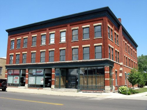
7 listings: 6 buildings, among them the David Cummins Octagon House (listed 1974, the first), and 1 structure.
How old are the homes in Conneaut?
41% of Conneaut’s homes were built before 1940 (Census estimate, ±5.1 points), against a typical 15% for an Ohio town; the median home was built in 1950.
Founding dates: Wikidata, Wikipedia, the U.S. post office records of Blevins & Helbock (CC0) and the Census. Homes by year built: Census ACS 2020–24. National Register of Historic Places: National Park Service (list of May 22, 2026). Old photos, postcards and papers: Wikimedia Commons, the Library of Congress and other public archives, credited on each item’s page. Maps: U.S. Geological Survey historical topographic maps (via Esri) and Sanborn fire-insurance maps (Library of Congress). History text and census tables: Wikipedia (CC BY-SA 4.0). Places that used to be: USGS Geographic Names Information System (2021).
From the Library of Congress (6), the National Register of Historic Places (7), Wikipedia, Wikidata and Wikipedia for famous people, U.S. Geological Survey historical maps, U.S. Census counts (via Wikipedia), the US Post Offices dataset (Blevins & Helbock), the USGS Geographic Names Information System, Sanborn fire insurance maps (Library of Congress) and old county and town histories (Internet Archive). Archive images are copied here with their credits and licenses, shown on each photo’s page. Refreshed monthly.


 1900
 1900
 1900
 1900
 1900