Circleville dates to 1810, and 23% of its homes were built before 1940
More historic than 92% of U.S. towns · #116 of 993 in Ohio. What drives it
9 places in town are on the National Register, among them a historic district with 69 buildings. Below: 10 old photos and papers, maps from 1884 on, and the census since 1820.
Founding year: Wikidata; Wikipedia’s history section gives the same year. First post office: 1811.The full story ↓
History grade
What drives Circleville’s History grade
On its age, its old homes and the National Register, Circleville is more historic than 92% of U.S. towns, #116 of 993 in Ohio. All 3 inputs are above most U.S. towns; its National Register listings ranks highest and its age lowest.
A
HistoryA character grade: shown, never part of Circleville’s overall grade.
Ohio towns list about as much on the Register as the country (a typical Ohio town has 2.9 per 10,000 residents, the U.S. 2.4), so Circleville’s 55.9 sits above most of its state (89% of Ohio towns have fewer) while its 79 historic buildings outnumber those of 88% of U.S. towns.
How sure. Graded on any two of the three inputs instead, the letter would range from A− to A. The pre-1940 share is a Census survey estimate (±3.3 points). Two sources give 1810.
Founding year: Wikidata (other dates in Quick answers). Homes: Census ACS 2020–24. National Register: National Park Service, May 2026 list; each listing counted once (boundary changes and added documentation belong to their listing), and a historic district counts its contributing buildings. How TownRatings grades history →
What stands out about Circleville’s past
Read from the archive, the National Register and the record. The page puts what stands out first.
National Park Service, National Register of Historic Places. Photos from Wikimedia Commons, credited on each place’s page.
Places that used to be
Old corners, places now gone and burying grounds
Circleville’s post office has been open since 1811.
Hamlets and corners on the map
Brookside ParkCampus CourtDels Trailer ParkElsea Mobile VillageGraystone VillasHeathergreenMorris Mobile VillageNorthwood ParkSheldonVoorheis
Gone or out of use
Circleville HospitalhospitalCorwin Street SchoolschoolFranklin SchoolschoolHigh Street SchoolschoolSchool Number 5schoolStout Schoolschool
3cemeteries and burying grounds inside Circleville
ForestHigh StreetSaint Joseph
US Post Offices dataset (Blevins & Helbock, CC0). Places and cemeteries from the USGS Geographic Names Information System (2021).
Every building
Circleville, building by building, 1884–1927
Fire insurance maps drew every building, what it was made of and what it was used for, so insurers could price the risk of fire. Pick a year, then a sheet.
By the mid-18th century, the Lenape (Delaware Indians) were pushed west from Pennsylvania by European settlers flowing into the colony. The Lenape were given permission by the Wyandot people to settle in the Ohio country. One of their settlements was Maguck, a small village built before 1750 on the banks of the Scioto River. Modern Circleville was built to the north of this site.
Passages that mention Circleville, cut from the printed page as they were published.
HISTORY OF PICKAWAY COUNTY, OHIO AND REPERESENTATIVE CITIZENS1906 · page 210Read the page →
Read the text
Other turnpikes in the county are: The Circleville and Washington, which company was incorporated February 25, 1839; the Circleville and Adelphi road, an act for whose incorporation passed the General Assembly on February 24, 1848; the next year, the Circleville, Darbyville and London Turnpike Company was incorporated but it was 20 years
Text read by machine from the scan; it may contain errors.
cleville, and recorded in the recorder’s office of said county, be, and the same is hereby erected into a town corporate, henceforth to be known and distinguished by the name of the town of Circleville, subject, however, to such alterations and regulations as the legislature may, from time to time, think proper to make.
Text read by machine from the scan; it may contain errors.
HISTORY OF PICKAWAY COUNTY, OHIO AND REPERESENTATIVE CITIZENS1906 · page 36Read the page →
Read the text
cleville, and recorded in the recorder’s office of said county, be, and the same is hereby erected into a town corporate, henceforth to be known and distinguished by the name of the town of Circleville, subject, however, to such alterations and regulations as the legislature may, from time to time, think proper to make.
Text read by machine from the scan; it may contain errors.
Other turnpikes in the county are : The | Circleville and Washington, which company I was incorporated February 25, 1839; the bircleville and Adelphi road, an act for whose incorporation passed the General Assembly on February 24, 1S48; the next year, the Circleville, Darby ville and London Turnpike Company was incorporated but it was 20 years
Text read by machine from the scan; it may contain errors.
Scans and text from the Internet Archive. Books published in 1930 or earlier, which are in the public domain.
Timeline
Circleville, 1810 to 1938
Woven from the archive, old maps, post office records, the National Register and the people born here.
Nothing in the archives for these yearsWeddings on Main Street, storms, parades, school pictures, the old store. If it’s in your family album, it belongs here.
In 1810, according to Wikidata and Wikipedia’s history of the town. Circleville’s post office opened in 1811, and the census of 1820 counted 908 people here.
How does Circleville rank for history?
Circleville is more historic than 92% of U.S. towns, #116 of 993 in Ohio. The History grade combines the town’s founding era, the share of homes built before 1940 and its National Register listings. It’s a character grade, so it isn’t part of the overall grade. How it works.
What is on the National Register in Circleville?
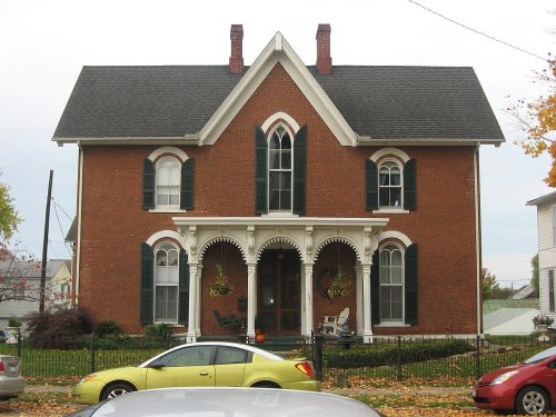
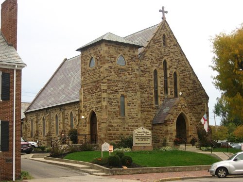
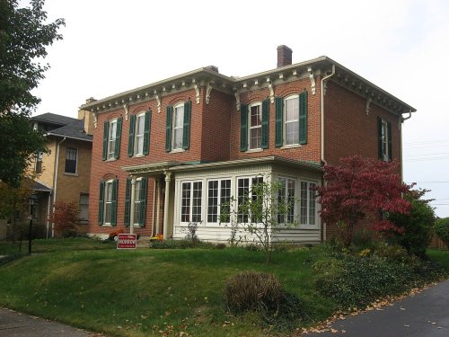
9 listings: 8 buildings and 1 historic district, the Circleville Historic District, with 69 contributing buildings. 79 historic buildings in all.
How old are the homes in Circleville?
23% of Circleville’s homes were built before 1940 (Census estimate, ±3.3 points), against a typical 15% for an Ohio town; the median home was built in 1964.
Founding dates: Wikidata, Wikipedia, the U.S. post office records of Blevins & Helbock (CC0) and the Census. Homes by year built: Census ACS 2020–24. National Register of Historic Places: National Park Service (list of May 22, 2026). Old photos, postcards and papers: Wikimedia Commons, the Library of Congress and other public archives, credited on each item’s page. Maps: U.S. Geological Survey historical topographic maps (via Esri) and Sanborn fire-insurance maps (Library of Congress). History text and census tables: Wikipedia (CC BY-SA 4.0). Places that used to be: USGS Geographic Names Information System (2021).
From Wikimedia Commons (4), the Library of Congress (6), Wikidata (2), the National Register of Historic Places (9), Wikipedia, Wikidata and Wikipedia for famous people, U.S. Geological Survey historical maps, U.S. Census counts (via Wikipedia), the US Post Offices dataset (Blevins & Helbock), the USGS Geographic Names Information System, Sanborn fire insurance maps (Library of Congress) and old county and town histories (Internet Archive). Archive images are copied here with their credits and licenses, shown on each photo’s page. Refreshed monthly.






 1863
 1938
 1938
 1938
 1938
 1938
 1938


