Guest, Sign inJoin

Post to Castine

We’ll email a one-tap link to publish your post. No password, and nothing is public until you click it.
Already a member? Sign in
–Not graded
History · Castine

Castine dates to 1832, and 88% of its homes were built before 1940

Below: maps from 1986 on and the census since 1870.

1832founded
0on the National Register
88%homes built before 1940
Photo: Nyttend · Public domain
Quick answers

How Castine began

When was Castine founded?

1832

Castine dates its founding to 1832 (Wikipedia’s history). The census first counted it in 1870.

First census: 177 in 18702020 census: 110194 years
Founding year: Wikipedia. First post office: 1838.The full story ↓

What stands out about Castine’s past

Read from the archive, the National Register and the record. The page puts what stands out first.

★ What stands out · Help out

Start Castine’s collection

The first neighbors to add old photos shape how Castine’s history is told.

Decades since 1900 with photos
00s10s20s30s40s50s60s70s80s90s
0 of 10 decades. The empty ones are waiting for someone’s album.
The story

How Castine came to be

From Wikipedia’s history of Castine.

Read it all →

Castine was platted in 1832 and replatted in the following year. Its location was chosen because it lay at the intersection of the road between Greenville and Eaton with the road between the communities of Miami County, Ohio and New Garden, Indiana. For its first few decades, the village (then known as "New Castine") grew and prospered, but the building of the Little Miami Railroad through West Manchester, 2 miles (3.2 km) to the south, retarded Castine's progress. Revival came with the construction of the Cincinnati Northern Railroad in 1894.

Text from Wikipedia, licensed CC BY-SA 4.0.

Timeline

Castine, 1832 to 1986

Woven from the archive, old maps, post office records, the National Register and the people born here.

  1. 19th century
  2. 1832
    FoundingCastine is established
  3. 1838Post officeThe New Castine post office opens
  4. 1850Post officeThe New Castine post office closes
  5. 1850Post officeThe Castine post office opens
  6. 20th century
  7. 1982Post officeThe Castine post office closes
  8. 1986On the mapFirst mapped by the U.S. Geological Survey
From the old history books

What they wrote about Castine in 1880

Passages that mention Castine, cut from the printed page as they were published.

minsville. The route decided on by the agents of the road, was via College Hill, Hamilton. West Elkton, Eaton, Paris, to Newport, Ind. The same night on which these twenty-eight fugitives arrived at Newport, three slave-hunters from Boone County, Ky., stopped over night in the village of Castine. N…
The history of Darke County, Ohio, containing a history of the county1880 · page 324Read the page →
Read the text

minsville. The route decided on by the agents of the road, was via College Hill, Hamilton. West Elkton, Eaton, Paris, to Newport, Ind. The same night on which these twenty-eight fugitives arrived at Newport, three slave-hunters from Boone County, Ky., stopped over night in the village of Castine. Newport is sixteen miles west of Castine. But from the fact that the fugitives took the longest route from Paris, by mistake, they must have been overtaken. My suspicions had been aroused that these strangers might be in search of lost property. As they were about leaving the village, one of the party recognized an old friend and classmate,

Text read by machine from the scan; it may contain errors.
altogether quite successful. Mr. Minnich received only such education as the common schools of Montgomery Co. afforded during his youth ; lived on a farm until 19 years of age. then learned the trade of millwright, and worked at that until he came to Castine and engaged in the saw-mill and lumber t…
The history of Darke County, Ohio, containing a history of the county1880 · page 675Read the page →
Read the text

altogether quite successful. Mr. Minnich received only such education as the common schools of Montgomery Co. afforded during his youth ; lived on a farm until 19 years of age. then learned the trade of millwright, and worked at that until he came to Castine and engaged in the saw-mill and lumber trade ; he started the first merchant mill in Castine, and during the twelve years following the firm distributed many thousands of dollars among the farmers in this vicinity m exchange for their timber, which stimulated improvements and furnished the means. ° Mr. Minnich's marriage with Terressa Sinclair was celebrated in Castine

Text read by machine from the scan; it may contain errors.

Scans and text from the Internet Archive. Books published in 1930 or earlier, which are in the public domain.

By decade

Castine, decade by decade

On the map

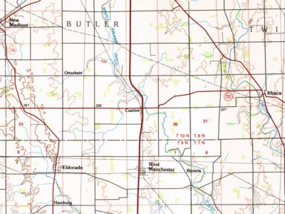
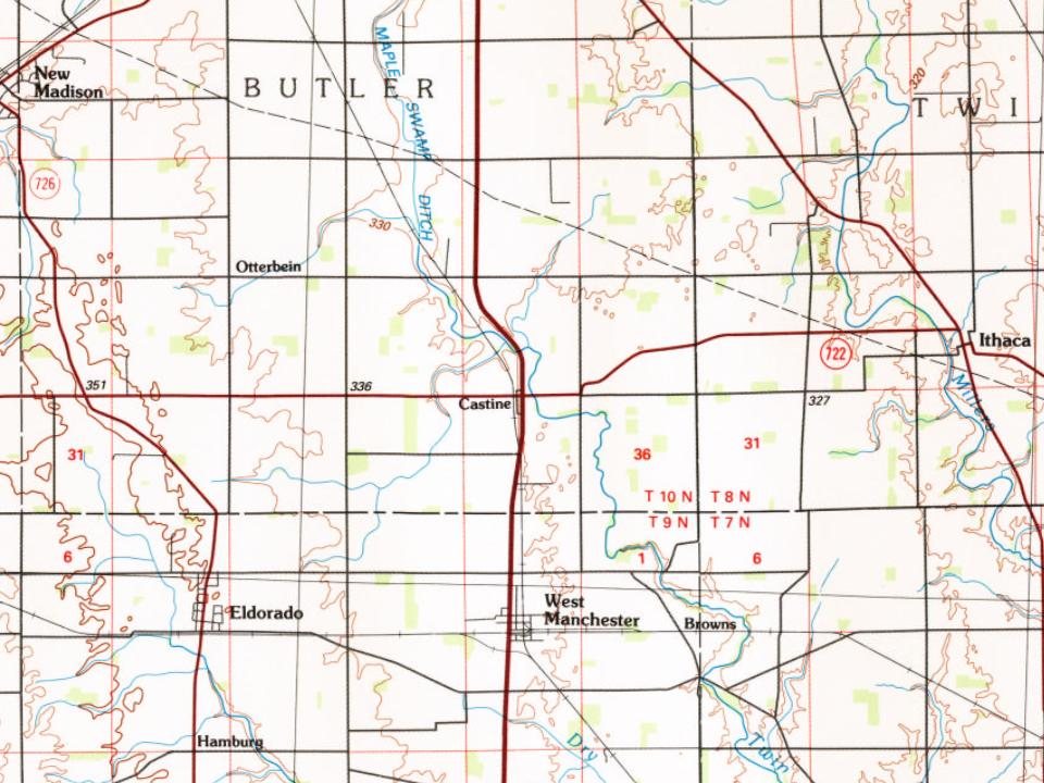
Castine on the map in 1986

The U.S. Geological Survey’s map of Castine.

Castine on the 1986 USGS map1986Dayton sheet · 1:100,000

U.S. Geological Survey historical topographic maps (public domain), via Esri’s collection of the scans. The red ring marks the center of Castine.

People over time

Castine, census by census

010018801900192019401960198020002020Peak: 177

Between 91 and 177 people in every census since 1870.

14 censuses, 1870–2020.

U.S. Census Bureau decennial counts, from the census table on Castine’s Wikipedia page.

Famous people

Famous people close to Castine

Nobody well known was born in Castine itself, so here are the best known from just nearby.

See all →
Places that used to be

Lost post offices

Castine had its own post office from 1850 to 1982. Another post office, New Castine, opened and closed inside today’s town.

New Castine
1838–1850
Castine
1850–1982
18301930today

US Post Offices dataset (Blevins & Helbock, CC0). Places and cemeteries from the USGS Geographic Names Information System (2021).

Questions about Castine’s history

What year was Castine founded?

In 1832, according to Wikipedia’s history of the town. Castine’s post office opened in 1838, and the census of 1870 counted 177 people here.

Memory lane

What the archives can’t tell you, neighbors can.

Town Square →
Start a conversation
Sources

Where this page comes from

Founding dates: Wikidata, Wikipedia, the U.S. post office records of Blevins & Helbock (CC0) and the Census. Homes by year built: Census ACS 2020–24. National Register of Historic Places: National Park Service (list of May 22, 2026). Old photos, postcards and papers: Wikimedia Commons, the Library of Congress and other public archives, credited on each item’s page. Maps: U.S. Geological Survey historical topographic maps (via Esri) and Sanborn fire-insurance maps (Library of Congress). History text and census tables: Wikipedia (CC BY-SA 4.0). Places that used to be: USGS Geographic Names Information System (2021). How TownRatings grades history →

From Wikimedia Commons (4), Wikipedia, U.S. Geological Survey historical maps, U.S. Census counts (via Wikipedia), the US Post Offices dataset (Blevins & Helbock), the USGS Geographic Names Information System and old county and town histories (Internet Archive). Archive images are copied here with their credits and licenses, shown on each photo’s page. Refreshed monthly.