Cadiz dates to 1803, and 19% of its homes were built before 1940
More historic than 81% of U.S. towns · #293 of 993 in Ohio. What drives it
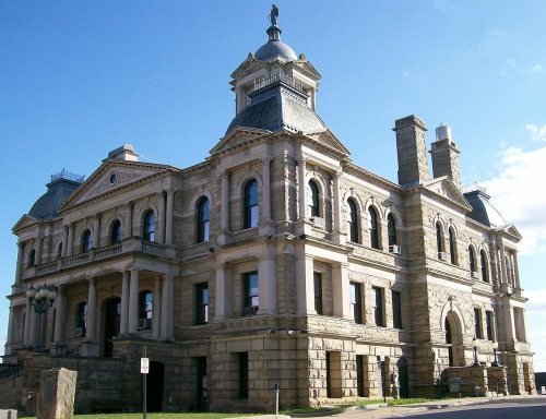
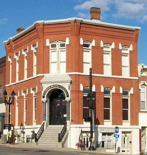
Its Register listings are the Harrison County Courthouse and the Harrison National Bank. Below: 6 old photos and papers, maps from 1887 on, and the census since 1820.
Founding year: Wikipedia. First post office: 1812.The full story ↓
History grade
What drives Cadiz’s History grade
On its age, its old homes and the National Register, Cadiz is more historic than 81% of U.S. towns, #293 of 993 in Ohio. All 3 inputs are above most U.S. towns; its age ranks highest and its National Register listings lowest.
A−
HistoryA character grade: shown, never part of Cadiz’s overall grade.
Ohio towns list about as much on the Register as the country (a typical Ohio town has 2.9 per 10,000 residents, the U.S. 2.4), so Cadiz’s 6.7 sits above most of its state (69% of Ohio towns have fewer) while its 2 listings outnumber those of 60% of U.S. towns.
How sure. Graded on any two of the three inputs instead, the letter would range from B+ to A−. The pre-1940 share is a Census survey estimate (±6.6 points). Two sources give 1803.
Founding year: Wikipedia (other dates in Quick answers). Homes: Census ACS 2020–24. National Register: National Park Service, May 2026 list; each listing counted once (boundary changes and added documentation belong to their listing), and a historic district counts its contributing buildings. How TownRatings grades history →
What stands out about Cadiz’s past
Read from the archive, the National Register and the record. The page puts what stands out first.
Fire insurance maps drew every building, what it was made of and what it was used for, so insurers could price the risk of fire. Pick a year, then a sheet.
Cadiz was founded in 1803 at the junction of westward roads from Pittsburgh and Washington, Pennsylvania, and named after Cádiz, Spain. The town became the county seat of newly formed Harrison County in 1813. By 1840, Cadiz had 1,028 residents; by 1846, the town had four churches and 21 stores. The Steubenville and Indiana Railroad, a predecessor of the Pennsylvania Railroad, opened to Cadiz June 11, 1854.
In the early and mid nineteenth century, several local families operated stations and served as conductors in the Underground Railroad, helping runaway slaves escape to Canada.
By 1880 population had nearly doubled and the town had three newspapers and three banks.
Passages that mention Cadiz, cut from the printed page as they were published.
A genealogy and brief history of the Haverfield family of the United States, one of the pioneer settlers of Jefferson County, Ohio, later Harrison County1919 · page 158Read the page →
Read the text
now (1918) owned by John Osborn. At this date (1813) land could be entered in as small tracts as a quarter section (160 acres) and John Haverfield, having sold his land near the village of Cadiz, entered in 1813 the "South-east quarter, (160 acres) of section 22 - 10 - 5, of Cadiz township"; and in 1817, having paid for the same, received patent deed from President James Monroe. This tract of land lies about three miles west of the village of Cadiz. There
Text read by machine from the scan; it may contain errors.
A genealogy and brief history of the Haverfield family of the United States, one of the pioneer settlers of Jefferson County, Ohio, later Harrison County1919 · page 34Read the page →
Read the text
The village of Cadiz was laid out in 1803 at the junction of two Indian trails, the one coming from Steubenville, or the old town of Mingo three miles below, and the other from Warrenton on the Ohio river. Cadiz was incorporated as the county seat of Harrison county when that county was formed by an act of the Ohio Legislature from parts of Jefferson and Tuscarawas counties, in 1813. (See Genealogy of Great Grandfather
Text read by machine from the scan; it may contain errors.
A brief history of Harrison county, Ohio1894 · page 37Read the page →
Read the text
Road-making in a hilly region is laborious and expensive, and while we have at this time roads in every direction, it is still an open question how to make better ones. We have a pike from Cadiz to New Athens, Cadiz to Harrisville, Cadiz to Unionvale, and all the roads leading from Cadiz have from onehalf to two miles of pike.
Text read by machine from the scan; it may contain errors.
A brief history of Harrison county, Ohio1894 · page 47Read the page →
Read the text
Messrs. Biggs and Beatty laid out the town of Cadiz in 1804. New Rumley was laid out August 15, 1814; Freeport in 1814; New Athens in 1817; Deersville in 1815; Harrisville in 1817.
Text read by machine from the scan; it may contain errors.
Scans and text from the Internet Archive. Books published in 1930 or earlier, which are in the public domain.
By decade
Cadiz, decade by decade
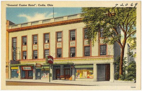
4 decades in the archive, from the 1900s to the 1970s. Scroll each row; tap a photo for its story.
Nothing in the archives for these yearsWeddings on Main Street, storms, parades, school pictures, the old store. If it’s in your family album, it belongs here.
Nothing in the archives for these yearsWeddings on Main Street, storms, parades, school pictures, the old store. If it’s in your family album, it belongs here.
In 1803, according to Wikipedia’s history of the town. Cadiz’s post office opened in 1812, and the census of 1820 counted 537 people here.
How does Cadiz rank for history?
Cadiz is more historic than 81% of U.S. towns, #293 of 993 in Ohio. The History grade combines the town’s founding era, the share of homes built before 1940 and its National Register listings. It’s a character grade, so it isn’t part of the overall grade. How it works.
What is on the National Register in Cadiz?
Two places: the Harrison County Courthouse (listed 1974) and the Harrison National Bank (1993).
How old are the homes in Cadiz?
19% of Cadiz’s homes were built before 1940 (Census estimate, ±6.6 points), against a typical 15% for an Ohio town; the median home was built in 1956.
Founding dates: Wikidata, Wikipedia, the U.S. post office records of Blevins & Helbock (CC0) and the Census. Homes by year built: Census ACS 2020–24. National Register of Historic Places: National Park Service (list of May 22, 2026). Old photos, postcards and papers: Wikimedia Commons, the Library of Congress and other public archives, credited on each item’s page. Maps: U.S. Geological Survey historical topographic maps (via Esri) and Sanborn fire-insurance maps (Library of Congress). History text and census tables: Wikipedia (CC BY-SA 4.0). Places that used to be: USGS Geographic Names Information System (2021).
From Wikimedia Commons (6), the National Register of Historic Places (2), Wikipedia, Wikidata and Wikipedia for famous people, U.S. Geological Survey historical maps, U.S. Census counts (via Wikipedia), the US Post Offices dataset (Blevins & Helbock), the USGS Geographic Names Information System, Sanborn fire insurance maps (Library of Congress) and old county and town histories (Internet Archive). Archive images are copied here with their credits and licenses, shown on each photo’s page. Refreshed monthly.
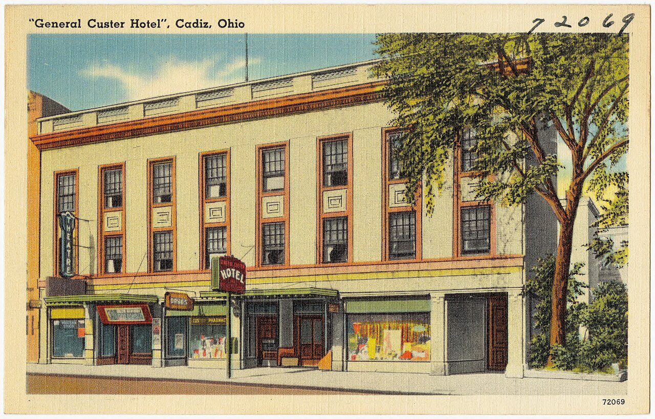


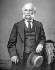




 1973
 1973