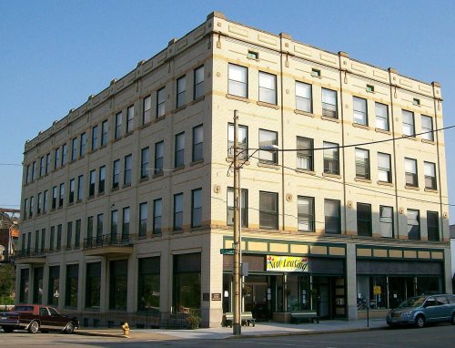
Founding year: Wikidata. First post office: 1841.The full story ↓
History grade
What drives Bellaire’s History grade
On its age, its old homes and the National Register, Bellaire is more historic than 93% of U.S. towns, #100 of 993 in Ohio. All 3 inputs are above most U.S. towns; its share of homes from before 1940 ranks highest and its National Register listings lowest.
A
HistoryA character grade: shown, never part of Bellaire’s overall grade.
Ohio towns list about as much on the Register as the country (a typical Ohio town has 2.9 per 10,000 residents, the U.S. 2.4), so Bellaire’s 10.5 sits above most of its state (75% of Ohio towns have fewer) while its 4 listings outnumber those of 68% of U.S. towns.
NoteThe founding year comes from Wikidata alone; no second source gives 1834.
How sure. Graded on any two of the three inputs instead, the letter would range from A− to A. The pre-1940 share is a Census survey estimate (±6.9 points).
Founding year: Wikidata (other dates in Quick answers). Homes: Census ACS 2020–24. National Register: National Park Service, May 2026 list; each listing counted once (boundary changes and added documentation belong to their listing), and a historic district counts its contributing buildings. How TownRatings grades history →
What stands out about Bellaire’s past
Read from the archive, the National Register and the record. The page puts what stands out first.
Fire insurance maps drew every building, what it was made of and what it was used for, so insurers could price the risk of fire. Pick a year, then a sheet.
Mound builders occupied numerous areas along the Ohio River and built complex earthworks. None of their distinctive prehistoric remains has been found within the present-day city limits. The Mingo, Shawnee, and Delaware were historic tribes who inhabited the area at the time of European encounter and settlement. The latter were involved in the Northwest Indian Wars after settlement began in the post- Revolutionary War years. Unhappy that the United States had ignored their grievances in the 1789 Treaty of Fort Harmar, the Indians tried to push out the settlers over the next several years.
Passages that mention Bellaire, cut from the printed page as they were published.
The Industries of Wheeling. Historical, descriptive and biographical review of the commercial and manufacturing advantages of Wheeling, Bellaire, Ohio, Martin's Ferry, Ohio, &c1879Read the page →
Read the text
naming some of them. We will now speak in detail of the college building, surroundings and the like. From the windows of the college building on the south the eye takes in one of the most lovely scenes imaginable. For miles the view of the Ohio river, skirted by a grand amphitheatre of hills, is uninterrupted. Bellaire. the railroad bridge, tinascending and descending steamers, the rattling trains of the Cleveland and Pittsburgh, and Baltimore and Ohio i-ailroads on opposite sides of the river, the grand old hills in striking contrast, all go to make up a picture of beauty rarely ecrualed, and this while right at omfeet is the roar of nail works, the smoke of glass factories and
Text read by machine from the scan; it may contain errors.
The Industries of Wheeling. Historical, descriptive and biographical review of the commercial and manufacturing advantages of Wheeling, Bellaire, Ohio, Martin's Ferry, Ohio, &c1879Read the page →
Read the text
A. RICHARDSON, Groceries and Produce, Bellaire, Ohio. Away back in 1859, when the city of Bellaire was but a small village. Richardson A- Brother started the above business with a capital of but $300.00. Under their careful and able management the busiuess has increased from year to year and to-day it stands a monument to their industry and is deserving to rank among the solid businesses of Bellaire. The store is situated at No. L'L'l Thirty-second street, and is a building L'OxdU feet, well stocked with a large and varied supply of Foreign and do-
Text read by machine from the scan; it may contain errors.
Centennial history of Belmont County, Ohio1903 · page 159Read the page →
Centennial history of Belmont County, Ohio1903 · page 241Read the page →
Read the text
Stewartsville is a railway station and coal mining town on the line of the Baltimore & Ohio Railroad, between six and seven miles west of Bellaire. It was named after John Stewart, of the late firm of Stewart & Mehan, and one of the proprietors of the Franklin mines which were organized in 1868. While the struggling mining towns of Stewartsville
Text read by machine from the scan; it may contain errors.
Scans and text from the Internet Archive. Books published in 1930 or earlier, which are in the public domain.
Timeline
Bellaire, 1834 to 1971
Woven from the archive, old maps, post office records, the National Register and the people born here.
Nothing in the archives for these yearsWeddings on Main Street, storms, parades, school pictures, the old store. If it’s in your family album, it belongs here.
In 1834, according to Wikidata. Bellaire’s post office opened in 1841, and the census of 1860 counted 1,466 people here.
How does Bellaire rank for history?
Bellaire is more historic than 93% of U.S. towns, #100 of 993 in Ohio. The History grade combines the town’s founding era, the share of homes built before 1940 and its National Register listings. It’s a character grade, so it isn’t part of the overall grade. How it works.
What is on the National Register in Bellaire?
4 listings: 3 buildings and 1 structure.
How old are the homes in Bellaire?
45% of Bellaire’s homes were built before 1940 (Census estimate, ±6.9 points), against a typical 15% for an Ohio town; the median home was built in 1944.
Founding dates: Wikidata, Wikipedia, the U.S. post office records of Blevins & Helbock (CC0) and the Census. Homes by year built: Census ACS 2020–24. National Register of Historic Places: National Park Service (list of May 22, 2026). Old photos, postcards and papers: Wikimedia Commons, the Library of Congress and other public archives, credited on each item’s page. Maps: U.S. Geological Survey historical topographic maps (via Esri) and Sanborn fire-insurance maps (Library of Congress). History text and census tables: Wikipedia (CC BY-SA 4.0). Places that used to be: USGS Geographic Names Information System (2021).
From Wikimedia Commons (5), the Library of Congress (1), the National Register of Historic Places (4), Wikipedia, Wikidata and Wikipedia for famous people, U.S. Geological Survey historical maps, U.S. Census counts (via Wikipedia), the US Post Offices dataset (Blevins & Helbock), the USGS Geographic Names Information System, Sanborn fire insurance maps (Library of Congress) and old county and town histories (Internet Archive). Archive images are copied here with their credits and licenses, shown on each photo’s page. Refreshed monthly.
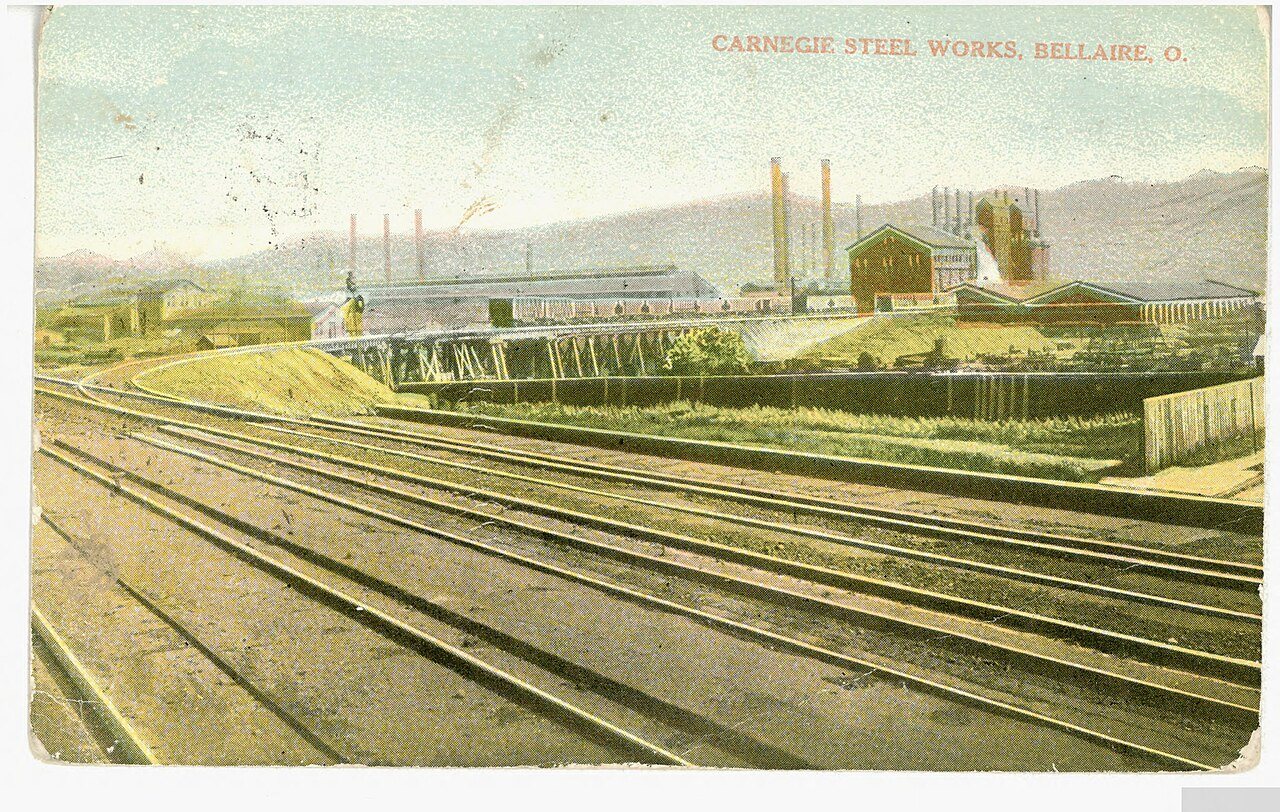




 1882
 1910