Ashland dates to 1815, and 29% of its homes were built before 1940
More historic than 95% of U.S. towns · #63 of 993 in Ohio. What drives it
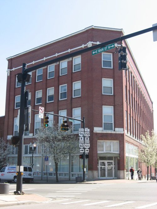
6 places in town are on the National Register, among them three historic districts with 119 buildings between them. Below: 6 old photos and papers, maps from 1884 on, and the census since 1850.
Founding year: Wikipedia. First post office: 1823.The full story ↓
History grade
What drives Ashland’s History grade
On its age, its old homes and the National Register, Ashland is more historic than 95% of U.S. towns, #63 of 993 in Ohio. All 3 inputs are above most U.S. towns; its National Register listings ranks highest and its age lowest.
A
HistoryA character grade: shown, never part of Ashland’s overall grade.
Ohio towns list about as much on the Register as the country (a typical Ohio town has 2.9 per 10,000 residents, the U.S. 2.4), so Ashland’s 64.5 sits above most of its state (91% of Ohio towns have fewer) while its 122 historic buildings outnumber those of 90% of U.S. towns.
How sure. Graded on any two of the three inputs instead, the letter would still be A. The pre-1940 share is a Census survey estimate (±3.7 points). Two sources give 1815.
Founding year: Wikipedia (other dates in Quick answers). Homes: Census ACS 2020–24. National Register: National Park Service, May 2026 list; each listing counted once (boundary changes and added documentation belong to their listing), and a historic district counts its contributing buildings. How TownRatings grades history →
What stands out about Ashland’s past
Read from the archive, the National Register and the record. The page puts what stands out first.
National Park Service, National Register of Historic Places. Photos from Wikimedia Commons, credited on each place’s page.
Every building
Ashland, building by building, 1884–1904
Fire insurance maps drew every building, what it was made of and what it was used for, so insurers could price the risk of fire. Pick a year, then a sheet.
Sanborn Map Company, via the Library of Congress. Editions published in 1930 or earlier, which are in the public domain.
Places that used to be
Old corners and burying grounds
Ashland’s post office has been open since 1823.
Hamlets and corners on the map
Carpenters Mobile Home ParkHopes Mobile Home ParkLake Silverstone Mobile Home ParkMeadowbrook Mobile Home ParkTrailerville Mobile Home ParkTwin Mobile Home ParkWestview Mobile Home Park
2cemeteries and burying grounds inside Ashland
AshlandOld Hopewell
US Post Offices dataset (Blevins & Helbock, CC0). Places and cemeteries from the USGS Geographic Names Information System (2021).
Ashland was laid out by William Montgomery in 1815. Ashland was originally called Uniontown, but in 1822 the city was compelled to adopt a new name because another city in Ohio was already named Uniontown. The new name of Ashland was selected by supporters of the Kentucky congressman Henry Clay, from Ashland, his estate near Lexington. Later, "Henry Clay High School" was considered as a name for what is now known as Ashland High School.
The speaker said that the village of Ashland was laid out in 1815, and then called Uniontown, but was changed to Ashland at the request of Francis Graham, who was obliged to have another name for the postoffice. He then gave a tribute to the memory of Father Graham who has recently died.
Text read by machine from the scan; it may contain errors.
The decade during which the town of Ashland was incorporated and Ashland county was formed progress in the nation bounded forward. Between 1840 and 1850 the horse-drawn reaper, the sewing machine and the electrical telegraph were produced. In 1842 the old stone Presbyterian church which stood on the site of the present church was erected and the following year the Disciples built the church which was afterward moved to West Third c+reet when the present house of worship was erected.
Text read by machine from the scan; it may contain errors.
improvement and progress of any locality. He gave of his time, influence and money to secure the construction of the Pittsburg, Fort Wayne & Chicago line later the Pensylvania line, through Loudonville. He secured the right of way through Holmes, Ashland and a part of Wayne county, and when the railroad was completed to this point he was made the first station agent at Loudonville performing the duties of the position for about ten years, when he ornate retired. He remained throughout his life an earnest worker for the public good and his efforts were effective forces for general improvement in many lines
Text read by machine from the scan; it may contain errors.
The Ashland & Wooster railroad connecting Ashland with the Pennsylvania railroad at Custaloga was finished to this city in 1899 and the effect of this new road on the growth of Ashland was magical. On the 17th of August that year the Jeromeville folks made a trip over the line to Ashland and had a picnic in the Semple grove. Oct. 12, 1899 was the big celebration in Ashland to mark the completion of this railroad.
Text read by machine from the scan; it may contain errors.
Scans and text from the Internet Archive. Books published in 1930 or earlier, which are in the public domain.
Timeline
Ashland, 1815 to 1972
Woven from the archive, old maps, post office records, the National Register and the people born here.
Nothing in the archives for these yearsWeddings on Main Street, storms, parades, school pictures, the old store. If it’s in your family album, it belongs here.
In 1815, according to Wikipedia’s history of the town. Ashland’s post office opened in 1823, and the census of 1850 counted 1,264 people here.
How does Ashland rank for history?
Ashland is more historic than 95% of U.S. towns, #63 of 993 in Ohio. The History grade combines the town’s founding era, the share of homes built before 1940 and its National Register listings. It’s a character grade, so it isn’t part of the overall grade. How it works.
What is on the National Register in Ashland?
6 listings: 3 buildings and 3 historic districts, the Center Street Historic District, the Downtown Ashland Historic District and the Ashland County Children's Home, with 119 contributing buildings. 122 historic buildings in all.
How old are the homes in Ashland?
29% of Ashland’s homes were built before 1940 (Census estimate, ±3.7 points), against a typical 15% for an Ohio town; the median home was built in 1959.
Founding dates: Wikidata, Wikipedia, the U.S. post office records of Blevins & Helbock (CC0) and the Census. Homes by year built: Census ACS 2020–24. National Register of Historic Places: National Park Service (list of May 22, 2026). Old photos, postcards and papers: Wikimedia Commons, the Library of Congress and other public archives, credited on each item’s page. Maps: U.S. Geological Survey historical topographic maps (via Esri) and Sanborn fire-insurance maps (Library of Congress). History text and census tables: Wikipedia (CC BY-SA 4.0). Places that used to be: USGS Geographic Names Information System (2021).
From Wikimedia Commons (6), the National Register of Historic Places (6), Wikipedia, Wikidata and Wikipedia for famous people, U.S. Geological Survey historical maps, U.S. Census counts (via Wikipedia), the US Post Offices dataset (Blevins & Helbock), the USGS Geographic Names Information System, Sanborn fire insurance maps (Library of Congress) and old county and town histories (Internet Archive). Archive images are copied here with their credits and licenses, shown on each photo’s page. Refreshed monthly.




 1907
 1909
 1909


