Guest, Sign inJoin

Post to Woodbury

We’ll email a one-tap link to publish your post. No password, and nothing is public until you click it.
Already a member? Sign in
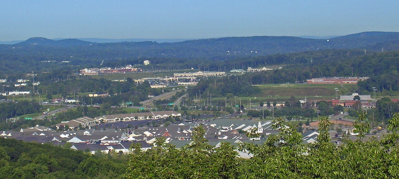
Woodbury Commons from US 6Photo: Daniel Case · CC BY-SA 3.0
–Not graded
Outdoors in Woodbury

Few parks or trails are on the map in Woodbury

The biggest trail networks: Harriman State Park (34.9 mi), Schunnemunk State Park (5.8 mi), Earl Reservoir Park (2.1 mi). 47% of Woodbury’s land is conserved, about 10,969 acres. 10,342 acres are parks and preserves, 846 per 1,000 residents.

Conserved land
47%
10,969 acres · of 36.1 sq mi of land
Trails
65 mi
1.8 per sq mi of land
Park land
10,342 ac
846 acres per 1,000 residents
Near a park
90%
of residents within ½ mile
Bike routes
0.1 mi
0.1 mi paths
Highest peak
1,663 ft
Schunnemunk Mountain
Lakes & rivers
23
3 beaches
The map

Conserved land, trails & bike routes

Tap a number to zoom to a park. Tap a layer to hide it.

1234
Easements protect land from building but are usually private.© OpenStreetMap contributors · USGS PAD-US
Places to walk

Pick a walk

The longest trail network is Harriman State Park, with 34.9 miles. Directions go to the nearest trailhead or public parking.

Harriman State Park

Managed by New York State Office of Parks, Recreation and Historic Preservation
7,708 acres34.9 mi of trail
Long PathMenomine TrailAppalachian TrailAppalachian Trail;Ramapo-Dunderberg Trail+1
Dog rules not recorded
Directionsto the parking lotWebsite ↗

Schunnemunk State Park

Managed by New York State Office of Parks, Recreation and Historic Preservation
1,712 acres5.8 mi of trail
Long PathJessup TrailRed TrailDark Hollow
Dog rules not recorded
No trailhead mapped yetWebsite ↗

Earl Reservoir Park

Park
243 acres2.1 mi of trail
Jessup Trail
Dog rules not recorded
Directionsto the parking lot

Gonzaga Park

Park
104 acres0.5 mi of trail
Jessup Trail
Dog rules not recorded
No trailhead mapped yet
All 6 parks & preserves
Harriman State Park7,708 acres · 34.9 mi of trail · New York State Office of Parks, Recreation and Historic Preservation
Directions
Schunnemunk State Park1,712 acres · 5.8 mi of trail · New York State Office of Parks, Recreation and Historic Preservation
Earl Reservoir Park243 acres · 2.1 mi of trail
Directions
Gonzaga Park104 acres · 0.5 mi of trail
Central Valley Park8 acres · 0.1 mi of trail
Directions
Mary Harriman Park14 acres
Directions
Who protects it

10,969 conserved acres

47% of Woodbury’s land. Who manages Woodbury’s conserved land, from the USGS Protected Areas Database. Approximate, because parcels can overlap.

State parks9,791 ac
Land trusts & nonprofits2,393 ac
Town or city580 ac
County209 ac
Other or Unknown Local Government41 ac
Other state land9 ac
Regional agency1 ac
State Park · 9,799 acRecreation or Education Easement · 1,018 acPrivate Conservation · 901 acLocal Park · 831 acHistoric or Cultural Easement · 456 ac
Good to know

Conserved doesn’t always mean open to visitors. 9 acres are conservation easements, usually private land. Public access isn’t recorded for 14 of 26 parcels. The walks above are places people visit.

The biggest protected parcels
Parcel (PAD-US)Managed byAcresPublic access
Harriman State Park
State Park
State parks8,079Open
Schunnemunk State Park
State Park
State parks1,712Open
Arden House
Private Conservation
Land trusts & nonprofits455Closed
Schunemunk Mountain Preserve
Private Conservation
Land trusts & nonprofits447Open
Town Of Woodbury Land
Local Park
Town or city254Unknown
Earl Reservoir Park
Local Park
Town or city238Open
Gonzaga Park
Local Park
County106Open
County Of Orange Land
Local Park
County103Unknown
Village of Woodbury Land
Local Park
Town or city83Unknown
Central Valley Park
Local Park
Other or Unknown Local Government22Open

5 smaller protected places aren’t shown.

Things to do

46 places to go in Woodbury

Beaches, playgrounds, peaks, falls and more. Pick a kind.

Peaks in Woodbury
Schunnemunk Mountain1,663 ft elevation · In Schunnemunk State Park
Directions
Bull Hill1,388 ft elevation
Directions
High Point1,388 ft elevation · In Schunnemunk State Park
Directions
Blackcap Mountain1,365 ft elevation
Directions
Bradley Mountain1,365 ft elevation
Directions
South Stockbridge Mountain1,348 ft elevation · In Harriman State Park
Directions
Stockbridge Mountain1,319 ft elevation · In Harriman State Park
Directions
Goshen Mountain1,299 ft elevation · In Harriman State Park
Directions
6 more peaks
Cranberry Hill1,227 ft elevation · In Harriman State Park
Directions
Stevens Mountain1,224 ft elevation · In Harriman State Park
Directions
Letterrock Mountain1,217 ft elevation · In Harriman State Park
Directions
Black Mountain1,165 ft elevation · In Harriman State Park
Directions
Brooks Mountain1,066 ft elevation · In Harriman State Park
Directions
Adria Hill1,004 ft elevation
Directions

Plus 2 peaks without a name on the map.

Trails & water

18 named trails and 23 lakes & rivers

Named trails
Open to bikes · 0.8 miUnpaved · 35.1 mi
Long Path6.6 mi
Menomine Trail3.4 mi
Jessup Trail2.5 mi
Appalachian Trail2.5 mi
Appalachian Trail;Ramapo-Dunderberg Trail2.1 mi
Bockey Swamp Trail1.8 mi
Ramapo-Dunderberg Trail1.2 mi
Appalachian Trail;1779 Trail1.1 mi
Anthony Wayne Trail0.8 mi
Ramapo Dunderberg Trail0.7 mi
8 more trails
Cranberry Mine Trail
0.6 mi
Ramapo-Dunderberg/Appalachian Trail
0.6 mi
Appalachian Trail;Anthony Wayne Trail
0.5 mi
Red Trail
0.4 mi
Dark Hollow
0.4 mi
1779 Trail
0.2 mi
Sapphire Trail
0.2 mi
Lake Tiorati Trail
0.1 mi
Lakes & rivers tap for directions
Biking & sports

0.1 miles of bike routes

Bike lanes are often missing from the map in smaller towns, so that number is likely low.

0.1 mi
off-road bike paths
Courts & fields
14Tennis
14Baseball
8Soccer
5Basketball
5Tracks
4Football
2Beach volleyball

Includes school and college facilities, which aren’t always open to the public.

History along the way

3 places on the National Register, one a National Historic Landmark

The country’s official list of places worth saving (National Park Service). The map also marks 1 historic points from OpenStreetMap: plaques, memorials and old buildings.

History →
★
Arden, E. H. Harriman EstateNational Historic Landmark · Building · listed 1966
About it
Smith Clove MeetinghouseBuilding · listed 1974
About it
Rushmore Memorial LibraryBuilding · listed 2008
About it
When to get out

The best walking months in Woodbury: May to September

NOAA’s 1991–2020 normals for the town and the daylight at its latitude. Outlined months have long days, highs of 59 to 86 °F and little rain for the place.

JanFebMarAprMayJunJulAugSepOctNovDec
Daylight (h)9.510.611.813.314.515.114.913.812.411.09.89.2
High (°F)353846586977818073625039
Rain (in)3.72.94.14.03.94.84.54.64.64.73.94.3

February is the driest month (2.9 in) and July the warmest (highs of 81 °F). 4.8 inches fall in June, the wettest month. The climate in Woodbury →

Next door

Woodbury and its neighbors

Tap a town to see its outdoors.

TownConserved
of land
Trail mi
per sq mi
Park acres
per 1,000
Near a park
½ mile
Outdoors
Woodbury— not graded: under 1,000 residents or part of its town
Blooming Grove4%0.54975%B+
Tuxedo81%3.27,47583%A+
Tuxedo77%3.06,01982%A+
Mountain Lodge Park— not graded: under 1,000 residents or part of its town
Highlands30%1.932287%A+
Monroe22%0.810179%A
Cornwall40%2.533791%A+

The four inputs of the Outdoors grade, from the engine; shares are of land, not water.

Questions about parks and trails in Woodbury

Where can I hike in Woodbury?

The longest trail networks: Harriman State Park, 34.9 miles; Schunnemunk State Park, 5.8 miles; Earl Reservoir Park, 2.1 miles; Gonzaga Park, 0.5 miles. Each one is on the map above, with directions to the nearest trailhead or parking.

Are dogs allowed on Woodbury’s trails?

Harriman State Park and Schunnemunk State Park don’t have dog rules recorded on the map; check the signs at the trailhead.

Where can I bike in Woodbury?

0.1 miles of bike routes are on the map: 0.1 of off-road paths.

Is there public land near Woodbury?

117,812 acres of parks and open public land lie inside Woodbury or within 10 miles of it (PAD-US), 10,342 of them inside the town line.

Trail talk

Conditions, parking and favorite walks from Woodbury neighbors.
Town Square →
Share a tip
Sources

Where this page comes from

Conserved and public land: USGS Protected Areas Database of the United States (PAD-US), service updated July 2026. Parks, trails, playgrounds, beaches and other places: OpenStreetMap (© OpenStreetMap contributors, ODbL), map data as of 2026-10-28. Land and water area: Census 2025 Gazetteer. Residents near a park: 2020 Census blocks. National Register: National Park Service. How TownRatings grades the outdoors →