The Winfield post office opened in 1817, the earliest record of the town by name. Two smaller post offices, North Winfield (1851) and Chepachet (1882), opened inside today’s town and later closed.
2020 census: 1,897209 years
How historic is Winfield?
A+
More historic than 98% of U.S. towns, on its age, its old homes and the National Register.
Founding year: the first Winfield post office (Blevins & Helbock, CC0).
History grade
What drives Winfield’s History grade
On its age, its old homes and the National Register, Winfield is more historic than 98% of U.S. towns. All 3 inputs are above most U.S. towns; its National Register listings ranks highest and its age lowest.
A+
HistoryA character grade: shown, never part of Winfield’s overall grade.
New York towns list more on the Register than most of the country (a typical New York town has 12.3 per 10,000 residents, the U.S. 2.4), so Winfield’s 2,044 sits above most of its state (99% of New York towns have fewer) while its 383 historic buildings outnumber those of 96% of U.S. towns.
How sure. Graded on any two of the three inputs instead, the letter would range from A to A+. The pre-1940 share is a Census survey estimate (±7.7 points). The founding year is the first post office, not a stated founding date.
Founding year: the first post office (other dates in Quick answers). Homes: Census ACS 2020–24. National Register: National Park Service, May 2026 list; each listing counted once (boundary changes and added documentation belong to their listing), and a historic district counts its contributing buildings. How TownRatings grades history →
What stands out about Winfield’s past
Read from the archive, the National Register and the record. The page puts what stands out first.
Lost post offices, old corners, places now gone and burying grounds
Winfield had its own post office from 1817 to 1936. Two other post offices opened and closed inside today’s town.
Winfield
1817–1936
West Winfield
1828–today
North Winfield
1851–1902
Chepachet
1882–1953
18101920today
Hamlets and corners on the map
Birmingham CornersCedar Hurst Park Mobile Home ParkCedarville StationChepachetEast WinfieldHitching CornerNorth WinfieldWest WinfieldWoods Corners
Gone or out of use
School Number 6schoolSchool Number 7school
8cemeteries and burying grounds inside Winfield
Babcock HillBardinBurgessEast WinfieldMeeting House GreenSaint Joseph'sWest WinfieldWood
US Post Offices dataset (Blevins & Helbock, CC0). Places and cemeteries from the USGS Geographic Names Information System (2021).
The story so far
Winfield, in brief
Wikipedia doesn’t have a history of Winfield yet. The photos, dates and memories neighbors add here are how it gets written.
Its first post office opened in 1817. Between the 2010 and 2020 censuses its population fell from 2,086 to 1,897 (-9%).
From the old history books
What they wrote about Winfield in 1893
Passages that mention Winfield, cut from the printed page as they were published.
History of Herkimer county, New York1893 · page 512Read the page →
Read the text
was the father of Alonzo, and was born on the 5th of February, 1765, at Monson. He was a farmer by occupation, held the post of captain in the militia, and was a sturdy representative of the New England pioneers. In the year 1792, when he was twentyseven years old, he came into what is now the town of Winfield, Herkimer coimty, his path being shown only by marked trees for much of the distance, and settled on the homestead which has ever since been in possession of the family, and is now occupied by Alonzo Wood. The immediate locality became known in early years as " Wood's Corners," two roads crossing near the homestead and a school-house and shops being
Text read by machine from the scan; it may contain errors.
History of Herkimer county, New York1893 · page 368Read the page →
Read the text
PREVIOUS to the year 18 16 the territory now embraced in the town of Winfield was a part of the towns of Richfield and Plainfield, Otsego county, and Litchfield, Herkimer county. Consequently, upon its formation the boundaries of Herkimer county were enlarged. The act under which the town came into existence is dated April 17, 18 16, and its passage in the Senate was procured by Dr. John J. Prendergast, then a member of that body. He had the privilege of naming the new town and proposed " Scott," in honor of Gen. Winfield Scott ; but on learn-
Text read by machine from the scan; it may contain errors.
Scans and text from the Internet Archive. Books published in 1930 or earlier, which are in the public domain.
Timeline
Winfield, 1801 to 1936
Woven from the archive, old maps, post office records, the National Register and the people born here.
The Winfield post office opened in 1817, the earliest record of the town by name (U.S. post office records).
How does Winfield rank for history?
Winfield is more historic than 98% of U.S. towns. The History grade combines the town’s founding era, the share of homes built before 1940 and its National Register listings. It’s a character grade, so it isn’t part of the overall grade. How it works.
What is on the National Register in Winfield?
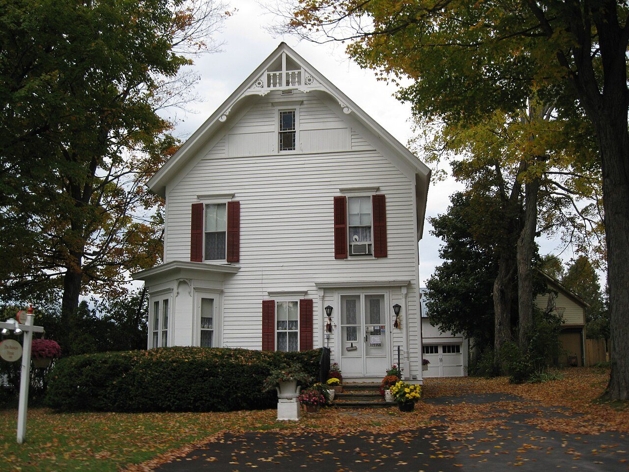
5 listings: 1 building, among them the Bonfoy-Barstow House (listed 2011, the first), 3 historic districts, the Brace Farm, the Rice-Dodge-Burgess Farm and the West Winfield Historic District, with 381 contributing buildings, and 1 site. 383 historic buildings in all.
How old are the homes in Winfield?
37% of Winfield’s homes were built before 1940 (Census estimate, ±7.7 points), against a typical 27% for a New York town; the median home was built in 1958.
Founding dates: Wikidata, Wikipedia, the U.S. post office records of Blevins & Helbock (CC0) and the Census. Homes by year built: Census ACS 2020–24. National Register of Historic Places: National Park Service (list of May 22, 2026). Old photos, postcards and papers: Wikimedia Commons, the Library of Congress and other public archives, credited on each item’s page. Maps: U.S. Geological Survey historical topographic maps (via Esri) and Sanborn fire-insurance maps (Library of Congress). History text and census tables: Wikipedia (CC BY-SA 4.0). Places that used to be: USGS Geographic Names Information System (2021).
From Wikimedia Commons (1), the National Register of Historic Places (5), the US Post Offices dataset (Blevins & Helbock), the USGS Geographic Names Information System and old county and town histories (Internet Archive). Archive images are copied here with their credits and licenses, shown on each photo’s page. Refreshed monthly.


 2012


