More historic than 42% of U.S. towns · #700 of 758 in New York. What drives it
Most of Wilton was built recently: 8% of its homes predate 1940 and the median home dates from 1999. Below: 2 old photos and papers, maps from 1900 on, and the census since 1820.
The Wilton post office opened in 1825, the earliest record of the town by name. Three smaller post offices, South Wilton (1866), Kings Station (1885) and Gurnspring (1895), opened inside today’s town and later closed.
First census: 1,293 in 18202020 census: 17,361201 years
How historic is Wilton?
C+
More historic than 42% of U.S. towns, on its age, its old homes and the National Register.
Founding year: the first Wilton post office (Blevins & Helbock, CC0).The full story ↓
History grade
What drives Wilton’s History grade
On its age, its old homes and the National Register, Wilton is more historic than 42% of U.S. towns, #700 of 758 in New York. Its age holds the grade up; its National Register listings pull it down.
C+
HistoryA character grade: shown, never part of Wilton’s overall grade.
New York towns list more on the Register than most of the country (a typical New York town has 12.3 per 10,000 residents, the U.S. 2.4), so Wilton’s 0.0 sits below most of its state (10% of New York towns have fewer) while its 0 listings outnumber those of 23% of U.S. towns.
How sure. Graded on any two of the three inputs instead, the letter would range from C− to B. The pre-1940 share (±2.8 points) is firm at this size. The founding year is the first post office, not a stated founding date.
Founding year: the first post office (other dates in Quick answers). Homes: Census ACS 2020–24. National Register: National Park Service, May 2026 list; each listing counted once (boundary changes and added documentation belong to their listing), and a historic district counts its contributing buildings. How TownRatings grades history →
What stands out about Wilton’s past
Read from the archive, the National Register and the record. The page puts what stands out first.
Lost post offices, old corners and burying grounds
Wilton’s post office has been open since 1825. Three other post offices opened and closed inside today’s town.
Wilton
1825–today
South Wilton
1866–1874
Kings Station
1885–1904
Gurnspring
1895–1904
18201920today
Hamlets and corners on the map
Adirondack EstatesBallard CornersBirch AcresCarlyle EstatesFox Run EstatesGurn SpringHearthwood NorthHighland HillsKings StationLost Valley EstatesLoughberry Mobile Home ParkPyramid Pines Mobile Home ParkTravers CornersWhispering Pines Mobile Home ParkWood Knolls
The region, once called "Palmertown," was first settled by Europeans around 1764. The Town of Wilton was created in 1818 from the Town of Northumberland.
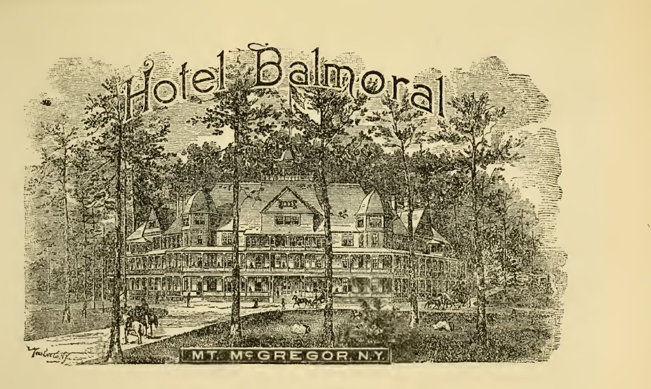
The Grant Cottage State Historic Site is located in Wilton, in an area known as Mount McGregor, which is the highest peak of the Palmertown Range, mostly north of Wilton. This site is the place where Ulysses S. Grant died of throat cancer in 1885 just after completing his memoirs.
A narrow-gauge railway built in 1882, the Saratoga, Mount McGregor and Lake George Railroad, ran through Wilton.
Passages that mention Wilton, cut from the printed page as they were published.
History of Saratoga County, New York, with illustrations biographical sketches of some of its prominent men and pioneers1878Read the page →
Read the text
The first settlement of what is now the town of Wilton, but then and long before known as Palmertown, was begun by two brothers, William and Samuel Brisbin, as early as the year 1764. These two brothers were the sous by his first wife of James Brisbin, who came over from the north of Ireland, and became the first settler of what is now the town of Northumberland, in the year 1765.
Text read by machine from the scan; it may contain errors.
History of Saratoga County, New York, with biographical sketches of some of its prominent men and pioneers1878Read the page →
Read the text
The first settlement of what is now the town of Wilton, but then and long before known as Palmertown, was begun by two brothers, William and Samuel Brisbin, as early as the year 1764. These two brothers were the sons by his first wife of James Brisbin, who came over from the north of Ireland, and became the first settler of what is now the town of Northumberland, in the year 1765.
Text read by machine from the scan; it may contain errors.
History of Saratoga County, New York, with biographical sketches of some of its prominent men and pioneers1878Read the page →
Read the text
the definition of its boundary lines, as given in the revised statutes of the State : ** The town of Saratoga Springs shall contain all that part of said county bounded northerly by Greenfield and Wilton, westerly by Milton, southerly by Malta, and easterly by a line beginning at the northeast corner of Malta, then down the middle of Saratoga lake and Fish creek to a point two rods above Stafford's bridge, and running thence, ao as to include said bridge and a piece of land four
Text read by machine from the scan; it may contain errors.
History of Saratoga County, New York, with illustrations biographical sketches of some of its prominent men and pioneers1878Read the page →
Read the text
the definition of its boundary lines, as given in the revised statutes of the State : ** The town of Saratoga Springs shall contain all that part of said county bounded northerly by Grcentield and Wilton, westerly by Milton, southerly by Malta, and easterly by a line beginning at the northeast corner of Malta, then down the middle of Siti'atoga lake and Fish creek to a point two rods above Stafford's bridge, and running thence, so as to include said bridge and apiece of land four
Text read by machine from the scan; it may contain errors.
Scans and text from the Internet Archive. Books published in 1930 or earlier, which are in the public domain.
Timeline
Wilton, 1825 to 2020
Woven from the archive, old maps, post office records, the National Register and the people born here.
Nothing in the archives for these yearsWeddings on Main Street, storms, parades, school pictures, the old store. If it’s in your family album, it belongs here.
Nothing in the archives for these yearsWeddings on Main Street, storms, parades, school pictures, the old store. If it’s in your family album, it belongs here.
The Wilton post office opened in 1825, the earliest record of the town by name (U.S. post office records).
How does Wilton rank for history?
Wilton is more historic than 42% of U.S. towns, #700 of 758 in New York. The History grade combines the town’s founding era, the share of homes built before 1940 and its National Register listings. It’s a character grade, so it isn’t part of the overall grade. How it works.
How old are the homes in Wilton?
8% of Wilton’s homes were built before 1940 (Census estimate, ±2.8 points), against a typical 27% for a New York town; the median home was built in 1999.
Founding dates: Wikidata, Wikipedia, the U.S. post office records of Blevins & Helbock (CC0) and the Census. Homes by year built: Census ACS 2020–24. National Register of Historic Places: National Park Service (list of May 22, 2026). Old photos, postcards and papers: Wikimedia Commons, the Library of Congress and other public archives, credited on each item’s page. Maps: U.S. Geological Survey historical topographic maps (via Esri) and Sanborn fire-insurance maps (Library of Congress). History text and census tables: Wikipedia (CC BY-SA 4.0). Places that used to be: USGS Geographic Names Information System (2021).
From Wikimedia Commons (6), Wikipedia, Wikidata and Wikipedia for famous people, U.S. Geological Survey historical maps, U.S. Census counts (via Wikipedia), the US Post Offices dataset (Blevins & Helbock), the USGS Geographic Names Information System and old county and town histories (Internet Archive). Archive images are copied here with their credits and licenses, shown on each photo’s page. Refreshed monthly.


 2021
 2016
 2016
 2011


