Founding year: Wikidata. First post office: 1818.The full story ↓
History grade
What drives Westfield’s History grade
On its age, its old homes and the National Register, Westfield is among the most historic 1% of U.S. towns, #7 of 758 in New York. All 2 inputs put Westfield near the top nationally; its share of homes from before 1940 ranks highest.
A+
HistoryA character grade: shown, never part of Westfield’s overall grade.
New York towns list more on the Register than most of the country (a typical New York town has 12.3 per 10,000 residents, the U.S. 2.4), so Westfield’s 446 sits above most of its state (91% of New York towns have fewer) while its 142 historic buildings outnumber those of 91% of U.S. towns.
How sure. Graded on two of the three inputs, so a change in either one moves the letter more than it would with three. The pre-1940 share is a Census survey estimate (±13.9 points). Two sources give 1802.
Founding year: Wikidata (other dates in Quick answers). Homes: Census ACS 2020–24. National Register: National Park Service, May 2026 list; each listing counted once (boundary changes and added documentation belong to their listing), and a historic district counts its contributing buildings. How TownRatings grades history →
What stands out about Westfield’s past
Read from the archive, the National Register and the record. The page puts what stands out first.
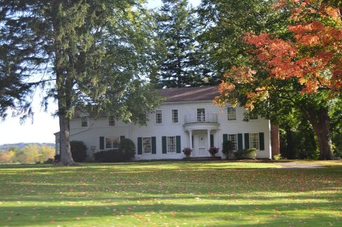
The country’s official list of buildings and places worth saving.
places listed
19
National Historic Landmarks
0
none yet
historic buildings protected
142
each building in a district counts
National Park Service, National Register of Historic Places. Photos from Wikimedia Commons, credited on each place’s page.
Every building
Westfield, building by building, 1886–1912
Fire insurance maps drew every building, what it was made of and what it was used for, so insurers could price the risk of fire. Pick a year, then a sheet.
The area was first settled in 1802 by James McMahan, formerly of Northumberland County, Pennsylvania. McMahan established a mill near the mouth of Chautauqua Creek, where it empties into Lake Erie. The mill was later dismantled in advance of the War of 1812 to prevent it from falling into the hands of the British. Today some of the millstones from McMahan's mill rest outside the Patterson Library in Westfield village.
The town of Westfield was established in 1828 from parts of the towns of Portland and Ripley.
The Barcelona Lighthouse was constructed in 1829 to overlook Barcelona Harbor and aided sailors on Lake Erie until being deactivated in 1859. It was the first lighthouse in the world to be powered by natural gas.
Westfield post-office was established June 15, 1818, Fenn Demming, postmaster, virtually superseding the old Chautauqua office, the first in the county. Demming had been a surgeon in the war of 181 2, and opened the first drug store in Westfield. Orvis Nichols was appointed in February, 1833 ; Calvin Rumsey in 1840; Wm. Sexton a few months later, and in' 1843 superseded by Orvis Nichols, who was in turn superseded by Mr. Sexton. In 1853, Hiram W. Beers, a Methodist minister, was appointed, and in about a year was succeeded by Dr. Marcellus Kenyon. David Mann, a former district-attor-
Text read by machine from the scan; it may contain errors.
History of Chautauqua County, New York1875 · page 44Read the page →
Read the text
The Portage road commenced on the west bank of Chautauqua creek, a little distance from its mouth, in the town of Westfield. Thence it passed up, on the west side of the creek, crossing the present Erie road at the Old McHeniy tavern, where the historical monument stands, to a point above the woolen factory, about a mile from Westfield. Here the road crossed the creek ; still further on it crossed the present road leadin^from Mayville to Westfield, and continued most of the distance fey the remainder of the way, on the east side of the present road, and terminated at the foot of Main
Text read by machine from the scan; it may contain errors.
Scans and text from the Internet Archive. Books published in 1930 or earlier, which are in the public domain.
Timeline
Westfield, 1802 to 1991
Woven from the archive, old maps, post office records, the National Register and the people born here.
In 1802, according to Wikidata. Westfield’s post office opened in 1818, and the census of 1830 counted 2,476 people here.
How does Westfield rank for history?
Westfield is among the most historic 1% of U.S. towns, #7 of 758 in New York. The History grade combines the town’s founding era, the share of homes built before 1940 and its National Register listings. It’s a character grade, so it isn’t part of the overall grade. How it works.
How old are the homes in Westfield?
60% of Westfield’s homes were built before 1940 (Census estimate, ±13.9 points), against a typical 27% for a New York town; the median home was built in 1938.
Founding dates: Wikidata, Wikipedia, the U.S. post office records of Blevins & Helbock (CC0) and the Census. Homes by year built: Census ACS 2020–24. National Register of Historic Places: National Park Service (list of May 22, 2026). Old photos, postcards and papers: Wikimedia Commons, the Library of Congress and other public archives, credited on each item’s page. Maps: U.S. Geological Survey historical topographic maps (via Esri) and Sanborn fire-insurance maps (Library of Congress). History text and census tables: Wikipedia (CC BY-SA 4.0). Places that used to be: USGS Geographic Names Information System (2021).
From Wikimedia Commons (17), Wikidata (1), Wikipedia, Wikidata and Wikipedia for famous people, U.S. Geological Survey historical maps, U.S. Census counts (via Wikipedia), Sanborn fire insurance maps (Library of Congress) and old county and town histories (Internet Archive). Archive images are copied here with their credits and licenses, shown on each photo’s page. Refreshed monthly.


 1867
 1867
 1867
 1867
 1867
 1992
 2014
 2012
 2006
 2006
 2006
 2006
 2006
 2006


