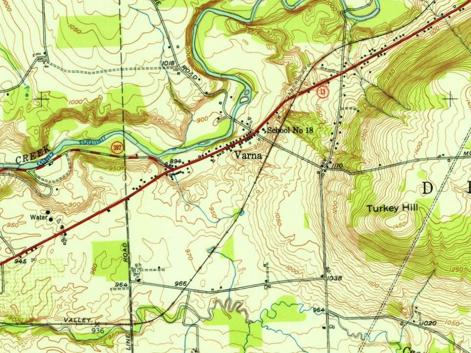
Most of Varna was built recently: 7% of its homes predate 1940 and the median home dates from 1988. Below: 1 old photo or paper, maps from 1900 on, and old-book passages.
Wikipedia doesn’t have a history of Varna yet. The photos, dates and memories neighbors add here are how it gets written.
Varna is a hamlet (and census-designated place) located in Tompkins County, New York, United States. It is within the Town of Dryden. As of the 2020 census, Varna had a population of 767. Varna is located near the west town line on New York State Route 366 (Dryden Road). Fall Creek flows past the town to Cayuga Lake.
Its first post office opened in 1830.
Intro from Wikipedia. Population: U.S. Census Bureau.
From the old history books
What they wrote about Varna in 1894
Passages that mention Varna, cut from the printed page as they were published.
Landmarks of Tompkins county, New York1894 · page 88Read the page →
Read the text
88 LANDMARKS f)F TOMPKINS COUNTY, married Miss Mary L. Sherwood, daujjhter of William Sherwood, of Varna. He left the hoiiiestead farm in 1859 and moved to Varna, living there six years, and in 1807 bought the Red Mills of Freeville, which he remodeled and soon established a well deserved reputation throughout the town and county, and remained there fifteen years. In 1881 he sold the mill and moved into the village of Freeville, where he has talcen a prominent part in advancing its best interests, being president of the village.
Text read by machine from the scan; it may contain errors.
Scans and text from the Internet Archive. Books published in 1930 or earlier, which are in the public domain.
By decade
Varna, decade by decade
One decade in the archive so far: the 1860s. Scroll each row; tap a photo for its story.
Founding dates: Wikidata, Wikipedia, the U.S. post office records of Blevins & Helbock (CC0) and the Census. Homes by year built: Census ACS 2020–24. National Register of Historic Places: National Park Service (list of May 22, 2026). Old photos, postcards and papers: Wikimedia Commons, the Library of Congress and other public archives, credited on each item’s page. Maps: U.S. Geological Survey historical topographic maps (via Esri) and Sanborn fire-insurance maps (Library of Congress). History text and census tables: Wikipedia (CC BY-SA 4.0). Places that used to be: USGS Geographic Names Information System (2021). How TownRatings grades history →
From Wikimedia Commons (1), Wikidata and Wikipedia for famous people, U.S. Geological Survey historical maps and old county and town histories (Internet Archive). Archive images are copied here with their credits and licenses, shown on each photo’s page. Refreshed monthly.