Every edition of the U.S. Geological Survey’s map of South Fallsburg. Tap a year, or press play to watch the town change.
1909Monticello sheet · 1:62,500
U.S. Geological Survey historical topographic maps (public domain), via Esri’s collection of the scans. The red ring marks the center of South Fallsburg.
South Fallsburg is located in the one-time resort area of the Catskill Mountains known as the Borscht Belt. The Raleigh Hotel on Heiden Road is a 320-room Glatt Kosher Cholov Yisrael hotel for Hasidic Jews sitting on 200 acres (0.81 km2); it also serves as a convention center for religious and nonreligious groups. The Rivoli Theatre and South Fallsburg Hebrew Association Synagogue are listed on the National Register of Historic Places. The town is home to a center of Siddha Yoga, the Shree Muktananda Ashram of the SYDA Foundation.
Founding dates: Wikidata, Wikipedia, the U.S. post office records of Blevins & Helbock (CC0) and the Census. Homes by year built: Census ACS 2020–24. National Register of Historic Places: National Park Service (list of May 22, 2026). Old photos, postcards and papers: Wikimedia Commons, the Library of Congress and other public archives, credited on each item’s page. Maps: U.S. Geological Survey historical topographic maps (via Esri) and Sanborn fire-insurance maps (Library of Congress). History text and census tables: Wikipedia (CC BY-SA 4.0). Places that used to be: USGS Geographic Names Information System (2021). How TownRatings grades history →
From Wikimedia Commons (6), Wikipedia, Wikidata and Wikipedia for famous people and U.S. Geological Survey historical maps. Archive images are copied here with their credits and licenses, shown on each photo’s page. Refreshed monthly.


 2012
 2012
 2008
 2008
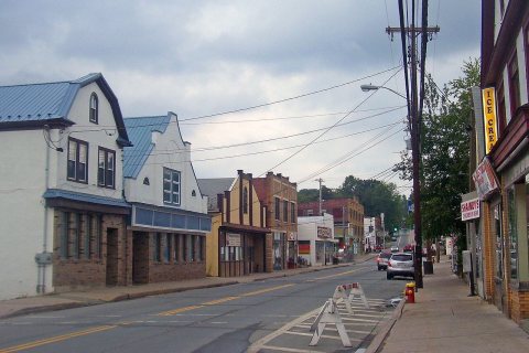 2008