9 places in town are on the National Register, among them the John Woodchuck Lodge (Burroughs Home), a National Historic Landmark, and five historic districts with 333 buildings between them. Below: 3 old photos and papers, maps from 1904 on, and the census since 1820.
Founding year: Wikidata. First post office: 1805.The full story ↓
History grade
What drives Roxbury’s History grade
On its age, its old homes and the National Register, Roxbury is more historic than 95% of U.S. towns. All 3 inputs are above most U.S. towns; its National Register listings ranks highest and its age lowest.
A+
HistoryA character grade: shown, never part of Roxbury’s overall grade.
New York towns list more on the Register than most of the country (a typical New York town has 12.3 per 10,000 residents, the U.S. 2.4), so Roxbury’s 1,510 sits above most of its state (98% of New York towns have fewer) while its 343 historic buildings outnumber those of 96% of U.S. towns.
How sure. Graded on any two of the three inputs instead, the letter would range from A− to A+. The pre-1940 share is a Census survey estimate (±4.9 points). Two sources give 1799.
Founding year: Wikidata (other dates in Quick answers). Homes: Census ACS 2020–24. National Register: National Park Service, May 2026 list; each listing counted once (boundary changes and added documentation belong to their listing), and a historic district counts its contributing buildings. How TownRatings grades history →
What stands out about Roxbury’s past
Read from the archive, the National Register and the record. The page puts what stands out first.
The town of Roxbury was formed in 1799 from the town of Stamford. It was part of Albany county when the state of New York was first split into counties.
Roxbury was the birthplace and the home of naturalist John Burroughs. A memorial site has been placed by his birthplace. Jay Gould, the railroad financier, was also born in the town. The Main Street Historic District includes the Jay Gould Memorial Church and was listed on the National Register of Historic Places in 1988. Other sites on the National Register include the First Old School Baptist Church of Roxbury and Vega Cemetery, Isaac Hardenbergh House, Second Old School Baptist Church of Roxbury, Walter Stratton House, and Ulster and Delaware Railroad Depot and Mill Complex.
In 1660, the General Court judged it "meet to grant to the Town of Roxbury five hundred acres of land towards the maintainance of a free school." The land, however, does not appear to have been located at that time. In 1715, upon the petition of Stephen^ Williams and others setting forth the facts, the general court granted "five hundred acres to the town of Roxbury towards the support of the free school." In
Text read by machine from the scan; it may contain errors.
History of ancient Woodbury, Connecticut, from the first Indian deed in 1659 ... including the present towns of Washington, Southbury, Bethlem, Roxbury, and a part of Oxford and Middlebury1854 · page 298Read the page →
Read the text
Roxbury and Zoar Bridge, in Newtown. In April, 1794, a portion of this church, with others, were organized into a new church, at Zoar Bridge. In January, 1803, the " Society agreed younanimous to have Mr. Fuller ordained as an Elder in said Society."
Text read by machine from the scan; it may contain errors.
Part I.] history of roxburv. 105 him to accept their call, but, regarding himself bound to his friends at Roxbury, he could not be prevailed on to decline their invitation, and he was dismissed to Roxbury. He was ordained Teacher of the first church, November 5th, 1632. Rev. Thomas Weld had been invested with the Pastoral care, in July preceding.
Text read by machine from the scan; it may contain errors.
History of ancient Woodbury, Connecticut, from the first Indian deed in 1659 ... including the present towns of Washington, Southbury, Bethlem, Roxbury, and a part of Oxford and Middlebury1854 · page 282Read the page →
Read the text
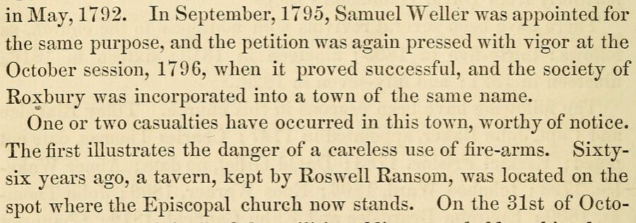
in May, 1792. In September, 1795, Samuel Weller was appointed for the same purpose, and the petition was again pressed with vigor at the October session, 1796, when it proved successful, and the society of Roxbury was incorporated into a town of the same name. One or two casualties have occurred in this town, worthy of notice. The first illustrates the danger of a careless use of fire-arms. Sixtysix years ago, a tavern, kept by Roswell Ransom, was located on the spot where the Episcopal church now stands. On the 31st of Octo-
Text read by machine from the scan; it may contain errors.
Scans and text from the Internet Archive. Books published in 1930 or earlier, which are in the public domain.
Timeline
Roxbury, 1799 to 1978
Woven from the archive, old maps, post office records, the National Register and the people born here.
Nothing in the archives for these yearsWeddings on Main Street, storms, parades, school pictures, the old store. If it’s in your family album, it belongs here.
Nothing in the archives for these yearsWeddings on Main Street, storms, parades, school pictures, the old store. If it’s in your family album, it belongs here.
In 1799, according to Wikidata. Roxbury’s post office opened in 1805, and the census of 1820 counted 2,488 people here.
How does Roxbury rank for history?
Roxbury is more historic than 95% of U.S. towns. The History grade combines the town’s founding era, the share of homes built before 1940 and its National Register listings. It’s a character grade, so it isn’t part of the overall grade. How it works.
What is on the National Register in Roxbury?
9 listings: 4 buildings, among them the John Woodchuck Lodge (Burroughs Home) (a National Historic Landmark since 1962), and 5 historic districts with 333 contributing buildings. 343 historic buildings in all.
How old are the homes in Roxbury?
26% of Roxbury’s homes were built before 1940 (Census estimate, ±4.9 points), against a typical 27% for a New York town; the median home was built in 1974.
Founding dates: Wikidata, Wikipedia, the U.S. post office records of Blevins & Helbock (CC0) and the Census. Homes by year built: Census ACS 2020–24. National Register of Historic Places: National Park Service (list of May 22, 2026). Old photos, postcards and papers: Wikimedia Commons, the Library of Congress and other public archives, credited on each item’s page. Maps: U.S. Geological Survey historical topographic maps (via Esri) and Sanborn fire-insurance maps (Library of Congress). History text and census tables: Wikipedia (CC BY-SA 4.0). Places that used to be: USGS Geographic Names Information System (2021).
From Wikimedia Commons (6), the National Register of Historic Places (9), Wikipedia, Wikidata and Wikipedia for famous people, U.S. Geological Survey historical maps, U.S. Census counts (via Wikipedia), the US Post Offices dataset (Blevins & Helbock), the USGS Geographic Names Information System and old county and town histories (Internet Archive). Archive images are copied here with their credits and licenses, shown on each photo’s page. Refreshed monthly.


 ★ Landmark


![Part I.] history of roxburv. 105 him to accept their call, but, regarding himself bound to his friends at Roxbury, he could not be prevailed on to decline their invitation, and he was dismissed to Roxbury. He was ordained Teacher of the first church, November 5th, 1632. Rev. Thomas Weld had been in…](https://images.townratings.com/story/28501/bk-a4d9a82d8656d6d1-l.jpg)


 2009
 2009
 2009

