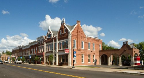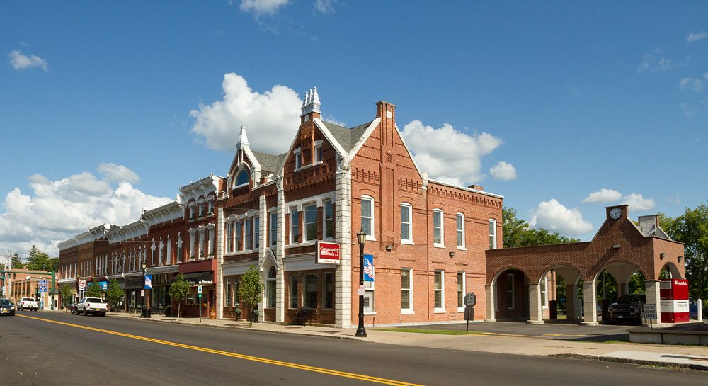
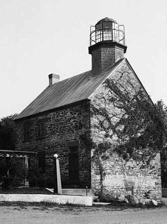
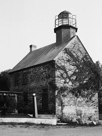
225 years in pictures
Census counts: 488 in 1820, 5,718 in 2010. The archive holds 4 old photos and papers going back to 1861 and 4 maps from 1895 on.
2 places on the National Register of Historic Places.
- 1801Richland is settled
Each edition grades its towns against each other only.

Home to 2 places on the National Register of Historic Places.
Richland gives you more for your money than most places: homes are within reach, about $164K for a typical one, or 2.2 years of the Syracuse metro’s $75K median household income. It grades C− overall, ranked 637th of 745 in New York. The low prices come with trade-offs. The median household income is $68K, and 18% of residents live below the poverty line. On the plus side, natural-hazard risk is low. History is its standout character grade: an A, better than 91% of U.S. towns, with 2 places on the National Register. 18% of residents live below the poverty line in Richland, above both the New York town median (9.5%) and the median of U.S. towns (9.6%). The biggest place to walk is Deer Creek Marsh Wildlife Management Area, 1,756 acres with 1.3 miles of trail.
Where Richland beats most towns.
Each subject compared with towns across the country (schools within New York), ordered by how far Richland is from typical.
How TownRatings grades towns →
Census counts: 488 in 1820, 5,718 in 2010. The archive holds 4 old photos and papers going back to 1861 and 4 maps from 1895 on.
2 places on the National Register of Historic Places.
Who provides power, water and the rest in Richland, and how to reach them.
EPA SDWIS (Oct 9, 2026) · HIFLD + EIA-861 2025 · Census 2020 ZCTAs · NCES 2024–25 · registration: vote.gov, updated Aug 3, 2026.
Ordered by what stands out in Richland.
Richland trades lower home prices for longer drives to work, gets more snow than nearly all U.S. towns and trades workers with Syracuse and other neighbors.
| Richland | New York towns | U.S. towns | |
|---|---|---|---|
| Conserved land | 8.7% | 5.2% | 4.3% |
| Miles of trail per square mile | 0.3 miles per square mile | 0.4 | 0.4 |
| Biggest places to walk | Trails | Acres |
|---|---|---|
| 1. Selkirk Shores State Park | 6.4 mi | 1,016 |
| 2. Deer Creek Marsh Wildlife Management Area | 1.3 mi | 1,756 |
| 3. John Ben Snow Memorial Park | 0.4 mi | 30 |
Trails & parks © OpenStreetMap contributors · Conserved land: USGS PAD-US
Its public schools are run by the Pulaski Central School District. Its two schools are below. The largest public high school is Pulaski Middle-High School, with 507 students.
| School | Level | Students | Letter |
|---|---|---|---|
| Pulaski Elementary SchoolLargest public elementary schoolGrades PK–5 | Grades PK–5 | 422 | C |
| Pulaski Middle-High SchoolLargest public high schoolGrades 6–12 | Grades 6–12 | 507 | B− |
NCES · EDFacts · graded within NY on state tests and graduation
Expected storm and flood damage is lower than in 76% of U.S. communities. Since 1979, 5 flood insurance claims have been paid out in Richland.
FEMA flood insurance claims · FEMA National Risk Index · OpenFEMA
Richland beats the New York average on 1 of 32 CDC measures and trails it on 13. 41% of Richland adults sleep under 7 hours.
| Richland | New York towns | U.S. towns | |
|---|---|---|---|
| Sleep under 7 hours (CDC PLACES) | 41% | 37% | 36% |
| Smoke cigarettes (CDC PLACES) | 17% | 13% | 14% |
| Frequent physical distress (CDC PLACES) | 16% | 14% | 14% |
| Get no exercise (CDC PLACES) | 30% | 25% | 25% |
| What stands out | Richland | NY |
|---|---|---|
| Fewer uninsured adults | 6.3% | 7.9% |
| More adults with COPD | 9.4% | 6% |
CDC PLACES 2025 · modeled estimates for adults · CMS · HRSA
The Fulton weather station, 20 miles away, records that 159 inches of snow fall in a normal winter, more than in 99% of U.S. towns.
Richland has cold, snowy winters and pleasant summers. The July high in Richland is 80°F.
NOAA U.S. Climate Normals, 1991–2020
Richland has about as many jobs (2,024) as working residents, but only 486 people both live and work here.
About one in 5 of Richland’s working residents works in town. Richland’s average trip to work is 30 minutes. The top destinations are Syracuse (10%), DeWitt (6%) and Oswego (6%).
| Richland | New York towns | U.S. towns | |
|---|---|---|---|
| Working residents who work in town | 21% | 10% | 8% |
| Average trip to work | 30 minutes | 25 minutes | 25 minutes |
| Median household income | $68,000 | $82,000 | $80,000 |
Census LEHD 2023 · ACS
Homes are within reach (B for cost of living), but half of working residents commute more than 28 miles. At 2.2 years of the Syracuse metro’s $75K median household income, the typical home costs less against local pay than in 83% of New York towns; that ratio is one input to its B for cost of living.
67% of households own their home in Richland.
| Richland | New York towns | U.S. towns | |
|---|---|---|---|
| Median rent | $856 a month | $1,103 a month | $1,185 a month |
| Households that own their home | 67% | 75% | 73% |
Census ACS, 2020–24 · Zillow Home Value Index · Redfin Data Center
Museums, parks, gardens and other places to visit around Richland. Close and well known come first.
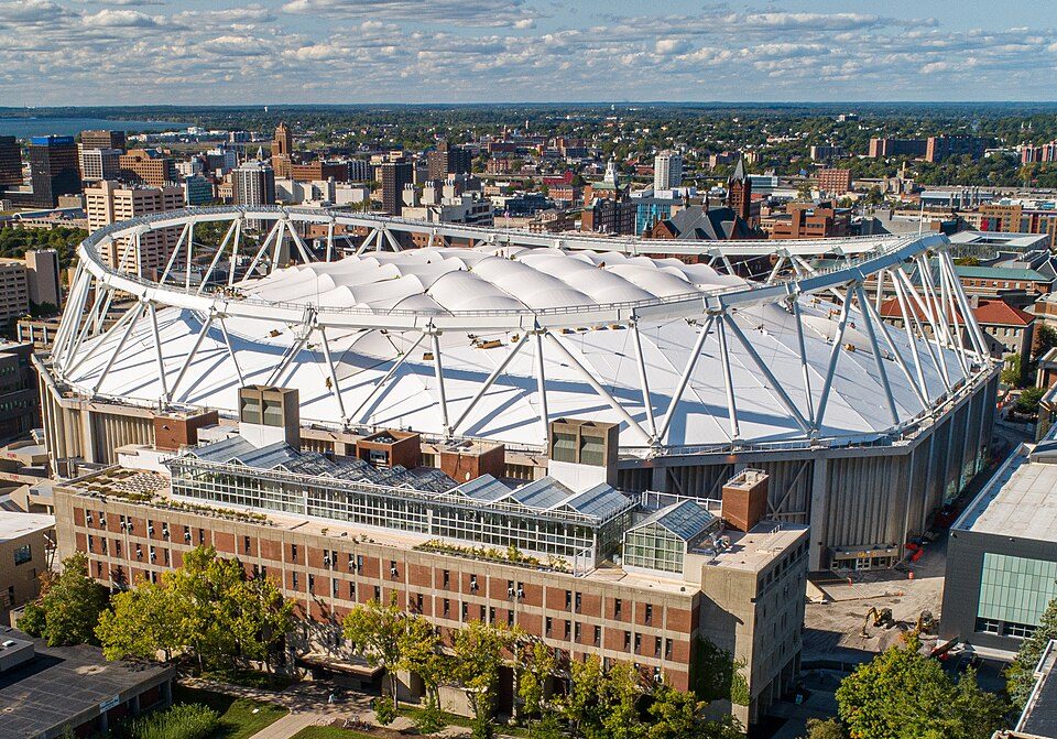
36 mi Stadium & arenaJMA Wireless Dome
32 mi LakeOnondaga Lake
18 mi LandmarkFort Ontario
36 mi State parkGreen Lakes State Park
35 mi Stadium & arenaOncenter War Memorial Arena
33 mi Stadium & arenaAlliance Bank StadiumJMA Wireless Dome: Jimhoward03, CC BY-SA 4.0 · Onondaga Lake: R. A. Nonenmacher, CC BY-SA 4.0 · Fort Ontario: Ad Meskens, CC BY-SA 3.0 · Green Lakes State Park: Ebedgert at English Wikipedia, Public domain · Oncenter War Memorial Arena: Crazyale, Public domain · Alliance Bank Stadium: Quintin Soloviev, CC BY 4.0
None within 15 miles of Richland; the nearest are
About 3 of every 100 Richland residents are enrolled in college, against 7 across New York.
2 places in Richland on the National Register of Historic Places.
Town in New York, United States
Richland is a town in the northeastern part of Oswego County, New York, United States. The population was 5,718 at the 2010 census.
From Wikipedia, licensed CC BY-SA 4.0 · facts via Wikidata (CC0)
4 towns share a border with Richland.
| Town | NY rank | Overall | Cost | Safety | Schools | Health |
|---|---|---|---|---|---|---|
| Richland | #637 | C− | B | — | C | C |
| Albion | — | — | B+ | — | C− | C |
| Sandy Creek | #712 | D | B | — | C− | C− |
| Mexico | #624 | C− | B− | — | C | B− |
| Orwell | — | — | A | — | C− | D |
Albion and Orwell have fewer than 2,500 residents, so they get subject grades but no overall grade. Richland, Albion, Sandy Creek, Mexico and Orwell report no FBI crime data of their own. Compare Richland with a neighbor →
Short answers, built from the data on this page.
Richland grades C− overall, better than 19% of U.S. towns and #637 of 745 in New York. It grades C for health and C for schools. Jobs & income is its weak spot, with a C−.
The typical home is worth about $164,000, 69% below the New York typical home. Cost of living, which also weighs rents, property taxes and how many households pay 30% or more of their income for housing, grades B.