Lost a third of its people between 1860 and 1940, then more than doubled.
19 censuses, 1830–2010.
U.S. Census Bureau decennial counts, from the census table on Parish’s Wikipedia page.
The story so far
Parish, in brief
Wikipedia doesn’t have a history of Parish yet. The photos, dates and memories neighbors add here are how it gets written.
Parish is a town in Oswego County, New York, United States. The population was 2,558 at the 2010 census. The Town of Parish was created from the Town of Mexico in 1828. There is a village called Parish in the town.
Its first post office opened in 1830. Its population held steady between the last two censuses: 450 in 2010, 447 in 2020.
Intro from Wikipedia. Population: U.S. Census Bureau.
From the old history books
What they wrote about Parish in 1917
Passages that mention Parish, cut from the printed page as they were published.
Memorials of a Yorkshire parish1917 · page 182Read the page →
Read the text
in 1895 ; two more bells were given by Miss Eliza Leckie, of Darrington, and dedicated by Dr. Maclagan, Archbishop of York, in the following year. Later the church was lighted by acetylene gas, and in 1914 the Yorkshire Parish Register Society printed its registers. All these things are, of course, outward and material signs of a revival ; the deeper significance of that may be best judged by the parishioners themselves, who for many years have seen the services of
Text read by machine from the scan; it may contain errors.
Memorials of a Yorkshire parish1917 · page 65Read the page →
Read the text
of Parliament, parish registers — which in law are the property of the incumbent for the time being — were, until comparatively recent times, very carelessly kept and looked after, and Burn, in his History of Parish Registers, gives many instances of their having been sold by rectors and vicars for waste-paper, and even used for such domestic purposes as lighting fires and singeing geese. Even nowadays they are very much at the mercy of the parochial
Text read by machine from the scan; it may contain errors.
Scans and text from the Internet Archive. Books published in 1930 or earlier, which are in the public domain.
Timeline
Parish, 1867 to 2000
Woven from the archive, old maps, post office records, the National Register and the people born here.
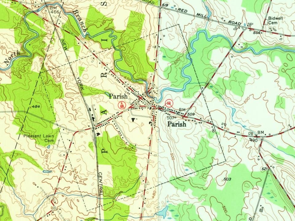
Every edition of the U.S. Geological Survey’s map of Parish. Tap a year, or press play to watch the town change.
1905Mexico sheet · 1:62,500
U.S. Geological Survey historical topographic maps (public domain), via Esri’s collection of the scans. The red ring marks the center of Parish.
Every building
Parish, building by building, 1898–1911
Fire insurance maps drew every building, what it was made of and what it was used for, so insurers could price the risk of fire. Pick a year, then a sheet.
1898Sheet 1 of 1
Edition
Sheets
BrickWoodStone
Sanborn Map Company, via the Library of Congress. Editions published in 1930 or earlier, which are in the public domain.
Then & now
Stand where they stood
No then-and-now pairs yet. Take a photo from the same spot as an old one and they appear here side by side.
Retake this viewParish Business Directory.; Parish (Village); Parish (Township), 1867
Find the spot, match the angle, and add your photo. It becomes the first then-and-now pair on Parish’s page.
Founding dates: Wikidata, Wikipedia, the U.S. post office records of Blevins & Helbock (CC0) and the Census. Homes by year built: Census ACS 2020–24. National Register of Historic Places: National Park Service (list of May 22, 2026). Old photos, postcards and papers: Wikimedia Commons, the Library of Congress and other public archives, credited on each item’s page. Maps: U.S. Geological Survey historical topographic maps (via Esri) and Sanborn fire-insurance maps (Library of Congress). History text and census tables: Wikipedia (CC BY-SA 4.0). Places that used to be: USGS Geographic Names Information System (2021). How TownRatings grades history →
From Wikimedia Commons (1), the Library of Congress (1), U.S. Geological Survey historical maps, U.S. Census counts (via Wikipedia), Sanborn fire insurance maps (Library of Congress) and old county and town histories (Internet Archive). Archive images are copied here with their credits and licenses, shown on each photo’s page. Refreshed monthly.


 Date?