
FMIB 32580 Discharging Menhaden from Steamer by Means of Bucket Elevator, 1902
Napeague’s story
Napeague in pictures
The archive holds 6 old photos and papers going back to 1834.
Explore the history →Each edition grades its towns against each other only.

A town of 70.
28% of the land in Napeague is conserved, against 5.2% in New York’s towns and 4.3% across U.S. towns. The biggest place to walk is Napeague State Park, 1,332 acres with 7.7 miles of trail. Napeague has fewer than 1,000 residents, too few for fair grades; the figures below are still real.
In a town this size, neighbors are the best guide. Ask them anything.
The archive holds 6 old photos and papers going back to 1834.
Explore the history →Napeague is unincorporated, so Suffolk County and regional agencies provide most services.
EPA SDWIS (Oct 9, 2026) · HIFLD + EIA-861 2025 · Census 2020 ZCTAs · NCES 2024–25 · registration: vote.gov, updated Aug 3, 2026.
Ordered by what stands out in Napeague.
The trail density for Napeague comes to 1.1 miles per square mile, where New York’s towns sit at 0.4 and U.S. towns at 0.4. 9.4 miles of trail in 2 parks and preserves. Parks and preserves in the town: 2, covering 1,383 acres.
| Biggest places to walk | Trails | Acres |
|---|---|---|
| 1. Napeague State Park | 7.7 mi | 1,332 |
| 2. Napeague Harbor Tidal Wetlands Area | 0.2 mi | 51 |
Trails & parks © OpenStreetMap contributors · Conserved land: USGS PAD-US
For half of commuters, work is under 65 miles away. Jobs in Napeague fell by 31 from 2013 to 2023, to 56. The top destinations are East Hampton (24%), New York (23%) and Southampton (6%).
Census LEHD 2023 · ACS
In Napeague, the natural-hazard score from FEMA is 29 of 100. Of the losses FEMA expects in the town, 81% come from inland flooding and 12% from hurricanes. Expected storm and flood damage is lower than in 71% of U.S. communities.
FEMA National Risk Index · OpenFEMA
NOAA U.S. Climate Normals, 1991–2020
For adults in Napeague, the share who get no exercise outside work is 20%. Only 2 of the 756 New York towns we compare have a higher share of adults who had a checkup this year than Napeague. Against the New York average, Napeague comes out ahead on 20 CDC measures out of 32, and behind on 4.
| Napeague | New York towns | U.S. towns | |
|---|---|---|---|
| Frequent mental distress (CDC PLACES) | 11% | 16% | 17% |
| Depression (CDC PLACES) | 15% | 21% | 23% |
| Feel lonely (CDC PLACES) | 25% | 32% | 33% |
| Smoke cigarettes (CDC PLACES) | 7.4% | 13% | 14% |
| What stands out | Napeague | NY |
|---|---|---|
| Fewer adults facing food insecurity | 6.7% | 17.2% |
| Fewer adults facing housing insecurity | 6.3% | 14.5% |
| More adults who have had cancer | 12.5% | 7.7% |
CDC PLACES 2025 · modeled estimates for adults · CMS · HRSA
Museums, parks, gardens and other places to visit around Napeague. Close and well known come first.
 11 mi State parkCamp Hero State Park
 34 mi Stadium & arenaMohegan Sun Arena
 12 mi LighthouseMontauk Point Light
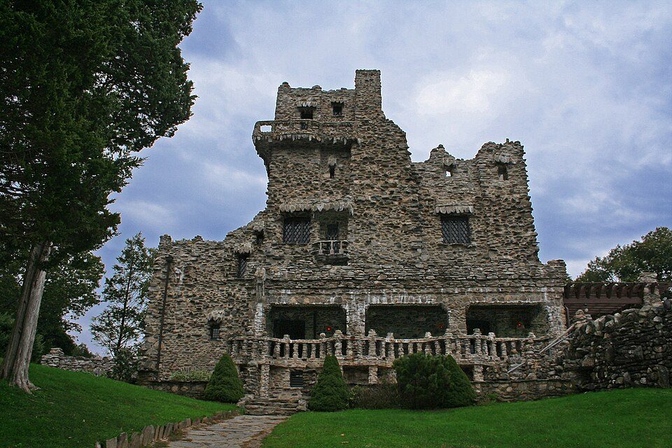 35 mi State parkGillette Castle State Park
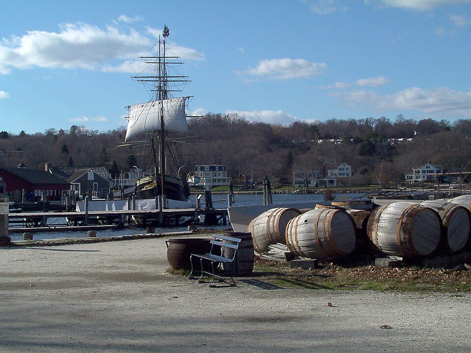 26 mi MuseumMystic Seaport
 27 mi MuseumSubmarine Force Library and Museum150K visitors a year
Camp Hero State Park: Transpoman, CC BY-SA 3.0 · Mohegan Sun Arena: Bbjeter, CC BY-SA 3.0 · Montauk Point Light: Wolfgang Wander, CC BY-SA 3.0 · Gillette Castle State Park: Original uploader was Kevinpepin at en.wikipedia, Public domain · Mystic Seaport: Joethon, Public domain · Submarine Force Library and Museum: Flickr user : https://www.flickr.com/photos/divemasterking2000, CC BY 2.0
None within 15 miles of Napeague; the nearest are
About 0 of every 100 Napeague residents are enrolled in college, against 7 across New York.
Where Napeague’s working residents go each day. Line width shows the share.
Census LEHD 2023
Hamlet and census-designated place in New York, United States
Napeague (, NAP-eeg) is a census-designated place (CDP) that roughly corresponds to the hamlet with the same name in the Town of East Hampton in Suffolk County, New York, United States. As of the 2020 census, Napeague had a population of 368. Napeague is located on a very narrow, low-lying strip between the Atlantic Ocean to the south and Gardiners Bay to the north that was flooded in the Great Hurricane of 1938. It lies between Napeague State Park on the west and Hither Hills State Park on the east. Napeague derives its name from the Montaukett name for "land overflowed by the sea".
From Wikipedia, licensed CC BY-SA 4.0 · facts via Wikidata (CC0)
Short answers, built from the data on this page.
Napeague has fewer than 1,000 residents, too few for fair grades; the figures below are still real.


