Fire insurance maps drew every building, what it was made of and what it was used for, so insurers could price the risk of fire. Pick a year, then a sheet.
1885Sheet 1 of 1
Edition
Sheets
BrickWoodStone
Sanborn Map Company, via the Library of Congress. Editions published in 1930 or earlier, which are in the public domain.
Katonah is named for Chief Katonah, a Native American sachem from whom the land of Bedford was purchased by a group of English colonists.
During the American Revolution, most local men supported the Continental side, with some joining the New York 4th Regiment of the Line and the majority the local Militia. Though Bedford Township lay in what was called the Neutral Ground, its inhabitants were preyed on by military units and irregulars affiliated with both sides of the war. The Katonah area suffered less from such depredations than other areas in the Neutral Ground because of the proximity of the Croton River and the "Westchester Lines", a sparse string of outposts defended by units of the Continental Army.
Passages that mention Katonah, cut from the printed page as they were published.
History of Westchester County, New York, from its earliest settlement to the year 19001900Read the page →
Read the text
from 1842 to 1900 615 one mile distant south to the new settlement where old residents of Katonah are establishing new homes and a new resident village, to be known as New Katonah. Whitlockville and Wood's Bridge, also in the Town of Bedford, will pass out as did old Katonah, and its people will find habitations elsewhere. The thriving locality of Purdy Station, or a greater part thereof, shares the fate of Katonah, and will lie in peace hereafter as a part of the bed of the new reser-
Text read by machine from the scan; it may contain errors.
Biographical history of Westchester County, New York..1899 · page 859Read the page →
Read the text
Cherry street was then a post-office and the business center of this region, containing flourishing stores and shops, while the present site of Katonah was a sandbank. Deciding to locate here, he returned to his home, made the necessary preparations, and came back to settle permanently on the 6th of August, 1829. On November 17th of the same year he was united in marriage to Miss Irene Pulford, of Warren, Connecticut, and they commenced keeping house that winter, on the site of the present residence of the family. At the
Text read by machine from the scan; it may contain errors.
History of Westchester County, New York, from its earliest settlement to the year 19001900Read the page →
Read the text
Jay. William (Judge). 545. lagei. purchase of by Richbell, 126: settlement, Jervis. J. P.., 553, 571. 176: first encounter of the Revolution mi West- Jessup, Edward, of West Farms, 150. Chester soil. 348: occupation by the Queen's Katonah, 26. 27. 183. 221. 589, 614. 619. 382; creation of the town by the act of 1788. Keskeskeck. Purchase of. 84. 532: James Fenimore Cooper's residence in. 567: Kidd, William. 212. 454. incorporation of the village 627: population at Kingsbridge (village ami former townshipl, various periods, 22.1. 533. 539, 577, 590. 605, 612, fortification of. 308, 309, 341, 351: spiking of the 619; other references, 176, 182, 233, 264, 298. 316,
Text read by machine from the scan; it may contain errors.
Scans and text from the Internet Archive. Books published in 1930 or earlier, which are in the public domain.
Timeline
Katonah, 1915 to 1994
Woven from the archive, old maps, post office records, the National Register and the people born here.
Nothing in the archives for these yearsWeddings on Main Street, storms, parades, school pictures, the old store. If it’s in your family album, it belongs here.
Founding dates: Wikidata, Wikipedia, the U.S. post office records of Blevins & Helbock (CC0) and the Census. Homes by year built: Census ACS 2020–24. National Register of Historic Places: National Park Service (list of May 22, 2026). Old photos, postcards and papers: Wikimedia Commons, the Library of Congress and other public archives, credited on each item’s page. Maps: U.S. Geological Survey historical topographic maps (via Esri) and Sanborn fire-insurance maps (Library of Congress). History text and census tables: Wikipedia (CC BY-SA 4.0). Places that used to be: USGS Geographic Names Information System (2021). How TownRatings grades history →
From Wikimedia Commons (4), the Library of Congress (2), Wikipedia, Wikidata and Wikipedia for famous people, U.S. Geological Survey historical maps, Sanborn fire insurance maps (Library of Congress) and old county and town histories (Internet Archive). Archive images are copied here with their credits and licenses, shown on each photo’s page. Refreshed monthly.


 1915
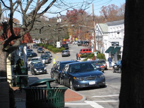 2007


