Guest, Sign inJoin

Post to Hartwick Seminary

We’ll email a one-tap link to publish your post. No password, and nothing is public until you click it.
Already a member? Sign in
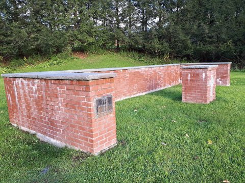
Hartwick-seminary-25 44710995065 oPhoto: Oaktree b · CC BY-SA 4.0
–Not graded
History · Hartwick Seminary

Hartwick Seminary’s post office opened in 1828, and 32% of its homes were built before 1940

1 place in town is on the National Register. Below: maps from 1907 on.

1828first post office
1on the National Register
32%homes built before 1940
Photo: Oaktree b · CC BY-SA 4.0
Quick answers

How Hartwick Seminary began

When was Hartwick Seminary founded?

1828

The Hartwick Seminary post office opened in 1828, the earliest record of the town by name.

2020 census: 356198 years
Founding year: the first Hartwick Seminary post office (Blevins & Helbock, CC0).

What stands out about Hartwick Seminary’s past

Read from the archive, the National Register and the record. The page puts what stands out first.

★ What stands out · Help out

Start Hartwick Seminary’s collection

The first neighbors to add old photos shape how Hartwick Seminary’s history is told.

Decades since 1900 with photos
00s10s20s30s40s50s60s70s80s90s
0 of 10 decades. The empty ones are waiting for someone’s album.
On the map

Hartwick Seminary on the map, 1907 to 1994

Every edition of the U.S. Geological Survey’s map of Hartwick Seminary. Tap a year, or press play to watch the town change.

Hartwick Seminary on the 1907 USGS mapHartwick Seminary on the 1943 USGS mapHartwick Seminary on the 1994 USGS map1907Cooperstown sheet · 1:62,500

U.S. Geological Survey historical topographic maps (public domain), via Esri’s collection of the scans. The red ring marks the center of Hartwick Seminary.

The story so far

Hartwick Seminary, in brief

Wikipedia doesn’t have a history of Hartwick Seminary yet. The photos, dates and memories neighbors add here are how it gets written.

Hartwick Seminary is a hamlet (and census-designated place) in Otsego County, New York, United States. The community is located along New York State Route 28, 5 miles (8.0 km) south of Cooperstown. Hartwick Seminary is served by ZIP code 13326. As of the 2020 census, Hartwick Seminary had a population of 356. Per plaques and signs along State Route 28, the hamlet is the original site of the Hartwick Seminary, now Hartwick College. The seminary was founded in 1797 by Rev. John Christopher Hartwick, who located the seminary here in 1816.

Its first post office opened in 1828.

Intro from Wikipedia. Population: U.S. Census Bureau.

By decade

Hartwick Seminary, decade by decade

On the National Register

1 historic place in Hartwick Seminary

The country’s official list of buildings and places worth saving.

place listed
1
National Historic Landmarks
0
none yet
historic buildings protected
1
each building in a district counts

National Park Service, National Register of Historic Places. Photos from Wikimedia Commons, credited on each place’s page.

Famous people

Famous people close to Hartwick Seminary

Nobody well known was born in Hartwick Seminary itself, so here are the best known from just nearby.

See all →
Stories next door

History across the town line

Each neighbor’s History grade, on the same three inputs.

Questions about Hartwick Seminary’s history

What year was Hartwick Seminary founded?

The Hartwick Seminary post office opened in 1828, the earliest record of the town by name (U.S. post office records).

Memory lane

What the archives can’t tell you, neighbors can.

Town Square →
Start a conversation
Sources

Where this page comes from

Founding dates: Wikidata, Wikipedia, the U.S. post office records of Blevins & Helbock (CC0) and the Census. Homes by year built: Census ACS 2020–24. National Register of Historic Places: National Park Service (list of May 22, 2026). Old photos, postcards and papers: Wikimedia Commons, the Library of Congress and other public archives, credited on each item’s page. Maps: U.S. Geological Survey historical topographic maps (via Esri) and Sanborn fire-insurance maps (Library of Congress). History text and census tables: Wikipedia (CC BY-SA 4.0). Places that used to be: USGS Geographic Names Information System (2021). How TownRatings grades history →

From Wikimedia Commons (5) and U.S. Geological Survey historical maps. Archive images are copied here with their credits and licenses, shown on each photo’s page. Refreshed monthly.