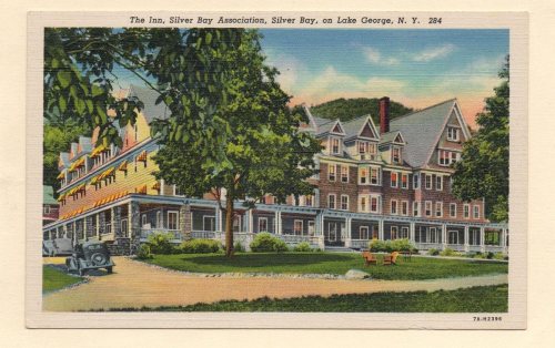
In 1757, during the French and Indian War, Sabbath Day Point was used as an encampment and staging area for the French Army and nearly two thousand Odawa in an expedition to capture the British Fort William Henry at the southern end of Lake George. While at the Sabbath Day Point camp, they conducted an ambush of a group of British soldiers and captured many. Later at the Sabbath Day Point base camp, the Indians cannibalized some of the captured British prisoners.
Sabbath Day Point was used a landing place in 1758 for British armies en route to attack the French at Fort Carillion and again in 1759 when General Jeffery Amherst finally succeeded in capturing Fort Carillon. It was then renamed Fort Ticonderoga.
Nothing in the archives for these yearsWeddings on Main Street, storms, parades, school pictures, the old store. If it’s in your family album, it belongs here.
Founding dates: Wikidata, Wikipedia, the U.S. post office records of Blevins & Helbock (CC0) and the Census. Homes by year built: Census ACS 2020–24. National Register of Historic Places: National Park Service (list of May 22, 2026). Old photos, postcards and papers: Wikimedia Commons, the Library of Congress and other public archives, credited on each item’s page. Maps: U.S. Geological Survey historical topographic maps (via Esri) and Sanborn fire-insurance maps (Library of Congress). History text and census tables: Wikipedia (CC BY-SA 4.0). Places that used to be: USGS Geographic Names Information System (2021). How TownRatings grades history →
From Wikimedia Commons (5), the Library of Congress (1), the National Register of Historic Places (2), Wikipedia, the US Post Offices dataset (Blevins & Helbock) and the USGS Geographic Names Information System. Archive images are copied here with their credits and licenses, shown on each photo’s page. Refreshed monthly.


 1898
 1898