Guest, Sign inJoin

Post to Colchester

We’ll email a one-tap link to publish your post. No password, and nothing is public until you click it.
Already a member? Sign in
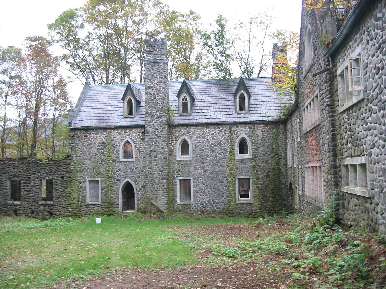
Dundas CastleDundas Castle · Photo: Peter Bond from Philadelphia, USA · CC BY-SA 2.0
AOutdoors
Outdoors in Colchester

Colchester has 22,404 acres of parks, 13,079 for every 1,000 residents

37% of Colchester’s land is conserved, about 32,115 acres. The biggest trail networks: Delaware Wild Forest (34.1 mi), Bear Spring Mountain Wildlife Management Area (18.7 mi), Colchester Forest Preserve Detached Parcel (1.1 mi). 78 miles of mapped trail cross Colchester, 0.6 per square mile of land.

Ahead of 90% of U.S. towns. What drives it

Conserved land
37%
32,115 acres · of 136.8 sq mi of land
Trails
78 mi
0.6 per sq mi of land
Park land
22,404 ac
13,079 acres per 1,000 residents
Near a park
57%
of residents within ½ mile
Highest peak
2,940 ft
East Mary Smith Hill
Lakes & rivers
13

What kind of outdoors town is Colchester?

Read from the map. The page puts what stands out first.

Outdoors grade

How much outdoors does Colchester have?

On conserved land, trails, park land and how close residents live to a park, Colchester is ahead of 90% of U.S. towns. Park acres per resident hold the grade up; the share of residents near a park pulls it down.

A
OutdoorsA character grade: shown, never part of Colchester’s overall grade.
All U.S. towns we grade (21,298)Ahead of 90%
LessMore
How sure. Graded on any three of the four inputs instead, the letter would range from A− to A. Trails and many small parks come from OpenStreetMap, mapped by volunteers, so coverage varies from town to town; the half mile is a straight line from each census block, so a river or highway in the way isn’t counted against it.

PAD-US, OpenStreetMap (© OpenStreetMap contributors), Census 2025 Gazetteer and 2020 blocks; details in Sources below. How TownRatings grades the outdoors →

The map

Conserved land, trails & bike routes

Tap a number to zoom to a park. Tap a layer to hide it.

1234
Easements protect land from building but are usually private.© OpenStreetMap contributors · USGS PAD-US
Places to walk

Pick a walk

The longest trail network is Delaware Wild Forest, with 34.1 miles. Directions go to the nearest trailhead or public parking.

Delaware Wild Forest

Nature preserve
21,245 acres34.1 mi of trail
Campbell Mountain TrailPelnor Hollow TrailMud Pond TrailHog Hollow Trail+1
Dog rules not recorded
Directionsto the parking lotWebsite ↗

Bear Spring Mountain Wildlife Management Area

Nature preserve
4,462 acres18.7 mi of trail
State Hill TrailSpruce Grove SpurSwitchback SpurBox of Rocks+1
Dog rules not recorded
Directionsto the parking lotWebsite ↗

Colchester Forest Preserve Detached Parcel

Managed by New York State Department of Environmental Conservation
763 acres1.1 mi of trail
State Hill Trail
Dog rules not recorded
No trailhead mapped yetWebsite ↗

Tomannex State Forest

Nature preserve
13 acres0.7 mi of trail
Dog rules not recorded
No trailhead mapped yetWebsite ↗
All 19 parks & preserves
Delaware Wild Forest21,245 acres · 34.1 mi of trail
Directions
Bear Spring Mountain Wildlife Management Area4,462 acres · 18.7 mi of trail
Directions
Colchester Forest Preserve Detached Parcel763 acres · 1.1 mi of trail · New York State Department of Environmental Conservation
Tomannex State Forest13 acres · 0.7 mi of trail
Flynn Brook Unit1,113 acres · New York City Department of Environmental Protection, Bureau of Water Supply
Raynor Brook Unit350 acres · New York City Department of Environmental Protection, Bureau of Water Supply
Murphy Hill Unit244 acres · New York City Department of Environmental Protection, Bureau of Water Supply
Delaware County Scenic Resource211 acres
Cat Hollow Unit167 acres · New York City Department of Environmental Protection, Bureau of Water Supply
Vinci Brook Unit93 acres · New York City Department of Environmental Protection, Bureau of Water Supply
Murphy Hill State Forest68 acres
Delaware Forest Preserve Detached Parcel66 acres
Huntley Hollow Unit44 acres · New York City Department of Environmental Protection, Bureau of Water Supply
Basin Clove Unit43 acres · New York City Department of Environmental Protection, Bureau of Water Supply
Miller Hollow Unit21 acres · New York City Department of Environmental Protection, Bureau of Water Supply
Beaverkill West Unit11 acres · New York City Department of Environmental Protection, Bureau of Water Supply
Horton Brook Unit7 acres · New York City Department of Environmental Protection, Bureau of Water Supply
Andes Forest Preserve Detached Parcel1 acres · New York State Department of Environmental Conservation
Covered Bridge Park1 acres · Town of Colchester
Directions
Who protects it

32,115 conserved acres

37% of Colchester’s land. Who manages Colchester’s conserved land, from the USGS Protected Areas Database. Approximate, because parcels can overlap.

State conservation28,032 ac
Land trusts & nonprofits2,260 ac
Town or city2,223 ac
Regional Water Districts3 ac
Other or Unknown Local Government1 ac
State Conservation Area · 22,244 acState Resource Management Area · 4,472 acOther Easement · 2,360 acLocal Other or Unknown · 2,015 acRecreation or Education Easement · 659 ac
Good to know

Conserved doesn’t always mean open to visitors. 2,850 acres are conservation easements, usually private land. Public access isn’t recorded for 24 of 81 parcels. The walks above are places people visit.

The biggest protected parcels
Parcel (PAD-US)Managed byAcresPublic access
Delaware Wild Forest
State Conservation Area
State conservation21,321Open
Bear Spring Mountain Wma
State Resource Management Area
State conservation4,472Open
Flynn Brook
Local Other or Unknown
Town or city1,132Unknown
Pepacton Fishing Access Area
Local Other or Unknown
Town or city876Unknown
Colchester Fp Detached Parcel
State Conservation Area
State conservation769Open
Delaware County Scenic Resource
State Other or Unknown
State conservation215Open
New York City Watershed
Watershed Protection Area
Town or city169Closed
Beaverkill Arcadia
Private Conservation
Land trusts & nonprofits112Closed
Murphy Hill State Forest
State Conservation Area
State conservation69Open
Delaware Fp Detached Parcel
State Conservation Area
State conservation67Open

5 smaller protected places aren’t shown.

Things to do

54 places to go in Colchester

Beaches, playgrounds, peaks, falls and more. Pick a kind.

Peaks in Colchester
East Mary Smith Hill2,940 ft elevation · In Delaware Wild Forest
Directions
Brock Mountain2,759 ft elevation · In Delaware Wild Forest
Directions
Cherry Ridge2,628 ft elevation · In Delaware Wild Forest
Directions
Cherry Ridge2,602 ft elevation · In Delaware Wild Forest
Directions
Brock Mountain2,513 ft elevation · In Delaware Wild Forest
Directions
Morton Hill2,510 ft elevation
Directions
Brock Mountain2,503 ft elevation · In Delaware Wild Forest
Directions
Bryden Hill2,487 ft elevation
Directions
6 more peaks
Rodgers Hill2,477 ft elevation · In Delaware Wild Forest
Directions
Brace Hill2,467 ft elevation
Directions
Fuller Hill2,464 ft elevation · In Delaware Wild Forest
Directions
Fork Mountain2,431 ft elevation · In Bear Spring Mountain Wildlife Management Area
Directions
Campbell Mountain2,352 ft elevation · In Delaware Wild Forest
Directions
Conklin Hill2,333 ft elevation
Directions

45 peaks are on OpenStreetMap in all; the list shows named ones from the first 30.

Trails & water

15 named trails and 13 lakes & rivers

Named trails
Open to bikes · 1.4 miHorses · 19.1 miUnpaved · 6.6 mi
Campbell Mountain Trail6.0 mi
Pelnor Hollow Trail4.3 mi
Mud Pond Trail3.9 mi
Hog Hollow Trail3.7 mi
State Hill Trail3.4 mi
Spruce Grove Spur1.9 mi
Trout Pond Trail1.9 mi
Snowmobile Trail (FLT)1.8 mi
Mary Smith Hill Trail1.6 mi
Snowmobile Trail1.5 mi
5 more trails
Box of Rocks
1.1 mi
Switchback Spur
0.9 mi
Snowmobile Trail (Blue)
0.9 mi
Little Spring Brook Trail
0.6 mi
Ski Trail
0.1 mi
Lakes & rivers tap for directions
Biking & sports

0.0 miles of bike routes

Bike lanes are often missing from the map in smaller towns, so that number is likely low.

Courts & fields
4Baseball
3Soccer
2Tennis
1Basketball

Includes school and college facilities, which aren’t always open to the public.

History along the way

3 places on the National Register

The country’s official list of places worth saving (National Park Service). The map also marks 3 historic points from OpenStreetMap: plaques, memorials and old buildings.

History →
Downsville Covered BridgeStructure · listed 1999
About it
Dundas CastleDistrict · listed 2001
About it
Union Free SchoolBuilding · listed 2004
About it
When to get out

The best walking months in Colchester: May, July and August

NOAA’s 1991–2020 normals for the town and the daylight at its latitude. Outlined months have long days, highs of 59 to 86 °F and little rain for the place.

JanFebMarAprMayJunJulAugSepOctNovDec
Daylight (h)9.410.511.813.314.515.214.913.912.411.09.79.1
High (°F)303240536572767568574534
Rain (in)3.73.13.64.24.45.44.95.05.04.93.94.2

February is the driest month (3.1 in) and July the warmest (highs of 76 °F). 5.4 inches fall in June, the wettest month. The climate in Colchester →

Next door

Colchester and its neighbors

Colchester has the most mapped trails of the 6 towns around it. Tap a town to see its outdoors.

TownConserved
of land
Trail mi
per sq mi
Park acres
per 1,000
Near a park
½ mile
Outdoors
Colchester37%0.613,07957%A
Hancock3%0.31,00640%B
Rockland25%0.42,99745%A−
Andes29%0.39,65017%A−
Hamden9%0.134717%B−
Walton11%0.34855%B+

The four inputs of the Outdoors grade, from the engine; shares are of land, not water.

Questions about parks and trails in Colchester

Where can I hike in Colchester?

The longest trail networks: Delaware Wild Forest, 34.1 miles; Bear Spring Mountain Wildlife Management Area, 18.7 miles; Colchester Forest Preserve Detached Parcel, 1.1 miles; Tomannex State Forest, 0.7 miles. Each one is on the map above, with directions to the nearest trailhead or parking.

How much of Colchester is conserved land?

37% of its land, against a typical 5% for a New York town and 4% nationally (PAD-US). Conserved doesn’t always mean open to visitors: easements are usually private land.

Are dogs allowed on Colchester’s trails?

Delaware Wild Forest and Bear Spring Mountain Wildlife Management Area don’t have dog rules recorded on the map; check the signs at the trailhead.

Is there public land near Colchester?

84,757 acres of parks and open public land lie inside Colchester or within 10 miles of it (PAD-US), 27,112 of them inside the town line.

How much outdoors does Colchester have?

Ahead of 90% of U.S. towns on the Outdoors grade. The grade combines the share of land that is conserved, miles of mapped trail per square mile of land, park acres per 1,000 residents and the share of residents within a half mile of a park. It’s a character grade, so it isn’t part of the overall grade. How it works.

Trail talk

Conditions, parking and favorite walks from Colchester neighbors.
Town Square →
Share a tip
Sources

Where this page comes from

Conserved and public land: USGS Protected Areas Database of the United States (PAD-US), service updated July 2026. Parks, trails, playgrounds, beaches and other places: OpenStreetMap (© OpenStreetMap contributors, ODbL), map data as of 2026-10-28. Land and water area: Census 2025 Gazetteer. Residents near a park: 2020 Census blocks. National Register: National Park Service. How TownRatings grades the outdoors →