Coeymans’ post office opened in 1811, and 24% of its homes were built before 1940
More historic than 93% of U.S. towns · #188 of 758 in New York. What drives it
17 places in town are on the National Register, among them two historic districts with 215 buildings between them. Below: 7 old photos and papers, maps from 1893 on, and the census since 1810.
The Coeymans post office opened in 1811, the earliest record of the town by name. Five smaller post offices, Indian Fields (1851), Keefer's Corners (1852) and Callanans Corners (1854), opened inside today’s town and later closed.
First census: 3,574 in 18102020 census: 7,256215 years
How historic is Coeymans?
A
More historic than 93% of U.S. towns, on its age, its old homes and the National Register.
Founding year: the first Coeymans post office (Blevins & Helbock, CC0).The full story ↓
History grade
What drives Coeymans’ History grade
On its age, its old homes and the National Register, Coeymans is more historic than 93% of U.S. towns, #188 of 758 in New York. All 3 inputs are above most U.S. towns; its National Register listings ranks highest and its age lowest.
A
HistoryA character grade: shown, never part of Coeymans’ overall grade.
New York towns list more on the Register than most of the country (a typical New York town has 12.3 per 10,000 residents, the U.S. 2.4), so Coeymans’ 352 sits above most of its state (88% of New York towns have fewer) while its 255 historic buildings outnumber those of 95% of U.S. towns.
How sure. Graded on any two of the three inputs instead, the letter would range from A− to A. The pre-1940 share is a Census survey estimate (±6.3 points). The founding year is the first post office, not a stated founding date.
Founding year: the first post office (other dates in Quick answers). Homes: Census ACS 2020–24. National Register: National Park Service, May 2026 list; each listing counted once (boundary changes and added documentation belong to their listing), and a historic district counts its contributing buildings. How TownRatings grades history →
What stands out about Coeymans’ past
Read from the archive, the National Register and the record. The page puts what stands out first.
National Park Service, National Register of Historic Places. Photos from Wikimedia Commons, credited on each place’s page.
Places that used to be
Lost post offices, old corners, places now gone and burying grounds
Coeymans’s post office has been open since 1811. Five other post offices opened and closed inside today’s town.
Coeymans
1811–today
Coeymans Hollow
1832–today
Indian Fields
1851–1933
Keefer's Corners
1852–1886
Callanans Corners
1854–1904
Aquetuck
1878–1925
Alcove
1881–today
Coeymans Junction
1886–1893
Ravena
1893–today
18101920today
Hamlets and corners on the map
AlcoveAquetuckCallanans CornersCoeymans HollowIndian FieldsKeefers CornersMeilaks Mobile Home CourtPine Ridge EstatesRavenaRoah Hook
Gone or out of use
Aquetuck Limestone QuarrymineAquetuck SchoolschoolButler SchoolschoolMossy Hill QuarrymineSchool Number 10schoolSchool Number 11schoolSchool Number 12schoolSchool Number 2schoolSchool Number 4schoolSchool Number 5schoolSchool Number 7schoolSchool Number 8schoolSchool Number 9schoolSouth Bethlehem Limestone Quarrymine
Barent Pieteres Koijemans first arrived in 1639 from Holland. He became an apprentice at a mill owned by the Van Rensselaers. He purchased the land and obtained a patent in 1673.
Coeymans was formed from part of the town of Watervliet in 1791. In 1815, part of the town was used to create the new town of Westerlo.
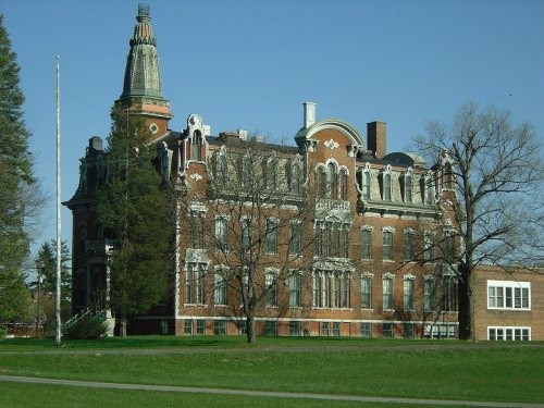
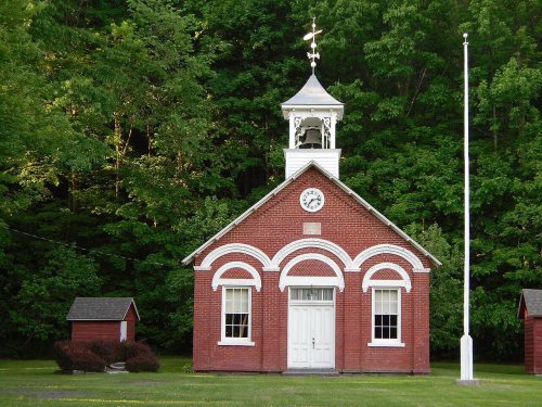
The Fletcher Blaisdell Farm Complex, Coeymans School, Ariaanje Coeymans House, Coeymans-Bronck Stone House, Mull House and Cemetery, Tobias Ten Eyck House and Cemeteries, and Cornelius and Agnietje Van Derzee House are listed on the National Register of Historic Places.
Nothing in the archives for these yearsWeddings on Main Street, storms, parades, school pictures, the old store. If it’s in your family album, it belongs here.
The Coeymans post office opened in 1811, the earliest record of the town by name (U.S. post office records).
How does Coeymans rank for history?
Coeymans is more historic than 93% of U.S. towns, #188 of 758 in New York. The History grade combines the town’s founding era, the share of homes built before 1940 and its National Register listings. It’s a character grade, so it isn’t part of the overall grade. How it works.
What is on the National Register in Coeymans?
17 listings: 14 buildings, among them the Coeymans School (listed 1970, the first), 2 historic districts, the Alcove Historic District and the Coeymans Landing Historic District, with 215 contributing buildings, and 1 site. 255 historic buildings in all.
How old are the homes in Coeymans?
24% of Coeymans’ homes were built before 1940 (Census estimate, ±6.3 points), against a typical 27% for a New York town; the median home was built in 1974.
Founding dates: Wikidata, Wikipedia, the U.S. post office records of Blevins & Helbock (CC0) and the Census. Homes by year built: Census ACS 2020–24. National Register of Historic Places: National Park Service (list of May 22, 2026). Old photos, postcards and papers: Wikimedia Commons, the Library of Congress and other public archives, credited on each item’s page. Maps: U.S. Geological Survey historical topographic maps (via Esri) and Sanborn fire-insurance maps (Library of Congress). History text and census tables: Wikipedia (CC BY-SA 4.0). Places that used to be: USGS Geographic Names Information System (2021).
From Wikimedia Commons (7), Wikidata (3), the National Register of Historic Places (17), Wikipedia, U.S. Geological Survey historical maps, U.S. Census counts (via Wikipedia), the US Post Offices dataset (Blevins & Helbock) and the USGS Geographic Names Information System. Archive images are copied here with their credits and licenses, shown on each photo’s page. Refreshed monthly.






 1866
 1933
 1933
 1933
 1933


