The village was founded in 1793 by Gerrit Boon, an agent of the Holland Land Company.
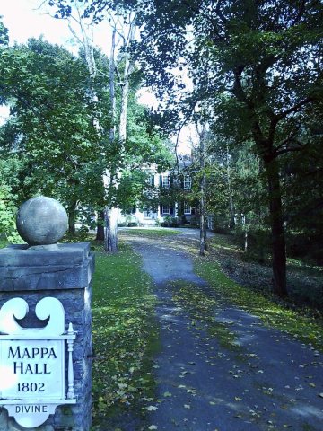
Mappa Hall was listed on the National Register of Historic Places in 1982.
In 1903, the post office and railroad station were redesignated as "Barneveld", though the legal name of the village was "Trenton", though it was only in 1975 that the legal name of the village was changed to Barneveld; prior to that, the village was still legally "Village of Trenton".
Passages that mention Barneveld, cut from the printed page as they were published.
History of Oneida County, New York, 1667-18781878 · page 536Read the page →
Read the text
“ The name of Olden Barneveld comes back to me as I recollect its inscription on the letters which my youthful hands so often carried to the mysterious post-office. It has been suggested that if the name had been shortened to Barneveld it might yet have been retained by a people too young and too much in a hurry to think or say Olden.
Text read by machine from the scan; it may contain errors.
History of Oneida County, New York, 1667-18781878 · page 559Read the page →
Read the text
up the tract to the Utica and Black River Railway, and a second time amended, April 25, 1S70, changing the boundaries to their present location. The records of the village of Olden Barneveld are not to be found, consequently a list can only be given of the trustees of the village of Trenton from 1834. They arc as follows, viz. : 1834. — Benjamin Brayton, John Mappa, Luther Guiteau, James Birdsell, Daniel Warren, Jr.
Text read by machine from the scan; it may contain errors.
Scans and text from the Internet Archive. Books published in 1930 or earlier, which are in the public domain.
Founding dates: Wikidata, Wikipedia, the U.S. post office records of Blevins & Helbock (CC0) and the Census. Homes by year built: Census ACS 2020–24. National Register of Historic Places: National Park Service (list of May 22, 2026). Old photos, postcards and papers: Wikimedia Commons, the Library of Congress and other public archives, credited on each item’s page. Maps: U.S. Geological Survey historical topographic maps (via Esri) and Sanborn fire-insurance maps (Library of Congress). History text and census tables: Wikipedia (CC BY-SA 4.0). Places that used to be: USGS Geographic Names Information System (2021). How TownRatings grades history →
From Wikimedia Commons (5), Wikipedia, U.S. Geological Survey historical maps, U.S. Census counts (via Wikipedia) and old county and town histories (Internet Archive). Archive images are copied here with their credits and licenses, shown on each photo’s page. Refreshed monthly.


 2018
 2012
 2012
 2012
 2012


