153 years in pictures
Census counts: 1,093 in 1920, 2,850 in 2020. The archive holds 18 old photos and papers going back to 1904 and 2 maps from 1963 on.
4 places on the National Register of Historic Places.
- 1873Santa Rosa is settled
Each edition grades its towns against each other only.

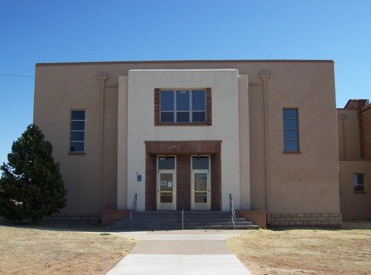
Santa Rosa gives you more for your money than most places: homes are within reach, about $112K for a typical one, or 2.6 years of the county’s $43K median household income. It grades C overall, 18th among New Mexico's 72 graded towns. The low prices come with trade-offs. FEMA rates its natural-hazard risk higher than 82% of U.S. communities, with inland flooding at the top, and the median household income is $49K, and 23% of residents live below the poverty line. 46% of working residents work locally in Santa Rosa, above both New Mexico’s towns (13%) and U.S. towns (8%). Its National Register listings include Guadalupe County Courthouse in Santa Rosa and Park Lake Historic District. Among 73 New Mexico towns, just 6 have a lower share of residents 65 or older than Santa Rosa.
Where Santa Rosa beats most towns.
Each subject compared with towns across the country (schools within New Mexico), ordered by how far Santa Rosa is from typical.
How TownRatings grades towns →
Census counts: 1,093 in 1920, 2,850 in 2020. The archive holds 18 old photos and papers going back to 1904 and 2 maps from 1963 on.
4 places on the National Register of Historic Places.
Who provides power, water and the rest in Santa Rosa, and how to reach them.
EPA SDWIS (Oct 9, 2026) · HIFLD + EIA-861 2025 · Census 2020 ZCTAs · NCES 2024–25 · registration: vote.gov, updated Aug 27, 2026.
Ordered by what stands out in Santa Rosa.
Santa Rosa is healthier than towns with similar incomes and has commutes shorter than most of New Mexico.
5.6 miles of trail in 2 parks and preserves. Santa Rosa’s trail density is 1.1 miles per square mile. The biggest park or preserve is Park Lake, at 58 acres.
| Santa Rosa | New Mexico towns | U.S. towns | |
|---|---|---|---|
| Miles of trail per square mile | 1.1 miles per square mile | 1.0 | 0.4 |
| Conserved land | 1% | 4% | 4.3% |
| Biggest places to walk | Trails | Acres |
|---|---|---|
| 1. Joe Gutierrez Park | 0.3 mi | 3 |
| 2. Park Lake | 0.1 mi | 58 |
Trails & parks © OpenStreetMap contributors · Conserved land: USGS PAD-US
Its public schools are run by the Santa Rosa school district. Two of its 4 schools are below, each with why it’s listed.
| School | Level | Students | Letter |
|---|---|---|---|
| Santa Rosa ElementaryLargest public elementary schoolGrades PK–5 | Grades PK–5 | 203 | – |
| Santa Rosa HighLargest public high schoolGrades 9–12 | Grades 9–12 | 193 | – |
NCES · EDFacts · graded within NM on state tests and graduation
FEMA National Risk Index · OpenFEMA
Against the 5,308 U.S. towns with household incomes like Santa Rosa’s, it is healthier than 60%, so its C− isn’t only a matter of income.
Santa Rosa beats the New Mexico average on 3 of 32 CDC measures and trails it on 10. 66% of Santa Rosa adults had a checkup this year. No town among the 73 in New Mexico we compare has a lower share of adults who have been diagnosed with depression than Santa Rosa.
| Santa Rosa | New Mexico towns | U.S. towns | |
|---|---|---|---|
| Yearly checkup (CDC PLACES) | 66% | 69% | 79% |
| No health insurance, 18–64 (CDC PLACES) | 24% | 16% | 8.1% |
| Food insecurity (CDC PLACES) | 29% | 23% | 14% |
| Fair or poor health (CDC PLACES) | 30% | 25% | 19% |
| What stands out | Santa Rosa | NM |
|---|---|---|
| Fewer adults who have had cancer | 5.2% | 7.4% |
| Fewer adults with depression | 19.4% | 23.2% |
| More uninsured adults | 24.4% | 15.6% |
CDC PLACES 2025 · modeled estimates for adults · CMS · HRSA
Santa Rosa has chilly winters and hot summers, with very little rain. The July high in Santa Rosa is 93°F.
NOAA U.S. Climate Normals, 1991–2020
The average commute for its 827 working residents takes 14.8 minutes, against 23.5 across New Mexico.
Jobs based in Santa Rosa fell to 875 in 2023, 91 fewer than in 2013. The top destinations are Albuquerque (10%), Santa Fe (6%) and Vaughn (4%). Half commute less than 27 miles.
| Santa Rosa | New Mexico towns | U.S. towns | |
|---|---|---|---|
| Average trip to work | 15 minutes | 23 minutes | 25 minutes |
| Median household income | $49,000 | $55,000 | $80,000 |
Census LEHD 2023 · ACS
Santa Rosa's reported crime rate is well below New Mexico's. 13 violent crimes were reported in 2024.
| Santa Rosa | New Mexico towns | U.S. towns | |
|---|---|---|---|
| Violent crimes per 1,000 (2024) | 4.7 per 1,000 residents | 5 | 1.7 |
| Property crimes per 1,000 (2024) | 9.1 per 1,000 residents | 18.9 | 11.5 |
FBI crime data, 2024 · crimes reported to police
None within 15 miles of Santa Rosa; the nearest are
About 3 of every 100 Santa Rosa residents are enrolled in college, against 6 across New Mexico.
4 places in Santa Rosa on the National Register of Historic Places.
4 notable people were born in Santa Rosa.
City in New Mexico, United States
Santa Rosa is a city in and the county seat of Guadalupe County, New Mexico, United States. As of the 2020 census, Santa Rosa had a population of 2,850. It lies between Albuquerque and Tucumcari, situated on the Pecos River at the intersection of Interstate 40 (I-40), U.S. Route 54 (US 54), and U.S. Route 84 (US 84). The city is located on the western edge of the Llano Estacado or "staked plains" of eastern New Mexico and western Texas.
From Wikipedia, licensed CC BY-SA 4.0 · facts via Wikidata (CC0)
Short answers, built from the data on this page.
Santa Rosa grades C overall, better than 30% of U.S. towns and #18 of 72 in New Mexico. It grades C− for health and B for schools. Hazard risk is its weak spot, with a D.
Not for the area. Cost of living, which also weighs rents, property taxes and how many households pay 30% or more of their income for housing, grades A−.
4 notable people were born here, including Santiago E. Campos and Charles E. Barnhart.