
Whitesboro NJ MLK Community Center, 2016
Whitesboro’s story
125 years in pictures
The archive holds 6 old photos and papers going back to 2016.
- 1901Whitesboro is founded
Each edition grades its towns against each other only.
Today 2,766 people live in this town, first founded in 1901.
96% of households are owner-occupiers in Whitesboro, above both the New Jersey town median (77%) and the median of U.S. towns (73%). 36% of the land in Whitesboro is conserved, above both the New Jersey town median (11%) and the median of U.S. towns (4.3%). The biggest park or preserve is Cape May National Wildlife Refuge, at 68 acres. We don’t grade Whitesboro yet; the figures below are still real.
Coastal flooding makes up 11% of the storm damage FEMA expects here.
FEMA National Risk Index · OpenFEMA · OpenStreetMap
The archive holds 6 old photos and papers going back to 2016.
Whitesboro is unincorporated, so Cape May County and regional agencies provide most services.
EPA SDWIS (Oct 9, 2026) · HIFLD + EIA-861 2025 · Census 2020 ZCTAs · NCES 2024–25 · registration: vote.gov, updated Nov 18, 2024.
Ordered by what stands out in Whitesboro.
Whitesboro’s density of trails is 1.1 miles per square mile. Trails total 4.0 miles in 1 park or preserve.
| Biggest places to walk | Trails | Acres |
|---|---|---|
| 1. Cape May National Wildlife Refuge | — | 68 |
Trails & parks © OpenStreetMap contributors · Conserved land: USGS PAD-US
In July, afternoons reach 85°; in January, nights fall to 28°, and about 15 inches of snow falls in a winter.
NOAA U.S. Climate Normals, 1991–2020
Jobs in Whitesboro grew by 287 from 2013 to 2023, reaching 784. Its average trip to work stands at 23 minutes. Half the trips to work are shorter than 7 miles. The share of working residents in Whitesboro who work locally: 3.2%.
| Whitesboro | New Jersey towns | U.S. towns | |
|---|---|---|---|
| Average trip to work | 23 minutes | 30 minutes | 25 minutes |
| Working residents who work in town | 3.2% | 6.3% | 8% |
Census LEHD 2023 · ACS
Among adults in Whitesboro, 80% had a checkup this year. Two figures for adults locally: 39% have high blood pressure, 17% have been diagnosed with depression.
| Whitesboro | New Jersey towns | U.S. towns | |
|---|---|---|---|
| Obesity (CDC PLACES) | 38% | 28% | 35% |
| High blood pressure (CDC PLACES) | 39% | 32% | 35% |
| Depression (CDC PLACES) | 17% | 16% | 23% |
| Diabetes (CDC PLACES) | 13% | 9.7% | 12% |
| What stands out | Whitesboro | NJ |
|---|---|---|
| More older adults who have lost all their teeth | 16.8% | 9.6% |
| More adults with COPD | 6.9% | 5.1% |
| More adults with obesity | 38.1% | 28.9% |
CDC PLACES 2025 · modeled estimates for adults · CMS · HRSA
Since 1979, Whitesboro has seen 47 flood insurance claims paid out. Expected damage from storms and floods is higher here than in 54% of U.S. communities. Of the losses FEMA expects here, 36% come from inland flooding and 21% from hurricanes.
FEMA flood insurance claims · FEMA National Risk Index · OpenFEMA
Zillow Home Value Index · Redfin Data Center
Museums, parks, gardens and other places to visit around Whitesboro. Close and well known come first.
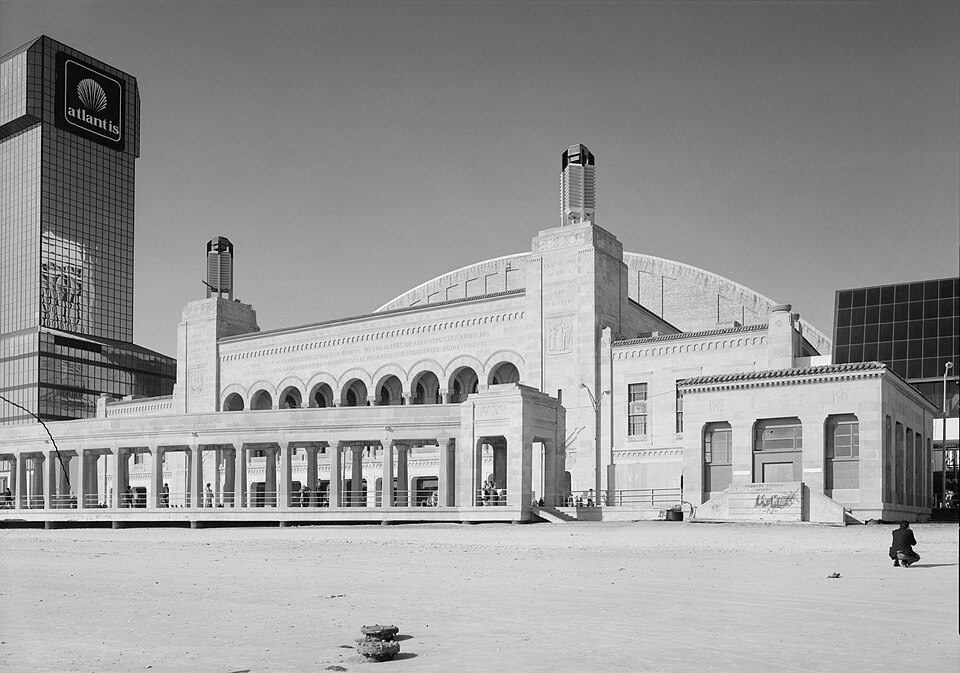 31 mi Stadium & arenaBoardwalk Hall
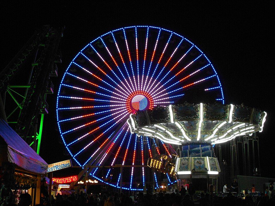 6 mi Theme parkMorey's Piers
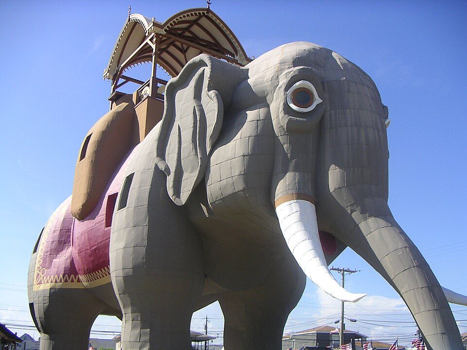 27 mi LandmarkLucy the Elephant5 mi Zoo & aquariumCape May County Park & Zoo
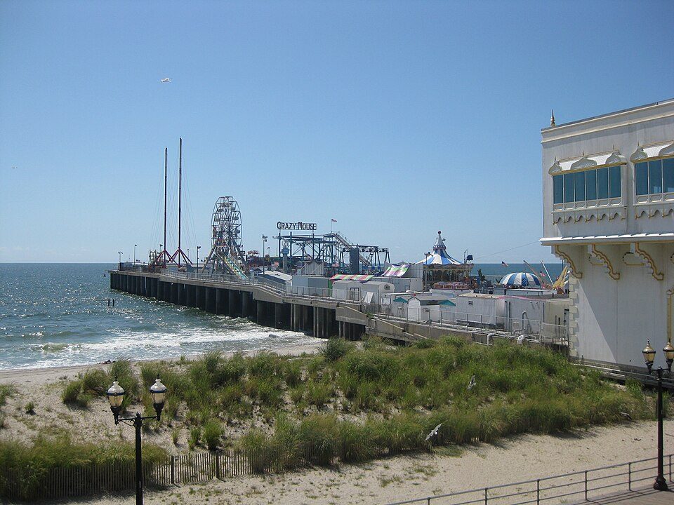 32 mi Theme parkSteel Pier6 mi Theme parkHunt's Pier
Boardwalk Hall: Jack Boucher, Public domain · Morey's Piers: Smallbones, CC0 · Lucy the Elephant: User:dtcdthingy 3:30 pm 30th July 2004 (Minolta Dimage X20), Public domain · Steel Pier: Make Lemons, CC BY-SA 2.0
None within 15 miles of Whitesboro; the nearest are
About 10 of every 100 Whitesboro residents are enrolled in college, against 6 across New Jersey.
Populated place in Cape May County, New Jersey, US
Whitesboro is an unincorporated community and census-designated place (CDP) located within Middle Township in Cape May County, in the U.S. state of New Jersey. Until the 2000 census the area had been part of the Whitesboro-Burleigh CDP, which was split in 2010 into separate CDPs for Burleigh and Whitesboro. As of the 2020 census, Whitesboro had a population of 2,300. Whitesboro was founded as a planned residential community for African Americans and has the majority of the township's black population.
From Wikipedia, licensed CC BY-SA 4.0 · facts via Wikidata (CC0)
2 towns share a border with Whitesboro.
| Town | NJ rank | Overall | Cost | Safety | Schools | Health |
|---|---|---|---|---|---|---|
| Whitesboro | — | — | — | — | — | — |
| Rio Grande | — | — | — | — | — | — |
| Burleigh | — | — | — | — | — | — |
Whitesboro, Rio Grande and Burleigh aren’t graded (fewer than 1,000 residents, or not enough data). Compare Whitesboro with a neighbor →
Short answers, built from the data on this page.
We don’t grade Whitesboro yet; the figures below are still real.


