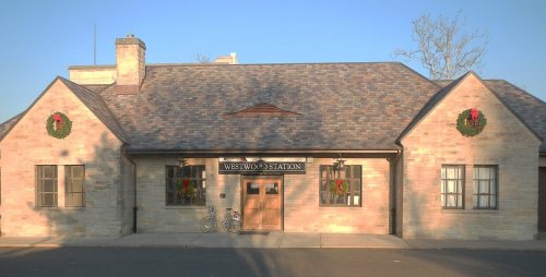
Founding year: the first Westwood post office (Blevins & Helbock, CC0).The full story ↓
History grade
What drives Westwood’s History grade
On its age, its old homes and the National Register, Westwood is more historic than 56% of U.S. towns, #269 of 468 in New Jersey. Its share of homes from before 1940 holds the grade up; its age pulls it down.
B
HistoryA character grade: shown, never part of Westwood’s overall grade.
New Jersey towns list more on the Register than most of the country (a typical New Jersey town has 3.7 per 10,000 residents, the U.S. 2.4), so Westwood’s 0.9 sits below most of its state (31% of New Jersey towns have fewer) while its 1 listings outnumber those of 51% of U.S. towns.
How sure. Graded on any two of the three inputs instead, the letter would range from C to B+. The pre-1940 share is a Census survey estimate (±7.2 points). The founding year is the first post office, not a stated founding date.
Founding year: the first post office (other dates in Quick answers). Homes: Census ACS 2020–24. National Register: National Park Service, May 2026 list; each listing counted once (boundary changes and added documentation belong to their listing), and a historic district counts its contributing buildings. How TownRatings grades history →
What stands out about Westwood’s past
Read from the archive, the National Register and the record. The page puts what stands out first.
The Lenni-Lenape Native Americans inhabited this part of the state and shared it with the transient hunters and trappers until the permanent settlers began to enter in mid-18th century. In the early 19th century, the area that would later become Westwood was within the larger political boundaries of Harrington Township, which had been established by royal charter in 1775. In 1840, the western half of Harrington Township became Washington Township, with the Hackensack River as the dividing line. Washington Township was an agrarian region with isolated farmsteads. Early families, including the Hoppers and Ackermans, are buried at the Old Hook Cemetery. An 18th-century mill was situated at the dammed stream near the intersection of today's Mill Street and First Avenue. This mill was on an important east west pathway and was the first on Musquapsink Brook. The mill was largely destroyed aft…
Passages that mention Westwood, cut from the printed page as they were published.
History of Bergen county, New Jersey1900 · page 294Read the page →
Read the text
Westwood, a beautiful village 21.6 miles from New York on the New Jersey and New York Railroad, has a population of about one thousand persons. The land occupying this site was purchased of John Marsellus on the 26th of March, 1765, in the fourth year of the reign of George III, and another tract ajdoining, was bought of Jacob Hopper April 5, 1780 by Isaac Bogert, of New York, who was the ancestor of Isaac D. Bogert, the present mayor of Westwood. Albert Bogert, son of Isaac, was a carpenter, and having fallen from the roof of a building
Text read by machine from the scan; it may contain errors.
History of Bergen county, New Jersey1900 · page 297Read the page →
Read the text
represent their interests in official life. He was Freeholder six years during a part of which time he was a director of the county board. He also filled the office of Collector for Washington Township. He was elected the first Mayor of Westwood in 1899. In conjunction with Richard Hopper, Abram B. Bogert and others he organized the Reformed Church at Westwood in 1887, of which Church organization he has filled the office of Elder since that time.
Text read by machine from the scan; it may contain errors.
Scans and text from the Internet Archive. Books published in 1930 or earlier, which are in the public domain.
Timeline
Westwood, 1870 to 1991
Woven from the archive, old maps, post office records, the National Register and the people born here.
Nothing in the archives for these yearsWeddings on Main Street, storms, parades, school pictures, the old store. If it’s in your family album, it belongs here.
Every edition of the U.S. Geological Survey’s map of Westwood. Tap a year, or press play to watch the town change.
1934Hackensack sheet · 1:24,000
U.S. Geological Survey historical topographic maps (public domain), via Esri’s collection of the scans. The red ring marks the center of Westwood.
Every building
Westwood, building by building, 1914–1921
Fire insurance maps drew every building, what it was made of and what it was used for, so insurers could price the risk of fire. Pick a year, then a sheet.
The Westwood post office opened in 1870, the earliest record of the town by name (U.S. post office records).
How does Westwood rank for history?
Westwood is more historic than 56% of U.S. towns, #269 of 468 in New Jersey. The History grade combines the town’s founding era, the share of homes built before 1940 and its National Register listings. It’s a character grade, so it isn’t part of the overall grade. How it works.
What is on the National Register in Westwood?
One place: the Westwood Railroad Station (listed 2020).
How old are the homes in Westwood?
28% of Westwood’s homes were built before 1940 (Census estimate, ±7.2 points), against a typical 15% for a New Jersey town; the median home was built in 1958.
Founding dates: Wikidata, Wikipedia, the U.S. post office records of Blevins & Helbock (CC0) and the Census. Homes by year built: Census ACS 2020–24. National Register of Historic Places: National Park Service (list of May 22, 2026). Old photos, postcards and papers: Wikimedia Commons, the Library of Congress and other public archives, credited on each item’s page. Maps: U.S. Geological Survey historical topographic maps (via Esri) and Sanborn fire-insurance maps (Library of Congress). History text and census tables: Wikipedia (CC BY-SA 4.0). Places that used to be: USGS Geographic Names Information System (2021).
From Wikimedia Commons (6), the National Register of Historic Places (1), Wikipedia, Wikidata and Wikipedia for famous people, U.S. Geological Survey historical maps, U.S. Census counts (via Wikipedia), the US Post Offices dataset (Blevins & Helbock), the USGS Geographic Names Information System, Sanborn fire insurance maps (Library of Congress) and old county and town histories (Internet Archive). Archive images are copied here with their credits and licenses, shown on each photo’s page. Refreshed monthly.


 2010
 2010
 2010
 2010
 2008