
West Deptford Twp., NJ municipal building, May 2022, 2022
Thorofare’s story
143 years in pictures
The archive holds 1 old photo or paper going back to 2022 and 7 maps from 1891 on.
- 1883Thorofare is settled
Each edition grades its towns against each other only.

A town of 2,348, settled in 1883.
39% of residents are 65 or older in Thorofare, where New Jersey’s towns sit at 18% and U.S. towns at 18%. Only 5 of the 469 New Jersey towns we compare have a higher July high than Thorofare. Thorofare’s trail density is 1.5 miles per square mile, where New Jersey’s towns sit at 0.7 and U.S. towns at 0.4. We don’t grade Thorofare yet; the figures below are still real.
Where Thorofare beats most towns.
Where Thorofare’s working residents go each day. Line width shows the share.
Census LEHD 2023
The archive holds 1 old photo or paper going back to 2022 and 7 maps from 1891 on.
Museums, parks, gardens and other places to visit around Thorofare. Close and well known come first.
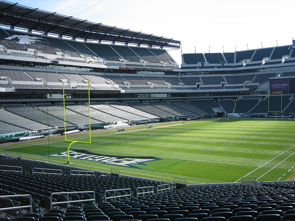 Big draw4 mi Stadium & arenaLincoln Financial Field
 Big draw7 mi MuseumUSS New Jersey
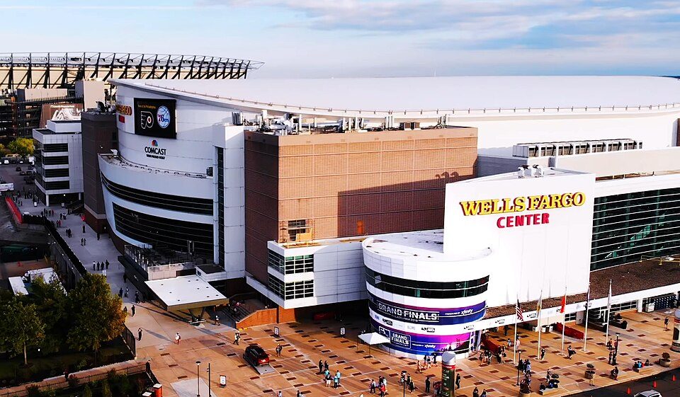 Big draw4 mi Stadium & arenaXfinity Mobile Arena
 Big draw7 mi Ancient siteIndependence Hall3.0M visitors a year
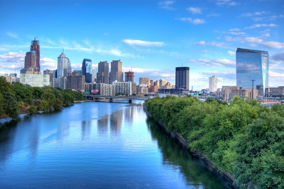 2 mi Park & preserveSchuylkill River
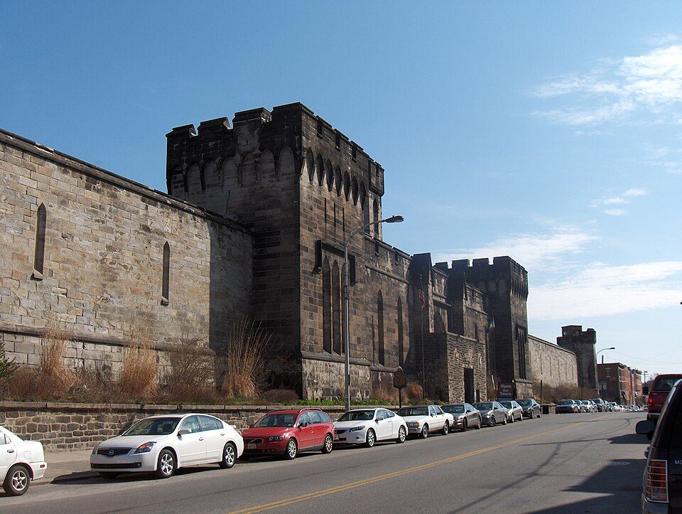 Big draw8 mi MuseumEastern State Penitentiary
Lincoln Financial Field: The original uploader was Betp at French Wikipedia., CC BY-SA 3.0 · USS New Jersey: Camera Operator: PH3 BRYANT, Public domain · Xfinity Mobile Arena: Jen Smith, CC BY 3.0 · Independence Hall: Mys 721tx, CC BY-SA 3.0 · Schuylkill River: Emy111 at English Wikipedia, Public domain · Eastern State Penitentiary: Davidt8, Public domain
Thorofare is unincorporated, so Gloucester County and regional agencies provide most services.
EPA SDWIS (Oct 9, 2026) · HIFLD + EIA-861 2025 · Census 2020 ZCTAs · NCES 2024–25 · registration: vote.gov, updated Nov 18, 2024.
Ordered by what stands out in Thorofare.
Most working residents leave Thorofare for work: only 5% work in town. Thorofare’s average trip to work is 39 minutes. Since 2013, Thorofare has lost 241 jobs, to 2,875 in 2023.
| Thorofare | New Jersey towns | U.S. towns | |
|---|---|---|---|
| Average trip to work | 39 minutes | 30 minutes | 25 minutes |
| Median household income | $88,000 | $113,000 | $80,000 |
| Working residents who work in town | 4.8% | 6.3% | 8% |
| Below the poverty line | 7.7% | 6.1% | 9.6% |
Census LEHD 2023 · ACS
Thorofare has chilly winters and warm summers. July afternoons reach 88°, January nights drop to 26° and about 23 inches of snow falls in a winter.
NOAA U.S. Climate Normals, 1991–2020
6.1 miles of trail in 0 parks and preserves.
Trails & parks © OpenStreetMap contributors · Conserved land: USGS PAD-US
46% of adults have high blood pressure in Thorofare. Thorofare beats the New Jersey average on 10 of 32 CDC measures and trails it on 9. 14% of adults have diabetes in Thorofare.
| Thorofare | New Jersey towns | U.S. towns | |
|---|---|---|---|
| High blood pressure (CDC PLACES) | 46% | 32% | 35% |
| Binge drink (CDC PLACES) | 13% | 16% | 16% |
| Diabetes (CDC PLACES) | 14% | 9.7% | 12% |
| Yearly checkup (CDC PLACES) | 82% | 78% | 79% |
| What stands out | Thorofare | NJ |
|---|---|---|
| Fewer uninsured adults | 7.8% | 11.3% |
| Fewer adults facing housing insecurity | 9.2% | 12.3% |
| More adults who have had cancer | 12.3% | 7.5% |
CDC PLACES 2025 · modeled estimates for adults · CMS · HRSA
The median rent in Thorofare is $1,915 a month.
| Thorofare | New Jersey towns | U.S. towns | |
|---|---|---|---|
| Median rent | $1,915 a month | $1,778 a month | $1,185 a month |
| Households that own their home | 74% | 77% | 73% |
Census ACS, 2020–24 · Zillow Home Value Index · Redfin Data Center
Expected storm and flood damage is higher than in 50% of U.S. communities. Since 1979, 6 flood insurance claims have been paid out in Thorofare.
FEMA flood insurance claims · FEMA National Risk Index · OpenFEMA
31 within 15 miles of the center of Thorofare
About 5 of every 100 Thorofare residents are enrolled in college, about the same as New Jersey.
Populated place in Gloucester County, New Jersey, US
Thorofare is an unincorporated community and census-designated place (CDP) located within West Deptford Township in northwestern Gloucester County, situated in the South Jersey region of the U.S. state of New Jersey. The area is served as United States Postal Service ZIP Code 08086. As of the 2020 United States census, the CDP's population was 2,806. As of the 2000 census, the population of a different geographic entity containing Thorofare, namely ZIP Code Tabulation Area 08086, was 5,424. Checkpoint Systems is headquartered in Thorofare.
From Wikipedia, licensed CC BY-SA 4.0 · facts via Wikidata (CC0)
4 towns share a border with Thorofare.
| Town | NJ rank | Overall | Cost | Safety | Schools | Health |
|---|---|---|---|---|---|---|
| Thorofare | — | — | — | — | — | — |
| West Deptford Township | #270 | B− | C− | B | C+ | B+ |
| National Park | #348 | C | C | — | C | B− |
National Park reports no FBI crime data of its own. Thorofare isn’t graded (fewer than 1,000 residents, or not enough data). Compare Thorofare with a neighbor →
Short answers, built from the data on this page.
We don’t grade Thorofare yet; the figures below are still real.


