
Beaches on the New Jersey shore, 2017
Strathmere’s story
114 years in pictures
Census counts: 175 in 2000, 137 in 2020. The archive holds 1 old photo or paper going back to 2017 and 5 maps from 1888 on.
- 1912Strathmere is settled
Each edition grades its towns against each other only.
A town of 266, settled in 1912.
Only 8 of the 469 New Jersey towns we compare have a higher January low than Strathmere. 30% of the land in Strathmere is conserved, where New Jersey’s towns sit at 11% and U.S. towns at 4.3%. The biggest park or preserve is Corson's Inlet State Park, at 49 acres. Strathmere has fewer than 1,000 residents, too few for fair grades; the figures below are still real.
Coastal flooding makes up 16% of the storm damage FEMA expects here.
FEMA National Risk Index · OpenFEMA · OpenStreetMap
Census counts: 175 in 2000, 137 in 2020. The archive holds 1 old photo or paper going back to 2017 and 5 maps from 1888 on.
Museums, parks, gardens and other places to visit around Strathmere. Close and well known come first.
 Big draw39 mi Park & preservePine Barrens
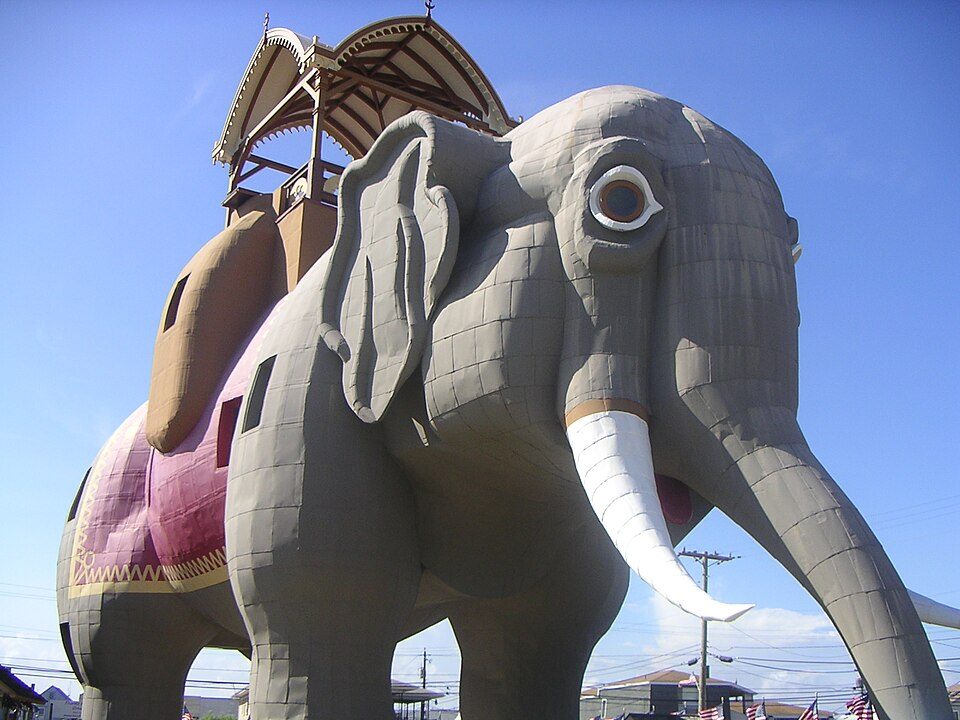 12 mi LandmarkLucy the Elephant
 16 mi Stadium & arenaBoardwalk Hall
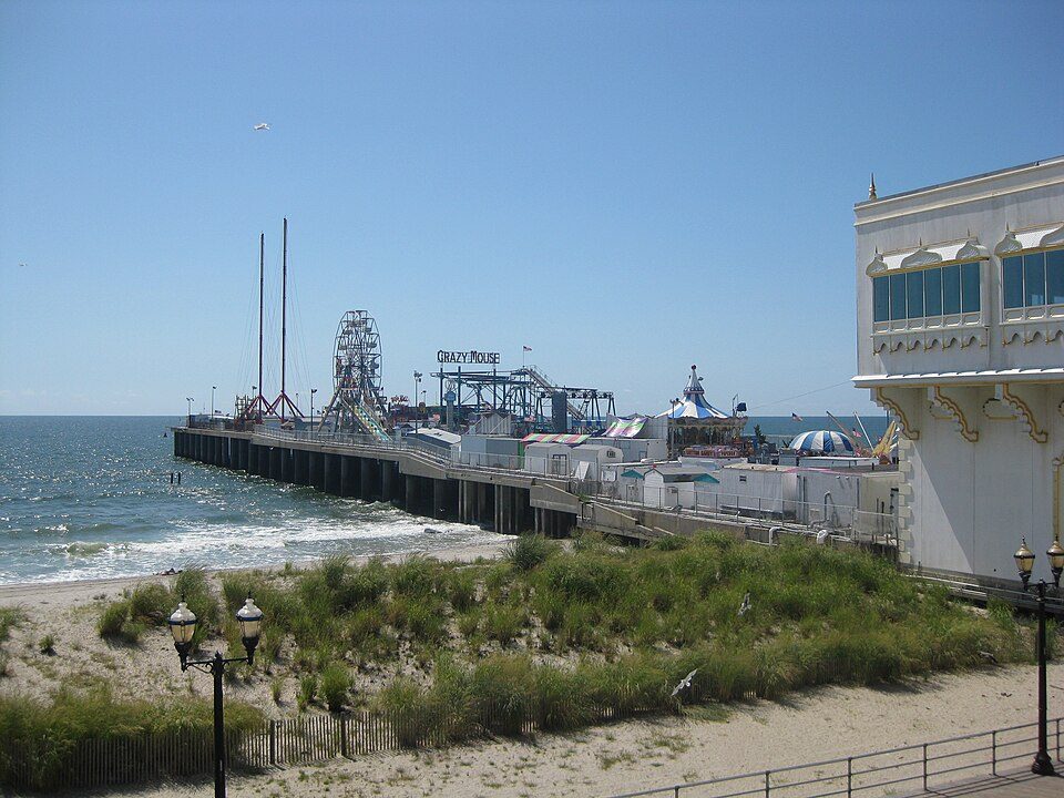 17 mi Theme parkSteel Pier
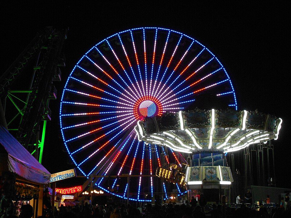 17 mi Theme parkMorey's Piers
 8 mi Theme parkGillians Wonderland Pier and Island Waterpark
Pine Barrens: Famartin, CC BY-SA 4.0 · Lucy the Elephant: User:dtcdthingy 3:30 pm 30th July 2004 (Minolta Dimage X20), Public domain · Boardwalk Hall: Jack Boucher, Public domain · Steel Pier: Make Lemons, CC BY-SA 2.0 · Morey's Piers: Smallbones, CC0 · Gillians Wonderland Pier and Island Waterpark: Kevin Jarrett from Northfield, NJ, USA, CC BY 2.0
Strathmere is unincorporated, so Cape May County and regional agencies provide most services.
EPA SDWIS (Oct 9, 2026) · HIFLD + EIA-861 2025 · Census 2020 ZCTAs · NCES 2024–25 · registration: vote.gov, updated Nov 18, 2024.
Ordered by what stands out in Strathmere.
The typical Strathmere home is worth about $1,692,000, up 12.7% in a year, 3 times the New Jersey typical home.
Zillow Home Value Index · Redfin Data Center
Adults 35 to 64 are 64% of residents (40% statewide); children under 18 are 0% of residents (22% statewide). Strathmere’s median age is 53.8 years. 41% of adults 25 and older have a bachelor’s degree or more, vs 44% across New Jersey.
| Strathmere | New Jersey towns | U.S. towns | |
|---|---|---|---|
| Median age | 53.8 years | 42 years | 40.5 years |
| Bachelor’s degree or more, 25+ | 41% | 45% | 29% |
Somewhere between 25% and 79% women
The Census survey reached too few of Strathmere’s residents to say more: its margin here is ±26.9 points. Across New Jersey, 50.8% of residents are women.
| Strathmere | NJ | U.S. | |
|---|---|---|---|
| Under 10 | 0% | 11.6% | 11.6% |
| 10 to 17 | 0% | 10.2% | 10.3% |
| 18 to 24 | 15.8% | 8.4% | 9.1% |
| 25 to 34 | 0% | 12.9% | 13.7% |
| 35 to 44 | 0% | 13.3% | 13.2% |
| 45 to 54 | 37.6% | 12.9% | 12.2% |
| 55 to 64 | 26.3% | 13.5% | 12.7% |
| 65 to 74 | 3.8% | 10% | 10.2% |
| 75 and older | 16.5% | 7.2% | 7% |
| No diploma | 0% | 9.3% | 10.4% |
| High school | 10.3% | 25.3% | 26% |
| Some college | 45.1% | 15% | 19.1% |
| Associate’s | 4% | 6.7% | 8.8% |
| Bachelor’s | 8.9% | 26.1% | 21.6% |
| Graduate | 31.7% | 17.6% | 14.1% |
U.S. Census Bureau · ACS 2020-2024 5-year estimates · in a town of 300, single groups can be off by several points
0.6 miles of trail in 3 parks and preserves.
| Biggest places to walk | Trails | Acres |
|---|---|---|
| 1. Cape May Coastal Wetlands Wildlife Management Area | — | 51 |
| 2. Corson's Inlet State Park | — | 49 |
| 3. Strathmere Natural Area | — | 49 |
Trails & parks © OpenStreetMap contributors · Conserved land: USGS PAD-US
Strathmere has chilly winters and pleasant summers. The July high in Strathmere is 84°F.
NOAA U.S. Climate Normals, 1991–2020
The top destinations are Middle Township (14%), Upper Township (9%) and Egg Harbor Township (7%). Half commute less than 15 miles.
| Strathmere | New Jersey towns | U.S. towns | |
|---|---|---|---|
| Median household income | $109,000 | $113,000 | $80,000 |
| Average trip to work | 28 minutes | 30 minutes | 25 minutes |
Census LEHD 2023 · ACS
Expected storm and flood damage is higher than in 61% of U.S. communities.
FEMA National Risk Index · OpenFEMA
24% of Strathmere adults feel lonely. Strathmere beats the New Jersey average on 15 of 32 CDC measures and trails it on 6. 14% of Strathmere adults say their health is fair or poor.
| Strathmere | New Jersey towns | U.S. towns | |
|---|---|---|---|
| Feel lonely (CDC PLACES) | 24% | 32% | 33% |
| Sleep under 7 hours (CDC PLACES) | 28% | 36% | 36% |
| Yearly checkup (CDC PLACES) | 84% | 78% | 79% |
| High blood pressure (CDC PLACES) | 41% | 32% | 35% |
| What stands out | Strathmere | NJ |
|---|---|---|
| Fewer adults facing food insecurity | 5.9% | 14.3% |
| Fewer adults facing housing insecurity | 5.2% | 12.3% |
| More adults who have had cancer | 14.5% | 7.5% |
CDC PLACES 2025 · modeled estimates for adults · CMS · HRSA
None within 15 miles of Strathmere; the nearest are
College town 16 of every 100 Strathmere residents are enrolled in college, against 6 across New Jersey.
In a town this size, neighbors are the best guide. Ask them anything.
Populated place in Cape May County, New Jersey, US
Strathmere is an unincorporated community and census-designated place (CDP) located within Upper Township in Cape May County, in the U.S. state of New Jersey. As of the 2020 United States census, the CDP's population was 137, a decrease of 21 (−13.3%) from the 158 counted at the 2010 U.S. census, which reflected a decrease of 17 (−9.7%) from the 175 enumerated at the 2000 census. With its beaches in the Strathmere section, Upper Township is one of five municipalities in the state that offer free public access to oceanfront beaches monitored by lifeguards, joining Atlantic City, North Wildwood, Wildwood, and Wildwood Crest.
From Wikipedia, licensed CC BY-SA 4.0 · facts via Wikidata (CC0)
Short answers, built from the data on this page.
Strathmere has fewer than 1,000 residents, too few for fair grades; the figures below are still real.


