On its age, its old homes and the National Register, Rockaway is more historic than 75% of U.S. towns, #147 of 468 in New Jersey. Its share of homes from before 1940 holds the grade up; its National Register listings pull it down.
B+
HistoryA character grade: shown, never part of Rockaway’s overall grade.
New Jersey towns list more on the Register than most of the country (a typical New Jersey town has 3.7 per 10,000 residents, the U.S. 2.4), so Rockaway’s 1.5 sits near the middle of its state (38% of New Jersey towns have fewer) while its 1 listings outnumber those of 51% of U.S. towns.
How sure. Graded on two of the three inputs, so a change in either one moves the letter more than it would with three. The pre-1940 share is a Census survey estimate (±12.2 points).
Founding year: our sources. Homes: Census ACS 2020–24. National Register: National Park Service, May 2026 list; each listing counted once (boundary changes and added documentation belong to their listing), and a historic district counts its contributing buildings. How TownRatings grades history →
What stands out about Rockaway’s past
Read from the archive, the National Register and the record. The page puts what stands out first.
Every edition of the U.S. Geological Survey’s map of Rockaway. Tap a year, or press play to watch the town change.
1888Lake Hopatcong sheet · 1:62,500
U.S. Geological Survey historical topographic maps (public domain), via Esri’s collection of the scans. The red ring marks the center of Rockaway.
Every building
Rockaway, building by building, 1886–1911
Fire insurance maps drew every building, what it was made of and what it was used for, so insurers could price the risk of fire. Pick a year, then a sheet.
1886Sheet 1 of 1
Edition
Sheets
BrickWoodStone
Sanborn Map Company, via the Library of Congress. Editions published in 1930 or earlier, which are in the public domain.
Rockaway was formed as a borough on June 19, 1894, from portions of Rockaway Township, based on the results of a referendum held the previous day. Additional portions of Rockaway Township were annexed by the borough in 1908.
The borough shares its name with the Rockaway River and the neighboring township. The name is derived from a Native American term, variously said to mean "place of sands", "creek between two hills" or "bushy" / "difficult to cross".
The First Presbyterian Church of Rockaway was founded in 1758. Many veterans of the American Revolutionary War are buried in its cemetery. The current brick church was built in 1832.
Passages that mention Rockaway, cut from the printed page as they were published.
A history of Morris County, New Jersey1914 · page 195Read the page →
Read the text
of Hanover from the township of Rockaway; thence southwesterly along said line to the point or place of beginning, is hereby set off from the said township of Rockaway, and shall from and after the passage of this act, constitute and be known as “The Township of Denville, in the County of Morris;’’ and the inhabitants of the said township of Denville are hereby constituted a body politic and corporate and shall be governed by the same general laws as other townships in said county of Morris. — (Session Laws of 1913, chap. 352, p. 769.)
Text read by machine from the scan; it may contain errors.
History of Morris County, New Jersey1882 · page 338Read the page →
Read the text
The name Rockaway at present designates several distinct places and things immediately connected with the history in question, viz., the village of Rockaway, the Rockaway River, Rockaway Valley, Rockaway Neck, "Old Rockaway" and Rockaway township; and all without doubt originated from one and the same source.
Text read by machine from the scan; it may contain errors.
A history of Morris County, New Jersey1914 · page 194Read the page →
Read the text
Rockaway; thence along the line of said borough of Rockaway (being the center line of said railroad track), northeasterly nineteen hundred and eighty feet to a point in the center of said railroad track being another corner of said borough of Rockaway; thence along another line of the said borough easterly two thousand nine hundred and seventy feet to another corner of the same ; thence along another line of the same northerly three hundred and ninety-six feet to another corner of the same in the center of the overhead bridge spanning the Morris and Essex railroad in the road leading from Denville to Rockaway; thence in another line of said
Text read by machine from the scan; it may contain errors.
History of Morris County, New Jersey1882 · page 358Read the page →
Read the text
The village of Rockaway is now the terminus of this new road, having its outlet by way of the Longwood Valley and High Bridge branches over the Central Railroad of New Jersey, and also connecting at Rockaway with the Hibernia, and the Delaware, Lackawanna and Western Railroad. All the Hibernia ores are carried over this new road to the furnaces in Pennsylvania.
Text read by machine from the scan; it may contain errors.
Scans and text from the Internet Archive. Books published in 1930 or earlier, which are in the public domain.
Timeline
Rockaway, 1792 to 1975
Woven from the archive, old maps, post office records, the National Register and the people born here.
Nothing in the archives for these yearsWeddings on Main Street, storms, parades, school pictures, the old store. If it’s in your family album, it belongs here.
Rockaway is more historic than 75% of U.S. towns, #147 of 468 in New Jersey. The History grade combines the town’s founding era, the share of homes built before 1940 and its National Register listings. It’s a character grade, so it isn’t part of the overall grade. How it works.
What is on the National Register in Rockaway?
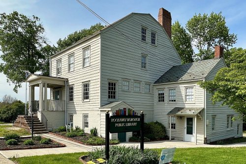
One place: the Joseph Jackson House (listed 1975).
How old are the homes in Rockaway?
30% of Rockaway’s homes were built before 1940 (Census estimate, ±12.2 points), against a typical 15% for a New Jersey town; the median home was built in 1960.
Founding dates: Wikidata, Wikipedia, the U.S. post office records of Blevins & Helbock (CC0) and the Census. Homes by year built: Census ACS 2020–24. National Register of Historic Places: National Park Service (list of May 22, 2026). Old photos, postcards and papers: Wikimedia Commons, the Library of Congress and other public archives, credited on each item’s page. Maps: U.S. Geological Survey historical topographic maps (via Esri) and Sanborn fire-insurance maps (Library of Congress). History text and census tables: Wikipedia (CC BY-SA 4.0). Places that used to be: USGS Geographic Names Information System (2021).
From Wikimedia Commons (4), the Library of Congress (2), the National Register of Historic Places (1), Wikipedia, Wikidata and Wikipedia for famous people, U.S. Geological Survey historical maps, U.S. Census counts (via Wikipedia), the US Post Offices dataset (Blevins & Helbock), the USGS Geographic Names Information System, Sanborn fire insurance maps (Library of Congress) and old county and town histories (Internet Archive). Archive images are copied here with their credits and licenses, shown on each photo’s page. Refreshed monthly.


 1905
 1905
 1906
 1906
 1906