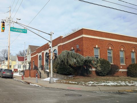
Founding year: the first Garfield post office (Blevins & Helbock, CC0).The full story ↓
History grade
What drives Garfield’s History grade
On its age, its old homes and the National Register, Garfield is more historic than 45% of U.S. towns, #337 of 468 in New Jersey. Its share of homes from before 1940 holds the grade up; its National Register listings pull it down.
C+
HistoryA character grade: shown, never part of Garfield’s overall grade.
New Jersey towns list more on the Register than most of the country (a typical New Jersey town has 3.7 per 10,000 residents, the U.S. 2.4), so Garfield’s 0.0 sits below most of its state (12% of New Jersey towns have fewer) while its 0 listings outnumber those of 23% of U.S. towns.
How sure. Graded on any two of the three inputs instead, the letter would range from D to B. The pre-1940 share is a Census survey estimate (±3.1 points). The founding year is the first post office, not a stated founding date.
Founding year: the first post office (other dates in Quick answers). Homes: Census ACS 2020–24. National Register: National Park Service, May 2026 list; each listing counted once (boundary changes and added documentation belong to their listing), and a historic district counts its contributing buildings. How TownRatings grades history →
What stands out about Garfield’s past
Read from the archive, the National Register and the record. The page puts what stands out first.
Long the home of the Lenape, Native Americans, European settlement in the area that would become Garfield dates back to 1679, when Jacques Cortelyou acquired more than 5,000 acres (2,000 ha) of land surrounding the Passaic River known as "Acqueyquinonke", that ran from the Saddle River to present day Glen Rock.
When the area that is now Garfield was first developed in 1873 with an initial group of seven homes constructed by Gilbert D. Bogart, it was known as East Passaic.
Passages that mention Garfield, cut from the printed page as they were published.
History of Bergen county, New Jersey1900 · page 169Read the page →
Read the text
The village of Garfield is properly an adjunct of Passaic — and lies east of that city, just across the river. The land was originally owned by the Cadmus and Van Winkle estates. About the year 1883, Gilbert D. Bogart, and Henry Marcellus, began improvements in the place.
Text read by machine from the scan; it may contain errors.
cess the property of the firm was destroyed by fire. It was not rebuilt, and the firm was dissolved by mutual consent. Mr. Mercer then turned his attention to the manufacture of woolen shoddies and extracts, and located in Garfield. For this purpose he organized in 1894 the Garfield Woolen Company and became its president and treasurer and still holds these offices, to which he devotes his most assidious attention. He is also a director of the Peoples' Bank and Trust Company of Passaic, of which concern he has been a stockholder from its inception. Seven
Text read by machine from the scan; it may contain errors.
Scans and text from the Internet Archive. Books published in 1930 or earlier, which are in the public domain.
Timeline
Garfield, 1882 to 1934
Woven from the archive, old maps, post office records, the National Register and the people born here.
Nothing in the archives for these yearsWeddings on Main Street, storms, parades, school pictures, the old store. If it’s in your family album, it belongs here.
Fire insurance maps drew every building, what it was made of and what it was used for, so insurers could price the risk of fire. Pick a year, then a sheet.
The Garfield post office opened in 1882, the earliest record of the town by name (U.S. post office records).
How does Garfield rank for history?
Garfield is more historic than 45% of U.S. towns, #337 of 468 in New Jersey. The History grade combines the town’s founding era, the share of homes built before 1940 and its National Register listings. It’s a character grade, so it isn’t part of the overall grade. How it works.
How old are the homes in Garfield?
30% of Garfield’s homes were built before 1940 (Census estimate, ±3.1 points), against a typical 15% for a New Jersey town; the median home was built in 1954.
Founding dates: Wikidata, Wikipedia, the U.S. post office records of Blevins & Helbock (CC0) and the Census. Homes by year built: Census ACS 2020–24. National Register of Historic Places: National Park Service (list of May 22, 2026). Old photos, postcards and papers: Wikimedia Commons, the Library of Congress and other public archives, credited on each item’s page. Maps: U.S. Geological Survey historical topographic maps (via Esri) and Sanborn fire-insurance maps (Library of Congress). History text and census tables: Wikipedia (CC BY-SA 4.0). Places that used to be: USGS Geographic Names Information System (2021).
From Wikimedia Commons (12), Wikipedia, Wikidata and Wikipedia for famous people, U.S. Geological Survey historical maps, U.S. Census counts (via Wikipedia), the US Post Offices dataset (Blevins & Helbock), the USGS Geographic Names Information System, Sanborn fire insurance maps (Library of Congress) and old county and town histories (Internet Archive). Archive images are copied here with their credits and licenses, shown on each photo’s page. Refreshed monthly.


 1909
 2025
 2025
 2025
 2022
 2012
 2012
 2010
 2008
 2008
 2007

