128 years in pictures
The archive holds 3 old photos and papers going back to 2018.
- 1898Dorothy is settled
Each edition grades its towns against each other only.

A town of 1,225, settled in 1898.
14% of residents live below the poverty line in Dorothy, above both New Jersey’s towns (6.1%) and U.S. towns (9.6%). The biggest park or preserve is Peaslee Wildlife Management Area, at 170 acres. We don’t grade Dorothy yet; the figures below are still real.
In a town this size, neighbors are the best guide. Ask them anything.

The archive holds 3 old photos and papers going back to 2018.
Dorothy is unincorporated, so Atlantic County and regional agencies provide most services.
EPA SDWIS (Oct 9, 2026) · HIFLD + EIA-861 2025 · Census 2020 ZCTAs · NCES 2024–25 · registration: vote.gov, updated Nov 18, 2024.
Ordered by what stands out in Dorothy.
Most working residents leave Dorothy for work: only 3% work in town. Since 2013, Dorothy has added 51 jobs, to 199 in 2023. At $107,000, Dorothy’s median household income is near the New Jersey town median ($113,000) and above the median of U.S. towns ($80,000).
| Dorothy | New Jersey towns | U.S. towns | |
|---|---|---|---|
| Working residents who work in town | 2.5% | 6.3% | 8% |
| Median household income | $107,000 | $113,000 | $80,000 |
| Average trip to work | 29 minutes | 30 minutes | 25 minutes |
Census LEHD 2023 · ACS
Dorothy has chilly winters and warm summers. July afternoons reach 86°, January nights drop to 25° and about 22 inches of snow falls in a winter.
NOAA U.S. Climate Normals, 1991–2020
Dorothy beats the New Jersey average on 1 of 32 CDC measures and trails it on 6. 18% of adults have been diagnosed with depression in Dorothy.
| Dorothy | New Jersey towns | U.S. towns | |
|---|---|---|---|
| Depression (CDC PLACES) | 18% | 16% | 23% |
| Smoke cigarettes (CDC PLACES) | 15% | 11% | 14% |
| Obesity (CDC PLACES) | 30% | 28% | 35% |
| Get no exercise (CDC PLACES) | 26% | 22% | 25% |
| What stands out | Dorothy | NJ |
|---|---|---|
| Fewer older adults who have lost all their teeth | 7.6% | 9.6% |
| More adults with COPD | 7.1% | 5.1% |
CDC PLACES 2025 · modeled estimates for adults · CMS · HRSA
Expected storm and flood damage is higher than in 58% of U.S. communities.
FEMA National Risk Index · OpenFEMA
| Biggest places to walk | Trails | Acres |
|---|---|---|
| 1. Peaslee Wildlife Management Area | 0.2 mi | 170 |
| 2. Maple Lake Wildlife Management Area | — | 32 |
Trails & parks © OpenStreetMap contributors · Conserved land: USGS PAD-US
Zillow Home Value Index · Redfin Data Center
Museums, parks, gardens and other places to visit around Dorothy. Close and well known come first.
Big draw24 mi Park & preservePine Barrens
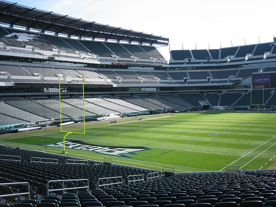
Big draw39 mi Stadium & arenaLincoln Financial Field
Big draw39 mi Stadium & arenaXfinity Mobile Arena
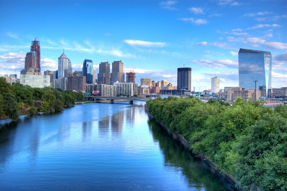
38 mi Park & preserveSchuylkill River
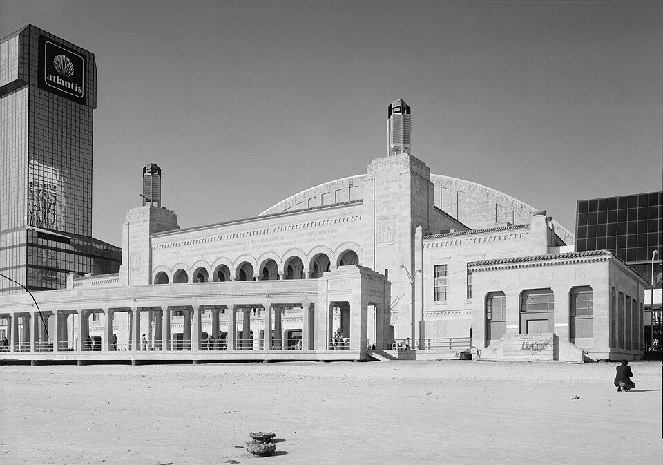
21 mi Stadium & arenaBoardwalk Hall
39 mi Stadium & arenaCitizens Bank ParkPine Barrens: Famartin, CC BY-SA 4.0 · Lincoln Financial Field: The original uploader was Betp at French Wikipedia., CC BY-SA 3.0 · Xfinity Mobile Arena: Jen Smith, CC BY 3.0 · Schuylkill River: Emy111 at English Wikipedia, Public domain · Boardwalk Hall: Jack Boucher, Public domain · Citizens Bank Park: Chris6d, CC BY-SA 4.0
2 within 15 miles of the center of Dorothy
About 5 of every 100 Dorothy residents are enrolled in college, about the same as New Jersey.
Where Dorothy’s working residents go each day. Line width shows the share.
Census LEHD 2023
School district in Atlantic County, New Jersey, US
Dorothy is an unincorporated community and census-designated place located in Weymouth Township in Atlantic County, in the U.S. state of New Jersey. The area is served as United States Postal Service ZIP Code 08317. As of the 2020 census, Dorothy had a population of 1,057.
From Wikipedia, licensed CC BY-SA 4.0 · facts via Wikidata (CC0)
Short answers, built from the data on this page.
We don’t grade Dorothy yet; the figures below are still real.