Cape May’s historic district, a National Historic Landmark, takes in 600 buildings
More historic than 84% of U.S. towns · #90 of 468 in New Jersey. What drives it
1 place in town is on the National Register, among them the Cape May Historic District, a National Historic Landmark, and a historic district with 600 buildings. Below: 10 old photos and papers, maps from 1888 on, and the census since 1870.
The Cape May post office opened in 1869, the earliest record of the town by name. Wikidata gives 1611, the date of an exploration of the area, not of the town. Another post office, Cape Island (1804), opened inside today’s city and later closed.
First census: 1,248 in 18702020 census: 2,768157 years
How historic is Cape May?
A−
More historic than 84% of U.S. towns, on its age, its old homes and the National Register.
Founding year: the first Cape May post office (Blevins & Helbock, CC0). Wikidata: 1611.The full story ↓
History grade
What drives Cape May’s History grade
On its age, its old homes and the National Register, Cape May is more historic than 84% of U.S. towns, #90 of 468 in New Jersey. Its National Register listings hold the grade up; its age pulls it down.
A−
HistoryA character grade: shown, never part of Cape May’s overall grade.
New Jersey towns list more on the Register than most of the country (a typical New Jersey town has 3.7 per 10,000 residents, the U.S. 2.4), so Cape May’s 2,168 sits above most of its state (99% of New Jersey towns have fewer) while its 600 historic buildings outnumber those of 98% of U.S. towns.
How sure. Graded on any two of the three inputs instead, the letter would range from B to A+. The pre-1940 share is a Census survey estimate (±6.3 points). The founding year is the first post office, not a stated founding date; Wikidata gives 1611.
Founding year: the first post office (other dates in Quick answers). Homes: Census ACS 2020–24. National Register: National Park Service, May 2026 list; each listing counted once (boundary changes and added documentation belong to their listing), and a historic district counts its contributing buildings. How TownRatings grades history →
What stands out about Cape May’s past
Read from the archive, the National Register and the record. The page puts what stands out first.
The country’s official list of buildings and places worth saving. One is a National Historic Landmark, the highest tier. Boundary changes and added documentation are counted with their listing.
The area that is now Cape May was originally inhabited by the Kechemeche Native American tribe, a subgroup of the Lenape people. The Kechemeche first encountered Europeans around 1600. The city is named after the Dutch captain Cornelius Jacobsen Mey, who charted the coast between 1611 and 1614 and claimed it for the province of New Netherland. It was later settled by colonists from the New Haven Colony in New England.
By the mid-18th century, Cape May had become a popular vacation destination for visitors from Philadelphia and is recognized as the country's oldest seaside resort.
Passages that mention Cape May, cut from the printed page as they were published.
Mayflower Pilgrim descendants in Cape May County, New Jersey1921 · page 329Read the page →
Read the text
(1) ROBERT EDMUNDS HUGHES, born at Cape May, 24 June, 1846, married Harriet Sehellenger, born at Cape May 30 March, 1853, and had :— MILLICENT SCHELLENGER HUGHES, born at Cape May, 25 January, 1876, married at Cape May, 18 April, 1900, Frank Bacon Mecray, born at Cape May, 23 April, 1877, and had, HARRIET HUGHES MECRAY bom at Cape May, 4 January, 1905 ; CHARLOTTE BRIDEN- THAL HUGHES, born at Cape May, 2 January, 1878, married
Text read by machine from the scan; it may contain errors.
The history of Cape May County, New Jersey1897 · page 299Read the page →
Read the text
B. Dungan, who was president of the company which -finally built the road and who was the contractor also, deserve, with others, a large share of gratitude from the present residents of Cape May county for their untiring efforts in •getting the road here. On May 13, 1863, the Board of Freeholders passed a resolution allowing the Cape May and Millville Railroad the right to lay rails over Cape Island bridge, and within a few days thereafter the railroad
Text read by machine from the scan; it may contain errors.
Mayflower Pilgrim descendants in Cape May County, New Jersey1921 · page 275Read the page →
Read the text
(5) RICHARD HAND, born at Cape May, 9 February, 1866, married at Cape May, Lillian Robinson, and had: RICHARD HAND, born at Cape May, 13 February, 1890, who married at Cape May, Miranda Stillwell, and had, REBECCA DOAK HAND, born at Cape May, 1 September, 1910 ; HARRY HAND, bom at Cape May, 13 October, 1894, married at Cape May, 23 December, 1917, Jennie Sutton, and had, LIDA DOAK HAND, born at Cape May, 12 December, 1918.
Text read by machine from the scan; it may contain errors.
The history of Cape May County, New Jersey1897 · page 405Read the page →
Read the text
All that portion of Cape May county, beginning at a point in the Atlantic Ocean opposite the mouth of Cold Spring Inlet, as far southerly as the jurisdiction of the State extends, and running a westerly course until opposite an inlet (now filled up) between Cape Island and the lighthouse; thence following the several courses of the inlet, or creek, to Mount Vernon Bridge, and Broadway; thence along the northwest side of Broadway to the north side of
Text read by machine from the scan; it may contain errors.
Scans and text from the Internet Archive. Books published in 1930 or earlier, which are in the public domain.
Timeline
Cape May, 1783 to 1980
Woven from the archive, old maps, post office records, the National Register and the people born here.
Nothing in the archives for these yearsWeddings on Main Street, storms, parades, school pictures, the old store. If it’s in your family album, it belongs here.
The Cape May post office opened in 1869, the earliest record of the town by name (U.S. post office records). Wikidata gives 1611.
How does Cape May rank for history?
Cape May is more historic than 84% of U.S. towns, #90 of 468 in New Jersey. The History grade combines the town’s founding era, the share of homes built before 1940 and its National Register listings. It’s a character grade, so it isn’t part of the overall grade. How it works.
What is on the National Register in Cape May?
One place: the Cape May Historic District (listed 1970).
How old are the homes in Cape May?
27% of Cape May’s homes were built before 1940 (Census estimate, ±6.3 points), against a typical 15% for a New Jersey town; the median home was built in 1973.
Founding dates: Wikidata, Wikipedia, the U.S. post office records of Blevins & Helbock (CC0) and the Census. Homes by year built: Census ACS 2020–24. National Register of Historic Places: National Park Service (list of May 22, 2026). Old photos, postcards and papers: Wikimedia Commons, the Library of Congress and other public archives, credited on each item’s page. Maps: U.S. Geological Survey historical topographic maps (via Esri) and Sanborn fire-insurance maps (Library of Congress). History text and census tables: Wikipedia (CC BY-SA 4.0). Places that used to be: USGS Geographic Names Information System (2021).
From Wikimedia Commons (8), the Library of Congress (2), the National Register of Historic Places (1), Wikipedia, Wikidata and Wikipedia for famous people, U.S. Geological Survey historical maps, U.S. Census counts (via Wikipedia), the US Post Offices dataset (Blevins & Helbock), the USGS Geographic Names Information System and old county and town histories (Internet Archive). Archive images are copied here with their credits and licenses, shown on each photo’s page. Refreshed monthly.


 ★ Landmark


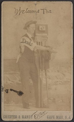


 1917
 1917
 1917
 1917
 1917
 1917