Nothing in the archives for these yearsWeddings on Main Street, storms, parades, school pictures, the old store. If it’s in your family album, it belongs here.
Incorporated in 1962 out of the town of Lisbon after considerable litigation, Sugar Hill is the most recently incorporated town in the state. The name "Sugar Hill" comes from the large groves of sugar maples within the town limits.
Passages that mention Sugar Hill, cut from the printed page as they were published.
History of the town of Bristol, Grafton County, New Hampshire1904 · page 143Read the page →
Read the text
(5) Nicholas B. Dolloff, b. Feb. 6, 1803, m. Jan. 29, 1851, Mrs. Harriet (Mason) Docke, widow of Benjamin and dau. of David Mason. (See.) She d. Nov. 16, 1856, ae. 42-3-24, and he m. (2) Rhoda Aldrich, dau. of Dr. Aldrich, of Sugar Hill, b. Mar. 16, 1813, d. Sept. 29, 1885, ae. 72-6-13. He was a farmer and also a school teacher and surveyor, and ranked high as a mathematician. In 1830, he purchased an interest in the' saw-mill at Moore's Mills and continued the manufacture of lum-
Text read by machine from the scan; it may contain errors.
Scans and text from the Internet Archive. Books published in 1930 or earlier, which are in the public domain.
On the map
Sugar Hill on the map, 1929 to 1995
Every edition of the U.S. Geological Survey’s map of Sugar Hill. Tap a year, or press play to watch the town change.
1929Moosilauke sheet · 1:62,500
U.S. Geological Survey historical topographic maps (public domain), via Esri’s collection of the scans. The red ring marks the center of Sugar Hill.
Then & now
Stand where they stood
No then-and-now pairs yet. Take a photo from the same spot as an old one and they appear here side by side.
Retake this viewMorning Mists, Sugar Hill, N.H, 1898
Find the spot, match the angle, and add your photo. It becomes the first then-and-now pair on Sugar Hill’s page.
Founding dates: Wikidata, Wikipedia, the U.S. post office records of Blevins & Helbock (CC0) and the Census. Homes by year built: Census ACS 2020–24. National Register of Historic Places: National Park Service (list of May 22, 2026). Old photos, postcards and papers: Wikimedia Commons, the Library of Congress and other public archives, credited on each item’s page. Maps: U.S. Geological Survey historical topographic maps (via Esri) and Sanborn fire-insurance maps (Library of Congress). History text and census tables: Wikipedia (CC BY-SA 4.0). Places that used to be: USGS Geographic Names Information System (2021). How TownRatings grades history →
From Wikimedia Commons (16), the Library of Congress (10), Wikipedia, Wikidata and Wikipedia for famous people, U.S. Geological Survey historical maps, U.S. Census counts (via Wikipedia), the US Post Offices dataset (Blevins & Helbock), the USGS Geographic Names Information System and old county and town histories (Internet Archive). Archive images are copied here with their credits and licenses, shown on each photo’s page. Refreshed monthly.


 1898
 1898
 1898
 1900
 c. 1912
 1913
 1939
 1939
 1940
 1940
 1940
 1940
 1940
 1940
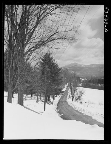 1940
 Date?
 Date?
 2022
 2020
 2015
 2014
 2014
 2014
 2014
 2014
 2009


