On its age, its old homes and the National Register, Windsor is more historic than 89% of U.S. towns, #14 of 290 in North Carolina. All 2 inputs are above most U.S. towns; its National Register listings ranks highest and its share of homes from before 1940 lowest.
A
HistoryA character grade: shown, never part of Windsor’s overall grade.
North Carolina towns list more on the Register than most of the country (a typical North Carolina town has 12.5 per 10,000 residents, the U.S. 2.4), so Windsor’s 272 sits above most of its state (89% of North Carolina towns have fewer) while its 89 historic buildings outnumber those of 89% of U.S. towns.
How sure. Graded on two of the three inputs, so a change in either one moves the letter more than it would with three. The pre-1940 share is a Census survey estimate (±9.5 points).
Founding year: our sources. Homes: Census ACS 2020–24. National Register: National Park Service, May 2026 list; each listing counted once (boundary changes and added documentation belong to their listing), and a historic district counts its contributing buildings. How TownRatings grades history →
What stands out about Windsor’s past
Read from the archive, the National Register and the record. The page puts what stands out first.
The land was historically the home of the Tuscarora people. Today, there are Tuscarora residents living in the village of Tandequemuc, now called Merry Hill.
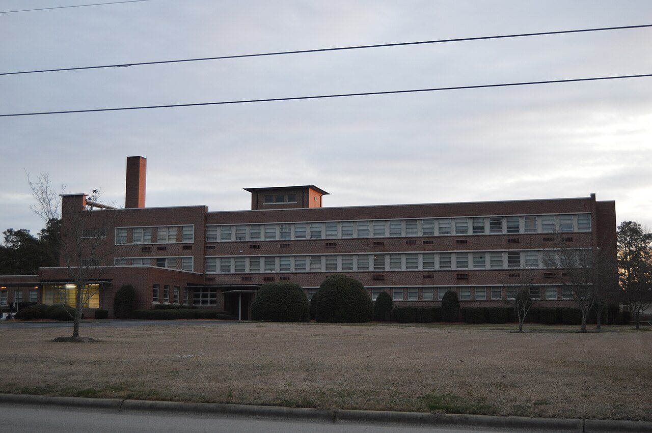
Bertie County Courthouse, Bertie Memorial Hospital, Elmwood, Freeman Hotel, Hope Plantation, Jordan House, King House, Liberty Hall, Rosefield, and Windsor Historic District are listed on the National Register of Historic Places.
silver river courted a plunge into its waves — the woods an hour's retirement into their shady recesses. The bells of Eton-college rang out merrily, but their sound saddened, rather than elated him. The road between Eton and Windsor, then marked by straggling cottages with gardens between them, with here and there a dwelling of a better kind, was thronged with herds ot cattle and their drivers, for a fair was held that day in the town of Windsor, to which they were hastening. Then there were
Text read by machine from the scan; it may contain errors.
Windsor, or VVyndlcshore. so called from the winding banks of the river flowing past it, was the abode of the ancient Saxon monarchs; and a legend is related b}r William of Malmsbury, of a woodman named Wulwin, who being stricken with blindness, and having visited eighty-seven churches and vainly implored their tutelary saints for relief, was at last restored to sigh* by the touch of Edward the Confessor, who further enhanced the boon by making him keeper of his palace at Windsor. But
Text read by machine from the scan; it may contain errors.
Scans and text from the Internet Archive. Books published in 1930 or earlier, which are in the public domain.
Timeline
Windsor, 1749 to 1978
Woven from the archive, old maps, post office records, the National Register and the people born here.
Windsor is more historic than 89% of U.S. towns, #14 of 290 in North Carolina. The History grade combines the town’s founding era, the share of homes built before 1940 and its National Register listings. It’s a character grade, so it isn’t part of the overall grade. How it works.
What is on the National Register in Windsor?
6 listings: 5 buildings, among them the Bertie County Courthouse (listed 1979, the first), and 1 historic district, the Windsor Historic District, with 78 contributing buildings. 89 historic buildings in all.
How old are the homes in Windsor?
17% of Windsor’s homes were built before 1940 (Census estimate, ±9.5 points), against a typical 4.1% for a North Carolina town; the median home was built in 1971.
Founding dates: Wikidata, Wikipedia, the U.S. post office records of Blevins & Helbock (CC0) and the Census. Homes by year built: Census ACS 2020–24. National Register of Historic Places: National Park Service (list of May 22, 2026). Old photos, postcards and papers: Wikimedia Commons, the Library of Congress and other public archives, credited on each item’s page. Maps: U.S. Geological Survey historical topographic maps (via Esri) and Sanborn fire-insurance maps (Library of Congress). History text and census tables: Wikipedia (CC BY-SA 4.0). Places that used to be: USGS Geographic Names Information System (2021).
From Wikimedia Commons (6), the National Register of Historic Places (6), Wikipedia, Wikidata and Wikipedia for famous people, U.S. Geological Survey historical maps, U.S. Census counts (via Wikipedia), the US Post Offices dataset (Blevins & Helbock), the USGS Geographic Names Information System and old county and town histories (Internet Archive). Archive images are copied here with their credits and licenses, shown on each photo’s page. Refreshed monthly.




 2020
 2020
 2020
 2014
 2013
 2004


