Salisbury dates to 1763, and 14% of its homes were built before 1940
More historic than 95% of U.S. towns · #3 of 290 in North Carolina. What drives it
34 places in town are on the National Register, among them ten historic districts with 1,295 buildings between them. Below: 17 old photos and papers, maps from 1885 on, and the census since 1850.
Founding year: Wikidata. First post office: 1792.The full story ↓
History grade
What drives Salisbury’s History grade
On its age, its old homes and the National Register, Salisbury is more historic than 95% of U.S. towns, #3 of 290 in North Carolina. All 3 inputs are above most U.S. towns; its age ranks highest and its share of homes from before 1940 lowest.
A
HistoryA character grade: shown, never part of Salisbury’s overall grade.
North Carolina towns list more on the Register than most of the country (a typical North Carolina town has 12.5 per 10,000 residents, the U.S. 2.4), so Salisbury’s 416 sits above most of its state (93% of North Carolina towns have fewer) while its 1,492 historic buildings outnumber those of 99% of U.S. towns.
NoteThe founding year comes from Wikidata alone; no second source gives 1763.
How sure. Graded on any two of the three inputs instead, the letter would range from A− to A+. The pre-1940 share (±2.4 points) is firm at this size.
Founding year: Wikidata (other dates in Quick answers). Homes: Census ACS 2020–24. National Register: National Park Service, May 2026 list; each listing counted once (boundary changes and added documentation belong to their listing), and a historic district counts its contributing buildings. How TownRatings grades history →
What stands out about Salisbury’s past
Read from the archive, the National Register and the record. The page puts what stands out first.
In 1753 an appointed Anglo-European trustee for Rowan County was directed to enter 40 acres (16 ha) of land for a County Seat, and public buildings were erected. The deed is dated February 11, 1755, when John Carteret, 2nd Earl Granville conveyed 635 acres (257 ha) for the "Salisbury Township". The settlement was built at the intersection of longtime Native American trading routes. It became an economic hub along what was improved as the Great Wagon Road in North Carolina. It became the principal city of the Salisbury judicial and militia districts in the years leading up to the American Revolutionary War. On June 12, 1792, Salisbury was granted a US Post Office. Its first postmaster was George Lauman. This post office has been in continuous operation ever since.
Passages that mention Salisbury, cut from the printed page as they were published.
A history of Rowan County, North Carolina1916 · page I78Read the page →
Read the text
Resolved, That Messrs. Samuel Young and Moses Winslow, for the County of Rowan, and for the town of Salisbury, William Kennon, Esq., be, and they are hereby, nominated and appointed Deputies upon the part of the inhabitants and freeholders of this county, and town of Salisbury, to meet such Deputies as shall be appointed by the other counties and corporations within this colony, at Johnston Courthouse, the twen-
Text read by machine from the scan; it may contain errors.
A history of Rowan County, North Carolina1916 · page I68Read the page →
Read the text
He was a lawyer, and it is supposed that he came to Salisbury from Wilmington, or from some other portion of Eastern Carolina. On the twenty-fifth of August, 1775, he represented the town of Salisbury in the Provincial Congress at Newbern. As early as the eighth of August, 1774, he was chosen as a member of the Rowan Committee of Safety, and on the twenty-seventh of September of the same year, he ap-
Text read by machine from the scan; it may contain errors.
Dark days of the rebellion, or, Life in Southern military prisons1897 · page 351Read the page →
Read the text
tured, and destroyed by burning, the stockade and prison pen. The place is now covered with houses and is called ‘South Brooklyn,’ but is a part of the town of Salisbury. Having no pho¬ tographs of this cemetery, I enclose you a sketch, with correct figures as to length, angles, etc. Graves, 437 and 18 trenches, where 11,700 Union soldiers, prisoners, are buried. Surface
Text read by machine from the scan; it may contain errors.
Scans and text from the Internet Archive. Books published in 1930 or earlier, which are in the public domain.
Timeline
Salisbury, 1763 to 1962
Woven from the archive, old maps, post office records, the National Register and the people born here.
Nothing in the archives for these yearsWeddings on Main Street, storms, parades, school pictures, the old store. If it’s in your family album, it belongs here.
Every edition of the U.S. Geological Survey’s map of Salisbury. Tap a year, or press play to watch the town change.
1962Salisbury sheet · 1:24,000
U.S. Geological Survey historical topographic maps (public domain), via Esri’s collection of the scans. The red ring marks the center of Salisbury.
Every building
Salisbury, building by building, 1885–1922
Fire insurance maps drew every building, what it was made of and what it was used for, so insurers could price the risk of fire. Pick a year, then a sheet.
In 1763, according to Wikidata. Salisbury’s post office opened in 1792, and the census of 1850 counted 1,086 people here.
How does Salisbury rank for history?
Salisbury is more historic than 95% of U.S. towns, #3 of 290 in North Carolina. The History grade combines the town’s founding era, the share of homes built before 1940 and its National Register listings. It’s a character grade, so it isn’t part of the overall grade. How it works.
What is on the National Register in Salisbury?
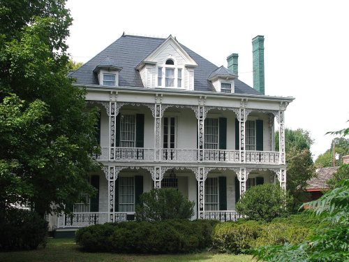
34 listings: 22 buildings, among them the Community Building (listed 1970, the first), 11 historic districts with 1,295 contributing buildings, and 1 site. 1,492 historic buildings in all.
How old are the homes in Salisbury?
14% of Salisbury’s homes were built before 1940 (Census estimate, ±2.4 points), against a typical 4.1% for a North Carolina town; the median home was built in 1976.
Founding dates: Wikidata, Wikipedia, the U.S. post office records of Blevins & Helbock (CC0) and the Census. Homes by year built: Census ACS 2020–24. National Register of Historic Places: National Park Service (list of May 22, 2026). Old photos, postcards and papers: Wikimedia Commons, the Library of Congress and other public archives, credited on each item’s page. Maps: U.S. Geological Survey historical topographic maps (via Esri) and Sanborn fire-insurance maps (Library of Congress). History text and census tables: Wikipedia (CC BY-SA 4.0). Places that used to be: USGS Geographic Names Information System (2021).
From Wikimedia Commons (4), the Library of Congress (13), Wikidata (1), the National Register of Historic Places (34), Wikipedia, U.S. Geological Survey historical maps, U.S. Census counts (via Wikipedia), the US Post Offices dataset (Blevins & Helbock), the USGS Geographic Names Information System, Sanborn fire insurance maps (Library of Congress) and old county and town histories (Internet Archive). Archive images are copied here with their credits and licenses, shown on each photo’s page. Refreshed monthly.




 1908
 1908
 1908
 1908
 1908
 1908
 1908
 1908
 1908
 1908
 1908
 1908
 1908
 1908


