North Carolina Coastal Land Trust: Orton Plantation Holdings, LLC
Nature preserve
4 acres
Dog rules not recorded
No trailhead mapped yet
Each edition grades its towns against each other only.
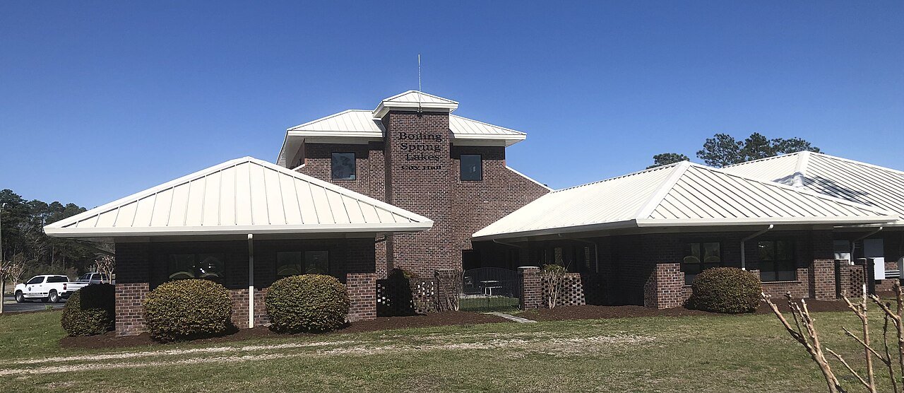 Photo: Piperpet · CC BY-SA 4.0
21 miles of mapped trail cross Boiling Spring Lakes, 0.9 per square mile of land. 53 acres are parks and preserves, 8.4 per 1,000 residents. 65% of residents live within a half mile of a park.
Ahead of 77% of U.S. towns · #30 of 290 in North Carolina. What drives it
Read from the map. The page puts what stands out first.
On conserved land, trails, park land and how close residents live to a park, Boiling Spring Lakes is ahead of 77% of U.S. towns, #30 of 290 in North Carolina. Conserved land holds the grade up; park acres per resident pull it down.
PAD-US, OpenStreetMap (© OpenStreetMap contributors), Census 2025 Gazetteer and 2020 blocks; details in Sources below. How TownRatings grades the outdoors →
Tap a number to zoom to a park. Tap a layer to hide it.
Directions go to the nearest trailhead or public parking.
47% of Boiling Spring Lakes’ land. Who manages Boiling Spring Lakes’s conserved land, from the USGS Protected Areas Database. Approximate, because parcels can overlap.
Conserved doesn’t always mean open to visitors. 79 acres are conservation easements, usually private land. Public access isn’t recorded for 331 of 342 parcels. The walks above are places people visit.
| Parcel (PAD-US) | Managed by | Acres | Public access |
|---|---|---|---|
| Boiling Spring Lakes Plant Conservation Preserve State Other or Unknown | Not recorded | 6,439 | Restricted |
| City of Boiling Spring Lakes Open Space Local Other or Unknown | Not recorded | 479 | Unknown |
| City of Boiling Spring Lakes - Boiling Spring Lakes Community Center Local Recreation Area | Not recorded | 43 | Unknown |
| Pretty Pond Limesink Complex Natural Heritage Preserve Unknown | Not recorded | 13 | Restricted |
| Brunswick County Open Space Local Other or Unknown | Not recorded | 8 | Unknown |
| Southeastern Brunswick County Private Conservation | Land trusts & nonprofits | 4 | Unknown |
| North Carolina Safe Harbor Agreement - Red-cockaded Woodpecker State Conservation Area | Not recorded | 4 | Restricted |
| Robert Muse Memorial Park Local Park | Town or city | 3 | Open |
| Tate Lake Park Local Park | Town or city | 2 | Open |
| Spring Lake Park Local Park | Town or city | 1 | Open |
5 smaller protected places aren’t shown.
Beaches, playgrounds, peaks, falls and more. Pick a kind.
2 playgrounds without a name on the map. Tap “Show all on map” to see them.
Bike lanes are often missing from the map in smaller towns, so that number is likely low.
Includes school and college facilities, which aren’t always open to the public.
NOAA’s 1991–2020 normals for the town and the daylight at its latitude. Outlined months have long days, highs of 59 to 86 °F and little rain for the place.
| Jan | Feb | Mar | Apr | May | Jun | Jul | Aug | Sep | Oct | Nov | Dec | |
|---|---|---|---|---|---|---|---|---|---|---|---|---|
| Daylight (h) | 10.1 | 10.9 | 11.9 | 13.0 | 13.9 | 14.4 | 14.2 | 13.4 | 12.3 | 11.3 | 10.3 | 9.9 |
| High (°F) | 58 | 61 | 67 | 74 | 81 | 87 | 90 | 88 | 84 | 76 | 67 | 60 |
| Rain (in) | 3.6 | 3.4 | 3.8 | 3.2 | 4.0 | 4.9 | 6.4 | 7.0 | 7.8 | 4.7 | 3.5 | 3.7 |
April is the driest month (3.2 in) and July the warmest (highs of 90 °F). 7.8 inches fall in September, the wettest month. Summer highs reach 90 °F, too hot for the outline. The climate in Boiling Spring Lakes →
Boiling Spring Lakes has the most mapped trails of the 2 towns around it. Tap a town to see its outdoors.
| Town | Conserved of land | Trail mi per sq mi | Park acres per 1,000 | Near a park ½ mile | Outdoors |
|---|---|---|---|---|---|
| Boiling Spring Lakes | 47% | 0.9 | 8 | 65% | A− |
| Oak Island | 20% | 0.7 | 9 | 66% | B+ |
The four inputs of the Outdoors grade, from the engine; shares are of land, not water.
47% of its land, against a typical 3% for a North Carolina town and 4% nationally (PAD-US). Conserved doesn’t always mean open to visitors: easements are usually private land.
North Carolina Coastal Land Trust: Orton Plantation Holdings, LLC and Robert Muse Memorial Park don’t have dog rules recorded on the map; check the signs at the trailhead.
23,642 acres of parks and open public land lie inside Boiling Spring Lakes or within 10 miles of it (PAD-US), 53 of them inside the city line.
Ahead of 77% of U.S. towns on the Outdoors grade, #30 of 290 in North Carolina. The grade combines the share of land that is conserved, miles of mapped trail per square mile of land, park acres per 1,000 residents and the share of residents within a half mile of a park. It’s a character grade, so it isn’t part of the overall grade. How it works.
Conditions, parking and favorite walks from Boiling Spring Lakes neighbors.
Conserved and public land: USGS Protected Areas Database of the United States (PAD-US), service updated July 2026. Parks, trails, playgrounds, beaches and other places: OpenStreetMap (© OpenStreetMap contributors, ODbL), map data as of 2026-10-28. Land and water area: Census 2025 Gazetteer. Residents near a park: 2020 Census blocks. National Register: National Park Service. How TownRatings grades the outdoors →