Pony’s post office opened in 1877, and 37% of its homes were built before 1940
2 places in town are on the National Register, among them a historic district with 95 buildings. Below: 12 old photos and papers and maps from 1950 on.
Nothing in the archives for these yearsWeddings on Main Street, storms, parades, school pictures, the old store. If it’s in your family album, it belongs here.
The town gained its name from one of its early miners, Tecumseth Smith, a man nicknamed "Pony" because of his diminutive size.
Settled in the 1860s, Pony was a prosperous gold-mining community in the late nineteenth century, with at least 5,000 residents. Mining operations declined in the early 20th century, and all were closed by 1922.
A number of historic buildings from Pony's boom era remain in the old town today. Major buildings are managed, voluntarily, by the Pony Homecoming Club, a non-profit organization that maintains the town's public spaces.
Founding dates: Wikidata, Wikipedia, the U.S. post office records of Blevins & Helbock (CC0) and the Census. Homes by year built: Census ACS 2020–24. National Register of Historic Places: National Park Service (list of May 22, 2026). Old photos, postcards and papers: Wikimedia Commons, the Library of Congress and other public archives, credited on each item’s page. Maps: U.S. Geological Survey historical topographic maps (via Esri) and Sanborn fire-insurance maps (Library of Congress). History text and census tables: Wikipedia (CC BY-SA 4.0). Places that used to be: USGS Geographic Names Information System (2021). How TownRatings grades history →
From the Library of Congress (12), the National Register of Historic Places (2), Wikipedia, U.S. Geological Survey historical maps, the US Post Offices dataset (Blevins & Helbock) and the USGS Geographic Names Information System. Archive images are copied here with their credits and licenses, shown on each photo’s page. Refreshed monthly.


 1939
 1939
 1939
 1939
 1939
 1939
 1939
 1939
 1939
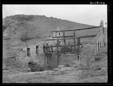 1939
 1939
 1939


