9 places in town are on the National Register, among them a historic district with 12 buildings. Below: 1 old photo or paper, maps from 1972 on, and the census since 1990.
The name Fort Peck is associated with Col. Campbell K. Peck, the partner of Elias H. Durfee in the Leavenworth, Kansas trading firm of Durfee and Peck. In 1867, company employee Abe Farwell constructed the Fort Peck trading post along the Missouri River, which enjoyed a virtual monopoly in trade with the Sioux and Assiniboine people. After its short life as a trading post, Fort Peck served as an Indian agency from 1873 until 1878. At that time, the agency was moved to its current location at Poplar. Fort Peck had a post office from 1879 to 1881.
Nothing in the archives for these yearsWeddings on Main Street, storms, parades, school pictures, the old store. If it’s in your family album, it belongs here.
Between 233 and 325 people in every census since 1990.
4 censuses, 1990–2020.
U.S. Census Bureau decennial counts, from the census table on Fort Peck’s Wikipedia page.
Places that used to be
Lost post offices and burying grounds
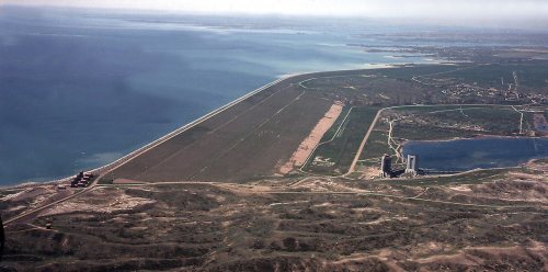
Another post office, Fort Peck Dam, opened and closed inside today’s town.
1cemetery inside Fort Peck
Fort Peck
US Post Offices dataset (Blevins & Helbock, CC0). Places and cemeteries from the USGS Geographic Names Information System (2021).
Questions about Fort Peck’s history
What is on the National Register in Fort Peck?
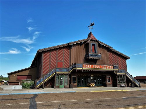
9 listings: 7 buildings, among them the Fort Peck Theatre (listed 1983, the first), 1 historic district, the Fort Peck Original Houses Historic District, with 12 contributing buildings, and 1 structure. 21 historic buildings in all.
Founding dates: Wikidata, Wikipedia, the U.S. post office records of Blevins & Helbock (CC0) and the Census. Homes by year built: Census ACS 2020–24. National Register of Historic Places: National Park Service (list of May 22, 2026). Old photos, postcards and papers: Wikimedia Commons, the Library of Congress and other public archives, credited on each item’s page. Maps: U.S. Geological Survey historical topographic maps (via Esri) and Sanborn fire-insurance maps (Library of Congress). History text and census tables: Wikipedia (CC BY-SA 4.0). Places that used to be: USGS Geographic Names Information System (2021). How TownRatings grades history →
From Wikimedia Commons (5), Wikidata (1), the National Register of Historic Places (9), Wikipedia, Wikidata and Wikipedia for famous people, U.S. Geological Survey historical maps, U.S. Census counts (via Wikipedia), the US Post Offices dataset (Blevins & Helbock) and the USGS Geographic Names Information System. Archive images are copied here with their credits and licenses, shown on each photo’s page. Refreshed monthly.





 2016
 2016
 2016
 2005
