Guest, Sign inJoin

Post to Bozeman

We’ll email a one-tap link to publish your post. No password, and nothing is public until you click it.
Already a member? Sign in
BHistory
History · Bozeman

Bozeman dates to 1864, and 63 of its places are on the National Register

More historic than 62% of U.S. towns · #17 of 42 in Montana. What drives it

Most of Bozeman was built recently: 9% of its homes predate 1940 and the median home dates from 2000. 63 places in town are on the National Register, among them ten historic districts with 722 buildings between them. Below: 5 old photos and papers, maps from 1884 on, and the census since 1870.

1864founded
63on the National Register
9%homes built before 1940
5old photos & papers
35famous people
From Bozeman’s archive · credits on each photo
Quick answers

How Bozeman began

When was Bozeman founded?

1864

Bozeman dates its founding to 1864 (Wikidata). The census first counted it in 1870.

First census: 168 in 18702020 census: 53,293162 years

How historic is Bozeman?

B

More historic than 62% of U.S. towns, on its age, its old homes and the National Register.

What drives the grade ↓
Founding year: Wikidata.The full story ↓
History grade

What drives Bozeman’s History grade

On its age, its old homes and the National Register, Bozeman is more historic than 62% of U.S. towns, #17 of 42 in Montana. Its National Register listings hold the grade up; its age pulls it down.

B
HistoryA character grade: shown, never part of Bozeman’s overall grade.
All U.S. towns we grade (21,289)Ahead of 62%
NewerOlder
Montana towns of 2,500+ (42)Ahead of 61%

Montana towns list more on the Register than most of the country (a typical Montana town has 12.7 per 10,000 residents, the U.S. 2.4), so Bozeman’s 139 sits above most of its state (83% of Montana towns have fewer) while its 778 historic buildings outnumber those of 98% of U.S. towns.

NoteThe founding year comes from Wikidata alone; no second source gives 1864.
How sure. Graded on any two of the three inputs instead, the letter would range from C to A−. The pre-1940 share (±1.4 points) is firm at this size.

Founding year: Wikidata (other dates in Quick answers). Homes: Census ACS 2020–24. National Register: National Park Service, May 2026 list; each listing counted once (boundary changes and added documentation belong to their listing), and a historic district counts its contributing buildings. How TownRatings grades history →

What stands out about Bozeman’s past

Read from the archive, the National Register and the record. The page puts what stands out first.

★ What stands out · On the National Register

63 listings protect 778 historic buildings

The country’s official list of buildings and places worth saving.

places listed
63
National Historic Landmarks
0
none yet
historic buildings protected
778
each building in a district counts
first listed
1978
South Willson Historic District
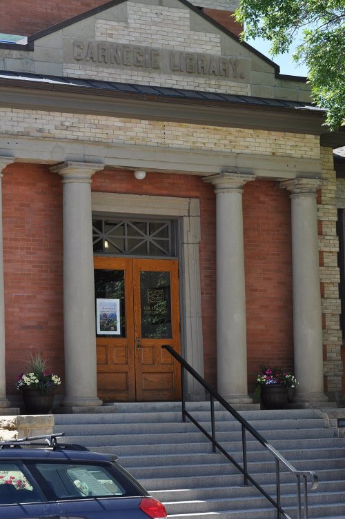
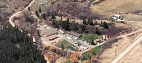
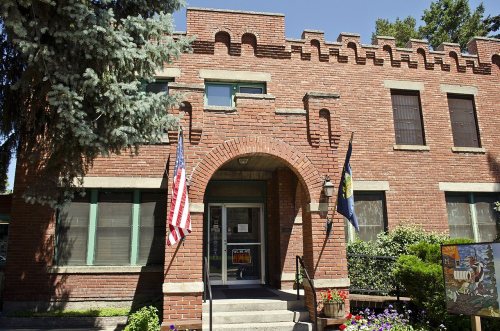
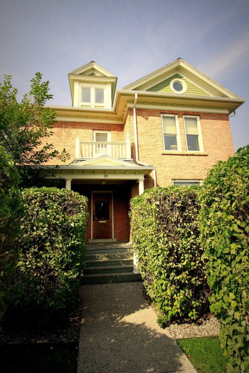
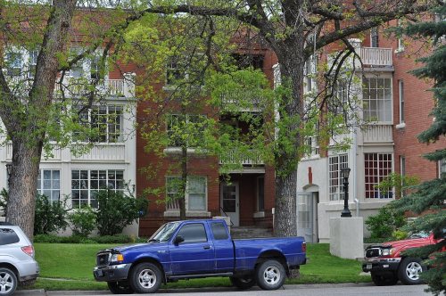
Bozeman Carnegie LibraryBarnett, R. T., and Company Building, built 1889Bozeman National Fish HatcheryGallatin County JailEmil Ketterer HouseBlackmore ApartmentsHotel Baxter, built 1929Spieth and Krug BreweryBurr Fisher HouseBozeman ArmoryGraf BuildingBeall Park Community Center, built 1927Bohart House, built 1889Bon Ton Historic DistrictBozeman YMCABrandenburg House, built 1883Bridger Arms ApartmentsBusch HouseColburn HouseCooper Park Historic DistrictFirst Baptist ChurchGallatin Valley Seed CompanyHamill ApartmentsHamill HouseHoly Rosary Church RectoryHouse at 22 West LammeKolble HouseMethodist Episcopal Church, built 1873MISCO Grain ElevatorNewman HousePanton HouseRouse HouseSpieth HousesSt. James Episcopal Church and RectoryDokken-Nelson Funeral HomeFirst Presbyterian ChurchGallatin County Courthouse, built 1935Gallatin County High SchoolHarris HouseHines HouseHouse at 714 North TracyHouse at 818 South EighthPeterson HouseEmerson SchoolSamuel Lewis House, built 1881Jack Bartlett HouseCharles Lundwall Building, built 1905Montana State University Historic DistrictFederal Building and US Post Office-BozemanSouth Willson Historic DistrictRea SchoolLitening GasBozeman Brewery Historic DistrictBozeman Sheet Metal WorksGifford HouseLindley Place Historic DistrictNorth Tracy Avenue Historic DistrictSouth Tracy Avenue Historic DistrictStory Motor CompanyMain Street Historic DistrictSouth Tracy-South Black Historic DistrictNorthern Pacific-Story Mill Historic DistrictWestgate Village Shopping Center
BuildingsDistrictsStructures

Architectural styles listings

Queen Anne13
Vernacular8
Bungalow8
Colonial Revival7
Italianate6
Art Deco4
All 63 listings
Burr Fisher HouseBuilding · listed 1985Bozeman ArmoryBuilding · listed 1987Graf BuildingBuilding · listed 1987Beall Park Community CenterBuilding · listed 1987Bohart HouseBuilding · listed 1987Bon Ton Historic DistrictDistrict · listed 1987Bozeman YMCABuilding · listed 1987Brandenburg HouseBuilding · listed 1987Bridger Arms ApartmentsBuilding · listed 1987Busch HouseBuilding · listed 1987Colburn HouseBuilding · listed 1987Cooper Park Historic DistrictDistrict · listed 1987First Baptist ChurchBuilding · listed 1987Gallatin Valley Seed CompanyBuilding · listed 1987Hamill ApartmentsBuilding · listed 1987Hamill HouseBuilding · listed 1987Holy Rosary Church RectoryBuilding · listed 1987House at 22 West LammeBuilding · listed 1987Kolble HouseBuilding · listed 1987Methodist Episcopal ChurchBuilding · listed 1987MISCO Grain ElevatorStructure · listed 1987Newman HouseBuilding · listed 1987Panton HouseBuilding · listed 1987Rouse HouseBuilding · listed 1987Spieth HousesBuilding · listed 1987St. James Episcopal Church and RectoryBuilding · listed 1987Dokken-Nelson Funeral HomeBuilding · listed 1987First Presbyterian ChurchBuilding · listed 1987Gallatin County CourthouseBuilding · listed 1987Gallatin County High SchoolBuilding · listed 1988Harris HouseBuilding · listed 1988Hines HouseBuilding · listed 1988House at 714 North TracyBuilding · listed 1988House at 818 South EighthBuilding · listed 1988Peterson HouseBuilding · listed 1988Emerson SchoolBuilding · listed 1990Samuel Lewis HouseBuilding · listed 1999Jack Bartlett HouseBuilding · listed 2000Charles Lundwall BuildingBuilding · listed 2001Montana State University Historic DistrictDistrict · listed 2013Federal Building and US Post Office-BozemanBuilding · listed 2018South Willson Historic DistrictDistrict · listed 1978Rea SchoolBuilding · listed 1981Litening GasBuilding · listed 1987Bozeman Brewery Historic DistrictDistrict · listed 1987Bozeman Sheet Metal WorksBuilding · listed 1987Gifford HouseBuilding · listed 1987Lindley Place Historic DistrictDistrict · listed 1987North Tracy Avenue Historic DistrictDistrict · listed 1987South Tracy Avenue Historic DistrictDistrict · listed 1987Story Motor CompanyBuilding · listed 1987Main Street Historic DistrictDistrict · listed 1987South Tracy-South Black Historic DistrictDistrict · listed 1987Northern Pacific-Story Mill Historic DistrictDistrict · listed 1996Westgate Village Shopping CenterBuilding · listed 2024

National Park Service, National Register of Historic Places. Photos from Wikimedia Commons, credited on each place’s page.

Places that used to be

Old corners, places now gone and burying grounds

Old hamlets and crossroads still carry their names on the map.

Hamlets and corners on the map
Alpine Trailer CourtBiselBridger View Trailer CourtCatronCelander Trailer CourtCovered Wagon Mobile Home ParkEldridge Trailer CourtHiland Trailer CourtNelsons Trailer CourtNortheast Annexation Trailer CourtPine Grove Trailer CourtPonderosa Trailer CourtStorySunset Trailer CourtTee Pee Trailer CourtWagon Wheel Trailer CourtWest College ParkWheelers Trailer Court
Gone or out of use
BisellocaleHarper SchoolschoolHoffmanlocaleJacobs CrossingbridgeStorylocaleStory MilllocaleStory Mill Schoolschool
3cemeteries and burying grounds inside Bozeman
Brondel CatholicHoly RosarySunset Hills

Places and cemeteries from the USGS Geographic Names Information System (2021).

The story

How Bozeman came to be

From Wikipedia’s history of Bozeman.

Read it all →

For many years, indigenous people of the United States, including the Shoshone, Nez Perce, Blackfeet, Flathead, Crow, and Sioux traveled through the area, called the "Valley of the Flowers." The Gallatin Valley in particular, in which Bozeman is located, was primarily within the territory of the Crow people.

William Clark visited the area in July 1806 as he traveled east from Three Forks along the Gallatin River. The party camped 3 miles (4.8 km) east of what is now Bozeman, at the mouth of Kelly Canyon. The journal entries from Clark's party briefly describe the future city's location.

Text from Wikipedia, licensed CC BY-SA 4.0.

Timeline

Bozeman, 1864 to 1965

Woven from the archive, old maps, post office records, the National Register and the people born here.

  1. 19th century
  2. 1864
    FoundingBozeman is established
  3. 1880In the archive23796 3283 540 Screen shot 2014 08 02 at 2 27 47 PM
  4. 1889BuiltBarnett, R. T., and Company Building is built
  5. 1889BuiltBohart House is built
  6. 20th century
  7. 1922In the archiveNelsonStoryFamily-1922
  8. 1924Born herePeter Voulkos is born here
  9. 1927BuiltBeall Park Community Center is built
  10. 1929BuiltHotel Baxter is built
  11. 1933In the archiveHABS MONT,16-BOZ,4- (sheet 1 of 8) - Bitnar House, 502 South Grand Avenue
  12. 1933Born hereDale W. Jorgenson is born here
  13. 1953On the mapFirst mapped by the U.S. Geological Survey
  14. 1961Born hereRyan Zinke is born here
  15. 1965Born hereBrannon Braga is born here
By decade

Bozeman, decade by decade

3 decades in the archive, from the 1880s to the 1930s. Scroll each row; tap a photo for its story.

1890s–1910snothing yet
Nothing in the archives for these yearsWeddings on Main Street, storms, parades, school pictures, the old store. If it’s in your family album, it belongs here.
Add from your album
1940s–1990snothing yet
Nothing in the archives for these yearsWeddings on Main Street, storms, parades, school pictures, the old store. If it’s in your family album, it belongs here.
Add from your album
On the map

Bozeman on the map, 1953 to 1987

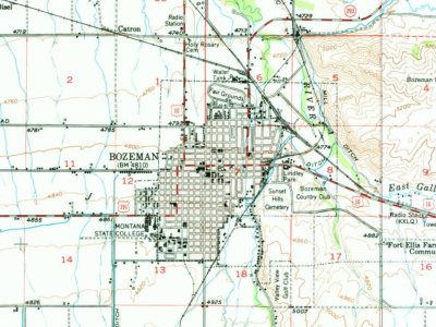
Every edition of the U.S. Geological Survey’s map of Bozeman. Tap a year, or press play to watch the town change.

Bozeman on the 1953 USGS mapBozeman on the 1987 USGS map1953Bozeman sheet · 1:62,500

U.S. Geological Survey historical topographic maps (public domain), via Esri’s collection of the scans. The red ring marks the center of Bozeman.

Every building

Bozeman, building by building, 1884–1912

Fire insurance maps drew every building, what it was made of and what it was used for, so insurers could price the risk of fire. Pick a year, then a sheet.

Bozeman fire insurance map, 1884, sheet 11884Sheet 1 of 3
Edition
BrickWoodStone

Sanborn Map Company, via the Library of Congress. Editions published in 1930 or earlier, which are in the public domain.

Then & now

Stand where they stood

No then-and-now pairs yet. Take a photo from the same spot as an old one and they appear here side by side.

23796 3283 540 Screen shot 2014 08 02 at 2 27 47 PM
Retake this view23796 3283 540 Screen shot 2014 08 02 at 2 27 47 PM, 1880

Find the spot, match the angle, and add your photo. It becomes the first then-and-now pair on Bozeman’s page.

Retake this view · +15
People over time

Bozeman, census by census

05,00010,00015,00020,00025,00030,00035,00040,00045,00050,00055,0001880190019201940196019802000202053,293

Grew from 168 people in 1870 to 53,293 in 2020, more than tenfold.

16 censuses, 1870–2020.

U.S. Census Bureau decennial counts, from the census table on Bozeman’s Wikipedia page.

Famous people

35 famous people were born in Bozeman

Writers, athletes, leaders and more, ranked by how widely they’re known.

See all →
Help out

Finish Bozeman’s story

Most archives stop around 1920. The photos from after that are in family albums, not libraries.

Decades since 1900 with photos
00s10s20s30s40s50s60s70s80s90s
2 of 10 decades. The empty ones are waiting for someone’s album.

Questions about Bozeman’s history

What year was Bozeman founded?

In 1864, according to Wikidata. the census of 1870 counted 168 people here.

How does Bozeman rank for history?

Bozeman is more historic than 62% of U.S. towns, #17 of 42 in Montana. The History grade combines the town’s founding era, the share of homes built before 1940 and its National Register listings. It’s a character grade, so it isn’t part of the overall grade. How it works.

What is on the National Register in Bozeman?

63 listings: 51 buildings, 11 historic districts with 722 contributing buildings, and 1 structure. 778 historic buildings in all.

How old are the homes in Bozeman?

9% of Bozeman’s homes were built before 1940 (Census estimate, ±1.4 points), against a typical 13% for a Montana town; the median home was built in 2000.

Memory lane

What the archives can’t tell you, neighbors can.

Town Square →
Start a conversation
Sources

Where this page comes from

Founding dates: Wikidata, Wikipedia, the U.S. post office records of Blevins & Helbock (CC0) and the Census. Homes by year built: Census ACS 2020–24. National Register of Historic Places: National Park Service (list of May 22, 2026). Old photos, postcards and papers: Wikimedia Commons, the Library of Congress and other public archives, credited on each item’s page. Maps: U.S. Geological Survey historical topographic maps (via Esri) and Sanborn fire-insurance maps (Library of Congress). History text and census tables: Wikipedia (CC BY-SA 4.0). Places that used to be: USGS Geographic Names Information System (2021).

From Wikimedia Commons (3), the Library of Congress (2), Wikidata (6), the National Register of Historic Places (63), Wikipedia, Wikidata and Wikipedia for famous people, U.S. Geological Survey historical maps, U.S. Census counts (via Wikipedia), the USGS Geographic Names Information System and Sanborn fire insurance maps (Library of Congress). Archive images are copied here with their credits and licenses, shown on each photo’s page. Refreshed monthly.