Vicksburg’s post office opened in 1824, and 15% of its homes were built before 1940
More historic than 88% of U.S. towns · #2 of 100 in Mississippi. What drives it
64 places in town are on the National Register, among them 2 National Historic Landmarks and nine historic districts with 959 buildings between them. Below: 7 old photos and papers, maps from 1886 on, and the census since 1850.
The Vicksburg post office opened in 1824, the earliest record of the town by name. Wikidata gives 1825. Four smaller post offices, Walnut Hills (1811), Warrenton (1811) and Cedars (1896), opened inside today’s city and later closed.
First census: 3,678 in 18502020 census: 21,573202 years
How historic is Vicksburg?
A
More historic than 88% of U.S. towns, on its age, its old homes and the National Register.
Founding year: the first Vicksburg post office (Blevins & Helbock, CC0). Wikidata: 1825.The full story ↓
History grade
What drives Vicksburg’s History grade
On its age, its old homes and the National Register, Vicksburg is more historic than 88% of U.S. towns, #2 of 100 in Mississippi. All 3 inputs are above most U.S. towns; its National Register listings ranks highest and its share of homes from before 1940 lowest.
A
HistoryA character grade: shown, never part of Vicksburg’s overall grade.
Mississippi towns list more on the Register than most of the country (a typical Mississippi town has 71.9 per 10,000 residents, the U.S. 2.4), so Vicksburg’s 495 sits above most of its state (89% of Mississippi towns have fewer) while its 1,020 historic buildings outnumber those of 99% of U.S. towns.
How sure. Graded on any two of the three inputs instead, the letter would range from B+ to A. The pre-1940 share (±2.7 points) is firm at this size. The founding year is the first post office, not a stated founding date; Wikidata’s 1825 falls in the same era, so the grade doesn’t depend on which one is used.
Founding year: the first post office (other dates in Quick answers). Homes: Census ACS 2020–24. National Register: National Park Service, May 2026 list; each listing counted once (boundary changes and added documentation belong to their listing), and a historic district counts its contributing buildings. How TownRatings grades history →
What stands out about Vicksburg’s past
Read from the archive, the National Register and the record. The page puts what stands out first.
The country’s official list of buildings and places worth saving. 2 are National Historic Landmarks, the highest tier. Boundary changes and added documentation are counted with their listing.
All Saints CollegeschoolCedars SchoolschoolFort GarrottmilitaryMagnolia AirportairportMarine HospitalhospitalMercy HospitalhospitalOld LandinglocaleQ and C FerrycrossingRailroad RedoubtlocaleSmedes PlantationlocaleSouth FortlocaleTwo Mile BridgebridgeWarren County Farmlocale
4cemeteries and burying grounds inside Vicksburg
BeulahCedarsCrocketTates
US Post Offices dataset (Blevins & Helbock, CC0). Places and cemeteries from the USGS Geographic Names Information System (2021).
The area that is now Vicksburg was long occupied by the Natchez Native Americans as part of their historical territory along the Mississippi. The Natchez spoke a language isolate not related to the Muskogean languages of the other major tribes in the area. Before the Natchez, other indigenous cultures had occupied this strategic area for thousands of years.
Passages that mention Vicksburg, cut from the printed page as they were published.
The history of Virgil A. Stewart, and his adventure in capturing and exposing the great "western land pirate" and his gang, in connexion with the evidence1836 · page 254Read the page →
Read the text
Blake, in the meantime, went from Livingston to Vicksburg, and thence to Natchez, where he remained a few days, and returned to Vicksburg, where he was passing himself off as an Indiana boatman at the time he was taken — five hundred dollars reward having been offered for him.
Text read by machine from the scan; it may contain errors.
Scans and text from the Internet Archive. Books published in 1930 or earlier, which are in the public domain.
Timeline
Vicksburg, 1800 to 1976
Woven from the archive, old maps, post office records, the National Register and the people born here.
Nothing in the archives for these yearsWeddings on Main Street, storms, parades, school pictures, the old store. If it’s in your family album, it belongs here.
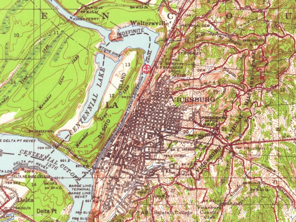
Every edition of the U.S. Geological Survey’s map of Vicksburg. Tap a year, or press play to watch the town change.
1918Vicksburg sheet · 1:62,500
U.S. Geological Survey historical topographic maps (public domain), via Esri’s collection of the scans. The red ring marks the center of Vicksburg.
Every building
Vicksburg, building by building, 1886–1913
Fire insurance maps drew every building, what it was made of and what it was used for, so insurers could price the risk of fire. Pick a year, then a sheet.
The Vicksburg post office opened in 1824, the earliest record of the town by name (U.S. post office records). Wikidata gives 1825.
How does Vicksburg rank for history?
Vicksburg is more historic than 88% of U.S. towns, #2 of 100 in Mississippi. The History grade combines the town’s founding era, the share of homes built before 1940 and its National Register listings. It’s a character grade, so it isn’t part of the overall grade. How it works.
What is on the National Register in Vicksburg?
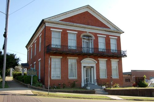
64 listings, 2 of them National Historic Landmarks: 47 buildings, among them the Old Courthouse, Warren County (a National Historic Landmark since 1968), 9 historic districts with 959 contributing buildings, 3 sites, and 5 structures. 1,020 historic buildings in all.
How old are the homes in Vicksburg?
15% of Vicksburg’s homes were built before 1940 (Census estimate, ±2.7 points), against a typical 4.5% for a Mississippi town; the median home was built in 1967.
Founding dates: Wikidata, Wikipedia, the U.S. post office records of Blevins & Helbock (CC0) and the Census. Homes by year built: Census ACS 2020–24. National Register of Historic Places: National Park Service (list of May 22, 2026). Old photos, postcards and papers: Wikimedia Commons, the Library of Congress and other public archives, credited on each item’s page. Maps: U.S. Geological Survey historical topographic maps (via Esri) and Sanborn fire-insurance maps (Library of Congress). History text and census tables: Wikipedia (CC BY-SA 4.0). Places that used to be: USGS Geographic Names Information System (2021).
From Wikimedia Commons (5), the Library of Congress (2), Wikidata (11), the National Register of Historic Places (64), Wikipedia, U.S. Geological Survey historical maps, U.S. Census counts (via Wikipedia), the US Post Offices dataset (Blevins & Helbock), the USGS Geographic Names Information System, Sanborn fire insurance maps (Library of Congress) and old county and town histories (Internet Archive). Archive images are copied here with their credits and licenses, shown on each photo’s page. Refreshed monthly.


 ★ Landmark
 ★ Landmark


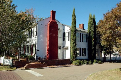


 1861
 1861
 1863