Most of Washburn was built recently: 2% of its homes predate 1940 and the median home dates from 1990. Below: maps from 1902 on and the census since 1880.
The Washburn post office opened in 1868, the earliest record of the town by name. Another post office, Washbourn (1837), opened inside today’s city and later closed.
First census: 217 in 18802020 census: 407158 years
Founding year: the first Washburn post office (Blevins & Helbock, CC0).The full story ↓
What stands out about Washburn’s past
Read from the archive, the National Register and the record. The page puts what stands out first.
Located along the historic Trail of Tears and on the Old Wire Road, and was a Butterfield Overland Mail Route Flag Stop. Keetsville traced its official settlement to Georgia native John Cureton (1795-1853), who had served as a judge in Washington County, Arkansas before settling on the Washburn Prairie about two miles north of current day Washburn in 1840 and then procured the location of the town. In 1853, Cureton died and ownership of the land transferred to the Englishman James T. Keet (1818-1863), who then laid out the town of Keetsville. The 1850s saw the first real establishment of the town with Keet establishing a store at the site. The growth of the town would be interrupted by the Civil War, as a February 1862 skirmish, a predecessor to the much larger Battle of Pea Ridge the next month in Pea Ridge, Arkansas, would result in the destruction of the fledgling town. Following the…
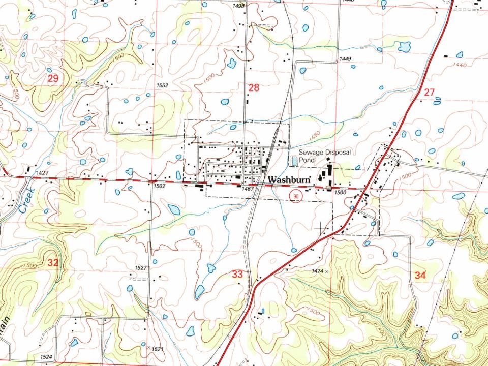
Every edition of the U.S. Geological Survey’s map of Washburn. Tap a year, or press play to watch the town change.
1937Cassville sheet · 1:62,500
U.S. Geological Survey historical topographic maps (public domain), via Esri’s collection of the scans. The red ring marks the center of Washburn.
Every building
Washburn, building by building, 1902–1914
Fire insurance maps drew every building, what it was made of and what it was used for, so insurers could price the risk of fire. Pick a year, then a sheet.
1902Sheet 1 of 1
Edition
Sheets
BrickWoodStone
Sanborn Map Company, via the Library of Congress. Editions published in 1930 or earlier, which are in the public domain.
People over time
Washburn, census by census
Between 217 and 448 people in every census since 1880.
7 censuses, 1880–2020.
U.S. Census Bureau decennial counts, from the census table on Washburn’s Wikipedia page.
Famous people
Famous people close to Washburn
Nobody well known was born in Washburn itself, so here are the best known from just nearby.
Founding dates: Wikidata, Wikipedia, the U.S. post office records of Blevins & Helbock (CC0) and the Census. Homes by year built: Census ACS 2020–24. National Register of Historic Places: National Park Service (list of May 22, 2026). Old photos, postcards and papers: Wikimedia Commons, the Library of Congress and other public archives, credited on each item’s page. Maps: U.S. Geological Survey historical topographic maps (via Esri) and Sanborn fire-insurance maps (Library of Congress). History text and census tables: Wikipedia (CC BY-SA 4.0). Places that used to be: USGS Geographic Names Information System (2021). How TownRatings grades history →
From Wikimedia Commons (1), Wikipedia, U.S. Geological Survey historical maps, U.S. Census counts (via Wikipedia), the US Post Offices dataset (Blevins & Helbock), the USGS Geographic Names Information System and Sanborn fire insurance maps (Library of Congress). Archive images are copied here with their credits and licenses, shown on each photo’s page. Refreshed monthly.

 2013