Warrensburg dates to 1835, and 12 of its places are on the National Register
More historic than 79% of U.S. towns · #45 of 247 in Missouri. What drives it
Most of Warrensburg was built recently: 8% of its homes predate 1940 and the median home dates from 1986. 12 places in town are on the National Register, among them two historic districts with 66 buildings between them. Below: 3 old photos and papers, maps from 1883 on, and the census since 1850.
Founding year: Wikipedia. First post office: 1837.The full story ↓
History grade
What drives Warrensburg’s History grade
On its age, its old homes and the National Register, Warrensburg is more historic than 79% of U.S. towns, #45 of 247 in Missouri. Its National Register listings hold the grade up; its share of homes from before 1940 pulls it down.
A−
HistoryA character grade: shown, never part of Warrensburg’s overall grade.
Missouri towns list about as much on the Register as the country (a typical Missouri town has 2.4 per 10,000 residents, the U.S. 2.4), so Warrensburg’s 39.8 sits above most of its state (87% of Missouri towns have fewer) while its 78 historic buildings outnumber those of 88% of U.S. towns.
How sure. Graded on any two of the three inputs instead, the letter would range from B to A. The pre-1940 share (±2.1 points) is firm at this size. Two sources give 1835.
Founding year: Wikipedia (other dates in Quick answers). Homes: Census ACS 2020–24. National Register: National Park Service, May 2026 list; each listing counted once (boundary changes and added documentation belong to their listing), and a historic district counts its contributing buildings. How TownRatings grades history →
What stands out about Warrensburg’s past
Read from the archive, the National Register and the record. The page puts what stands out first.
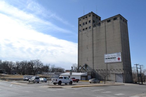
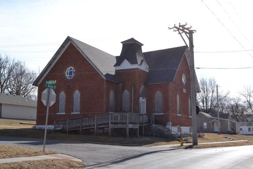
National Park Service, National Register of Historic Places. Photos from Wikimedia Commons, credited on each place’s page.
Every building
Warrensburg, building by building, 1883–1914
Fire insurance maps drew every building, what it was made of and what it was used for, so insurers could price the risk of fire. Pick a year, then a sheet.
1883Sheet 1 of 1
Edition
Sheets
BrickWoodStone
Sanborn Map Company, via the Library of Congress. Editions published in 1930 or earlier, which are in the public domain.
Warrensburg was founded in 1835 by European-American settlers John and Martin D. Warren, who gave the town their last name. A post office called Warrensburg has been in operation since 1837.
One folk etymology of the phrase "Man's best friend" places the origin of the phrase in a famous trial over the killing of Old Drum, a dog that was shot in Warrensburg. In 1958, a statue of Old Drum was erected on the Johnson County Courthouse lawn containing a summation of US Senator George G. Vest's closing speech, “A man’s best friend is his dog.”
Passages that mention Warrensburg, cut from the printed page as they were published.
History of Johnson County, Missouri1918 · page 196Read the page →
Read the text
Warrensburg Quarries. — The sandstone quarries of Warrensburg township are far famed. In 1870, Jacob Pickel, associated with his two brothers, Peter and Anton, opened at much expense and hard work the first sandstone quarry in Johnson county about two miles north of Warrensburg. A railroad switch was put in, and a steam channeling machine, the latter alone costing $6,000. The lifting was also done by machinery, run by steam.
Text read by machine from the scan; it may contain errors.
History of Johnson County, Missouri1918 · page 193Read the page →
Read the text
Early Settlements. — One of the early settlers of Warrensburg township was Martin Warren, from whom the township takes its name, who came from Kentucky about 1833 and settled on the present site of the city of Warrensburg, He built a log cabin and reared a large family here. He is described as having been a "plain, old fashioned, conser\ati\'e farmer and honest man; corpulent in person; without beard; in politics a Whig, though he never sought office," He lived to an advanced age and died here in 1850, Other early settlers who located in this
Text read by machine from the scan; it may contain errors.
Scans and text from the Internet Archive. Books published in 1930 or earlier, which are in the public domain.
Timeline
Warrensburg, 1835 to 1982
Woven from the archive, old maps, post office records, the National Register and the people born here.
Nothing in the archives for these yearsWeddings on Main Street, storms, parades, school pictures, the old store. If it’s in your family album, it belongs here.
Warrensburg’s post office has been open since 1837.
Gone or out of use
Union Prairie Schoolschool
2cemeteries and burying grounds inside Warrensburg
MaxwellSunset Hill
US Post Offices dataset (Blevins & Helbock, CC0). Places and cemeteries from the USGS Geographic Names Information System (2021).
Questions about Warrensburg’s history
What year was Warrensburg founded?
In 1835, according to Wikipedia’s history of the town. Warrensburg’s post office opened in 1837, and the census of 1850 counted 241 people here.
How does Warrensburg rank for history?
Warrensburg is more historic than 79% of U.S. towns, #45 of 247 in Missouri. The History grade combines the town’s founding era, the share of homes built before 1940 and its National Register listings. It’s a character grade, so it isn’t part of the overall grade. How it works.
What is on the National Register in Warrensburg?
12 listings: 10 buildings, among them the Johnson County Courthouse (listed 1970, the first), and 2 historic districts, the Grover Street Victorian Historic District and the Holden and Pine Streets Commercial Historic District, with 66 contributing buildings. 78 historic buildings in all.
How old are the homes in Warrensburg?
8% of Warrensburg’s homes were built before 1940 (Census estimate, ±2.1 points), against a typical 8.4% for a Missouri town; the median home was built in 1986.
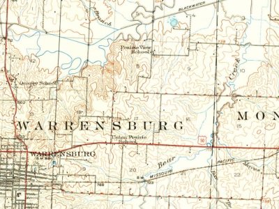
Founding dates: Wikidata, Wikipedia, the U.S. post office records of Blevins & Helbock (CC0) and the Census. Homes by year built: Census ACS 2020–24. National Register of Historic Places: National Park Service (list of May 22, 2026). Old photos, postcards and papers: Wikimedia Commons, the Library of Congress and other public archives, credited on each item’s page. Maps: U.S. Geological Survey historical topographic maps (via Esri) and Sanborn fire-insurance maps (Library of Congress). History text and census tables: Wikipedia (CC BY-SA 4.0). Places that used to be: USGS Geographic Names Information System (2021).
From Wikimedia Commons (6), the Library of Congress (1), Wikidata (7), the National Register of Historic Places (12), Wikipedia, Wikidata and Wikipedia for famous people, U.S. Geological Survey historical maps, U.S. Census counts (via Wikipedia), the US Post Offices dataset (Blevins & Helbock), the USGS Geographic Names Information System, Sanborn fire insurance maps (Library of Congress) and old county and town histories (Internet Archive). Archive images are copied here with their credits and licenses, shown on each photo’s page. Refreshed monthly.






 Date?
 2018
 2018
 2018
 2017


