Guest, Sign inJoin

Post to St. Louis

We’ll email a one-tap link to publish your post. No password, and nothing is public until you click it.
Already a member? Sign in
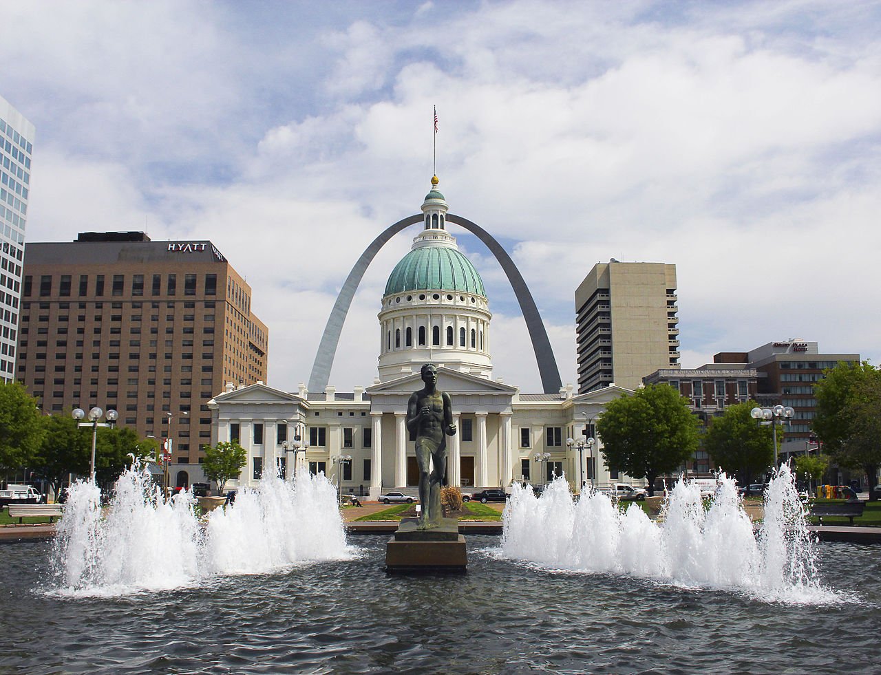
Runner Fountain and Old Courthouse and Arch (5618845531)Photo: Jefferson National Expansion Memorial, NPS from St. Louis, MO, USA · CC BY 2.0
A−Outdoors
Outdoors in St. Louis

8% of St. Louis’ land is conserved, and virtually every resident lives within a half mile of a park

Virtually every resident lives within a half mile of a park. The biggest trail networks: Forest Park (13.1 mi), Willmore Park (3 mi), Carondelet Park (2.5 mi). 8% of St. Louis’ land is conserved, about 3,004 acres.

Ahead of 82% of U.S. towns · #15 of 247 in Missouri. What drives it

Conserved land
8%
3,004 acres · of 61.7 sq mi of land
Trails
38 mi
0.6 per sq mi of land
Park land
3,935 ac
14 acres per 1,000 residents
Near a park
99%+
of residents within ½ mile
Bike routes
189 mi
67 mi lanes · 56 mi paths
Highest peak
541 ft
Art Hill
Lakes & rivers
56
1 boat launch

What kind of outdoors town is St. Louis?

Read from the map. The page puts what stands out first.

Outdoors grade

How much outdoors does St. Louis have?

On conserved land, trails, park land and how close residents live to a park, St. Louis is ahead of 82% of U.S. towns, #15 of 247 in Missouri. All four inputs are above most U.S. towns; the share of residents near a park ranks highest, park acres per resident lowest.

A−
OutdoorsA character grade: shown, never part of St. Louis’ overall grade.
All U.S. towns we grade (21,298)Ahead of 82%
LessMore
Missouri towns of 2,500+ (247)Ahead of 94%

Among the 400 U.S. cities of 100,000 or more, St. Louis ranks #166 on Outdoors.

Few Missouri towns conserve much land (a typical one, 2%; the U.S., 4%), so St. Louis’ 8% is ahead of 92% of Missouri towns, while its trails per square mile lead 74% of them.

Water is 7% of St. Louis’ area (4 of 66 square miles), so every share here is of land; over land and water together, the conserved share would read 7%.

How sure. Graded on any three of the four inputs instead, the letter would range from B+ to A. Trails and many small parks come from OpenStreetMap, mapped by volunteers, so coverage varies from town to town; the half mile is a straight line from each census block, so a river or highway in the way isn’t counted against it.

PAD-US, OpenStreetMap (© OpenStreetMap contributors), Census 2025 Gazetteer and 2020 blocks; details in Sources below. How TownRatings grades the outdoors →

The map

Conserved land, trails & bike routes

Tap a number to zoom to a park. Tap a layer to hide it.

12345678
Easements protect land from building but are usually private.© OpenStreetMap contributors · USGS PAD-US
Places to walk

Pick a walk

The longest trail network is Forest Park, with 13.1 miles. Directions go to the nearest trailhead or public parking.

Forest Park

Managed by City of St. Louis
1,345 acres13.1 mi of trail
Heels PathFlat Rock TrailPrimate Canopy Trail
Dogs on leash
Directionsto Turtle Playground ParkingWebsite ↗

Willmore Park

Managed by City of St. Louis
109 acres3 mi of trail
Dog rules not recorded
Directionsto the parking lotWebsite ↗

Carondelet Park

Managed by City of St. Louis
171 acres2.5 mi of trail
Federer’s Folly Trail
Dogs on leash
Directionsto the parking lotWebsite ↗

Tilles Park

Park
31 acres2 mi of trail
Dog rules not recorded
No trailhead mapped yet

Tower Grove Park

Managed by City of St. Louis
275 acres1.9 mi of trail
Dogs on leash
Directionsto the parking lotWebsite ↗

Missouri Botanical Garden

Park
81 acres1.5 mi of trail
Dog rules not recorded
Directionsto the parking lotWebsite ↗

Anne O’C. Albrecht Nature Playscape

Park
18 acres1.2 mi of trail
Dog rules not recorded
Directionsto the trail sign

Hyde Park

Park
12 acres1.1 mi of trail
Dog rules not recorded
Directionsto the parking lot
All 132 parks & preserves
Forest Park1,345 acres · 13.1 mi of trail · City of St. Louis
Directions
Willmore Park109 acres · 3 mi of trail · City of St. Louis
Directions
Carondelet Park171 acres · 2.5 mi of trail · City of St. Louis
Directions
Tilles Park31 acres · 2 mi of trail
Tower Grove Park275 acres · 1.9 mi of trail · City of St. Louis
Directions
Missouri Botanical Garden81 acres · 1.5 mi of trail
Directions
Anne O’C. Albrecht Nature Playscape18 acres · 1.2 mi of trail
Directions
Hyde Park12 acres · 1.1 mi of trail
Directions
North Riverfront Park159 acres · 0.9 mi of trail · City of St. Louis
Directions
O'Fallon Park137 acres · 0.8 mi of trail · City of St. Louis
Directions
Visitation Park12 acres · 0.7 mi of trail
Penrose Park59 acres · 0.6 mi of trail
Directions
Sublette Park12 acres · 0.6 mi of trail
Compton Hill Reservoir Park31 acres · 0.5 mi of trail · City of St. Louis
Directions
Filippine Garden3 acres · 0.4 mi of trail · General Services Administration
Directions
Sherman Park28 acres · 0.3 mi of trail
Directions
Laclede Park9 acres · 0.3 mi of trail
Directions
Mount Pleasant Park4 acres · 0.3 mi of trail
River Des Peres Park176 acres · 0.2 mi of trail
Directions
W. C. Handy Park12 acres · 0.2 mi of trail
Franz Park5 acres · 0.2 mi of trail
Turner Park2 acres · 0.2 mi of trail
Park-Like1 acres · 0.2 mi of trail · Pulitzer Arts Foundation
Directions
Francis Park59 acres · 0.1 mi of trail · City of St. Louis
Directions
Lafayette Park32 acres · 0.1 mi of trail · City of St. Louis
Directions
Marquette Park19 acres · 0.1 mi of trail
Lindenwood Park15 acres · 0.1 mi of trail
Fern and Russell F. de Greeff Park11 acres · 0.1 mi of trail
Directions
Ruth Porter Mall Park10 acres · 0.1 mi of trail · City of St. Louis
Directions
Lyon Park10 acres · 0.1 mi of trail · City of St. Louis
Directions
Gregory J. Carter Park9 acres · 0.1 mi of trail · City of St. Louis
Citygarden4 acres · 0.1 mi of trail
Directions
Fremont Park2 acres · 0.1 mi of trail
Directions
Pontiac Square Park2 acres · 0.1 mi of trail · City of St. Louis
Strodtman Park2 acres · 0.1 mi of trail
Directions
Carol Gates Throop Memorial Park1 acres · 0.1 mi of trail
Directions
Kingsbury Square Park1 acres · 0.1 mi of trail
Directions
Unity Park1 acres · 0.1 mi of trail
GHV Terrace Garden1 acres · 0.1 mi of trail
Fairground Park128 acres · City of St. Louis
Directions
Gateway Arch National Park78 acres · National Park Service
Directions
St. Marcus Park31 acres · City of St. Louis
Directions
Benton Park16 acres · City of St. Louis
Directions
Saint Louis Place Park16 acres · City of St. Louis
Directions
Barrett Brothers Park15 acres · City of St. Louis
Directions
Joe Leisure Park15 acres · City of St. Louis
Hickey Park14 acres · City of St. Louis
Chain of Rocks Park13 acres · Great Rivers Greenway
Directions
Christy Park11 acres · City of St. Louis
Directions
Saint Louis Zoo Annex11 acres
Directions
River Des Peres Extension11 acres · City of St. Louis
Directions
Memorial Plaza10 acres · City of St. Louis
Directions
DeSoto Park10 acres · City of St. Louis
Directions
Gravois Park9 acres · City of St. Louis
Busche Park8 acres · City of St. Louis
Flora Place Park7 acres
Directions
Francis R Slay Park7 acres
Directions
Ray Leisure Park7 acres · City of St. Louis
Directions
Clifton Heights Park7 acres · City of St. Louis
Chambers Park7 acres · City of St. Louis
Directions
Pagoda Circle7 acres
Directions
Bellerive Park7 acres · City of St. Louis
Directions
Jet Banks Park7 acres · City of St. Louis
Directions
Tandy Park6 acres
Directions
Gwen Giles Park6 acres
Dickman Park6 acres · City of St. Louis
Cherokee Park6 acres · City of St. Louis
Directions
Berra Park6 acres · City of St. Louis
Sister Marie Charles Park5 acres · City of St. Louis
Directions
Minnie Wood Memorial Square5 acres · City of St. Louis
Alaska Park5 acres · City of St. Louis
Directions
Father Filipiak Park5 acres · City of St. Louis
Directions
Scott Joplin House State Historic Site5 acres · Missouri State Parks
Directions
Loretta Hall Park4 acres · City of St. Louis
Terry Park4 acres · City of St. Louis
Lucier Park4 acres · City of St. Louis
Directions
Yeatman Square Park4 acres · City of St. Louis
Eads Square Park4 acres · City of St. Louis
Amherst Park4 acres · City of St. Louis
Fox Park4 acres · City of St. Louis
Directions
Eugene "Tink" Bradley Park4 acres · City of St. Louis
Beckett Park4 acres · City of St. Louis
Robert J. Baer Plaza4 acres
Directions
Kiener Plaza4 acres · City of St. Louis Parks Division
Directions
Chouteau Park4 acres · City of St. Louis
Directions
McDonald Park4 acres
Fountain Park3 acres · City of St. Louis
Directions
Norman Seay Park3 acres · City of St. Louis
Directions
Buder Park3 acres · City of St. Louis
Directions
Amberg Park3 acres · City of St. Louis
Directions
Mestres Park3 acres · City of St. Louis
Directions
Rumbold Park3 acres
Murphy Park3 acres · City of St. Louis
Directions
Soulard Market Park3 acres · City of St. Louis
Directions
Lemay Park2 acres · St. Louis County
Directions
Aloe Plaza2 acres · City of St. Louis
Directions
Frank Williamson Sr. Park2 acres · City of St. Louis
Cortex Commons2 acres · Cortex Innovation District
Directions
Jackson Place Park2 acres · City of St. Louis
Directions
Washington Square Park2 acres · City of St. Louis
Directions
Carondelet Lions Park2 acres · City of St. Louis
Kaufmann Park2 acres · City of St. Louis
Directions
Hamilton Heights Park2 acres
Directions
Carnegie Park2 acres · City of St. Louis
Directions
Eternal Flame Park2 acres · City of St. Louis
Directions
Luther Ely Smith Square2 acres
Directions
St. Louis Square Park2 acres · City of St. Louis
Directions
Adams Park2 acres · City of St. Louis
Directions
Poelker Park2 acres · City of St. Louis
Directions
Minnesota and Hill Park1 acres · City of St. Louis
Tiffany Park1 acres · City of St. Louis
Directions
Vivian Astra Park1 acres
Serra Sculpture Park1 acres · City of St. Louis
Directions
Peace Park1 acres
Directions
Lucas Gardens Park1 acres · City of St. Louis
Directions
Russell Park1 acres
Aloe Plaza West1 acres · City of St. Louis
Directions
Lafayette Park Historic Baseball Field1 acres
Directions
Ellen Clark Sculpture Park1 acres
Directions
Father Maurice J. Nutt Park1 acres · Saint Louis University
Directions
Fanetti Plaza1 acres
Bank of America Plaza1 acres
Directions
Peabody Plaza1 acres
Directions
Laclede’s Landing Active Art Park1 acres · Pocketparks
Directions
Janet B. Wood Park1 acres
Directions
Strauss Park1 acres · Grand Center Inc.
Directions
Triangle Park Plaza1 acres · Bi-State Development Agency
Directions
Fountain Park Plaza1 acres
Directions
William L. Clay Sr. Sculpture Park1 acres
Botanical Heights Playground1 acres · Botanical Heights Neighborhood Association
Soulard Community Garden1 acres · Gateway Greening Land Trust
Directions
Columbus Square Park1 acres · City of St. Louis
Who protects it

3,004 conserved acres

8% of St. Louis’ land. Water is left out: St. Louis has 61.7 square miles of land and 4.5 of water, so the share counts land only. Who manages St. Louis’s conserved land, from the USGS Protected Areas Database. Approximate, because parcels can overlap.

Town or city2,868 ac
National Park Service89 ac
Land trusts & nonprofits23 ac
Private owners22 ac
Regional agency22 ac
Other or Unknown Local Government7 ac
Other state land6 ac
Local Park · 2,911 acNational Park · 85 acLocal Recreation Area · 19 acLocal Conservation Area · 13 acLocal Other or Unknown · 11 ac
The biggest protected parcels
Parcel (PAD-US)Managed byAcresPublic access
Forest Park
Local Park
Town or city1,277Open
Tower Grove Park
Local Park
Town or city266Open
Willmore Park
Local Park
Town or city189Open
River Des Peres Park
Local Park
Town or city90Open
Gateway Arch National Park
National Park
National Park Service85Open
St. Louis Riverfront Trail
Local Park
Town or city81Open
Jefferson National Expansion Memorial
Local Park
Town or city70Open
Chain Of Rocks Park
Local Park
Town or city63Open
David R Francis Park
Local Park
Town or city56Open
Penrose Park
Local Park
Town or city56Open

5 smaller protected places aren’t shown.

Things to do

365 places to go in St. Louis

Beaches, playgrounds, peaks, falls and more. Pick a kind.

Playgrounds in St. Louis
Amberg PlaygroundIn Amberg Park
Directions
Amherst PlaygroundIn Amherst Park
Directions
Beckett PlaygroundIn Beckett Park
Directions
Benton Park PlaygroundIn Benton Park
Directions
Carondelet Lions PlaygroundIn Carondelet Lions Park
Directions
Christy Park PlaygroundIn Christy Park
Directions
Eads Park PlaygroundIn Eads Square Park
Directions
East PlaygroundIn Tower Grove Park
Directions
16 more playgrounds
Gravois Park PlaygroundIn Gravois Park
Directions
Jackson Place Park PlaygroundIn Jackson Place Park
Directions
Juanita Park
Directions
Juanita Park
Directions
Lafayette Park PlaygroundIn Lafayette Park
Directions
Loretta Hall PlaygroundIn Loretta Hall Park
Directions
Lucas Garden PlaygroundIn Lucas Gardens Park
Directions
Lucier Park PlaygroundIn Lucier Park
Directions
Margo Anderson PlaygroundIn Hamilton Heights Park
Directions
Norman Seay PlaygroundIn Norman Seay Park
Directions
Oakland Avenue PlaygroundIn Forest Park
Directions
Rainbow Park
Directions
Richard Hudlin PlaygroundIn Forest Park
Directions
Turtle PlaygroundIn Forest Park
Directions
Twin Snakes PlaygroundIn Francis Park
Directions
Variety Wonderland PlaygroundIn Forest Park
Directions

261 playgrounds are on OpenStreetMap in all; the list shows named ones from the first 30.

Trails & water

4 named trails and 53 lakes & rivers

Biking & sports

189 miles of bike routes

Bike lanes are often missing from the map in smaller towns, so that number is likely low.

67 mi
painted or protected bike lanes
56 mi
off-road bike paths
66 mi
shoulders & shared lanes
Courts & fields
126Tennis
55Basketball
45Pickleball
41Baseball
39Soccer
39Softball
17Football
12Tracks

Includes school and college facilities, which aren’t always open to the public.

History along the way

444 places on the National Register, 13 of them National Historic Landmarks

The country’s official list of places worth saving (National Park Service). The map also marks 80 historic points from OpenStreetMap: plaques, memorials and old buildings.

History →
★
Jefferson National Expansion Memorial National Historic SiteNational Historic Landmark · District · listed 1966
About it
★
Anheuser-Busch BreweryNational Historic Landmark · District · listed 1966
About it
★
Wainwright BuildingNational Historic Landmark · Building · listed 1968
About it
★
U.S. Customhouse and Post OfficeNational Historic Landmark · Building · listed 1968
About it
★
St. Louis Union StationNational Historic Landmark · Building · listed 1970
About it
★
Missouri Botanical GardensNational Historic Landmark · District · listed 1971
About it
★
Tower Grove ParkNational Historic Landmark · District · listed 1972
About it
★
Eugene Field HouseNational Historic Landmark · Building · listed 1975
About it
★
Joseph Erlanger HouseNational Historic Landmark · Building · listed 1976
About it
★
Scott Joplin HouseNational Historic Landmark · Building · listed 1976
About it
★
Gateway ArchNational Historic Landmark · Structure · listed 1987
About it
★
Shelley HouseNational Historic Landmark · Building · listed 1988
About it

432 more on the History page.

When to get out

The walking year in St. Louis

NOAA’s 1991–2020 normals for the town and the daylight at its latitude. Outlined months have long days, highs of 59 to 86 °F and little rain for the place.

JanFebMarAprMayJunJulAugSepOctNovDec
Daylight (h)9.710.711.813.214.314.914.613.712.411.110.09.5
High (°F)404556687785888780695544
Rain (in)2.52.13.44.64.94.43.93.43.43.13.42.7

February is the driest month (2.1 in) and July the warmest (highs of 88 °F). 4.9 inches fall in May, the wettest month. Summer highs reach 88 °F, too hot for the outline. The climate in St. Louis →

Next door

St. Louis and its neighbors

St. Louis has the most mapped trails of the 8 towns around it. Tap a town to see its outdoors.

TownConserved
of land
Trail mi
per sq mi
Park acres
per 1,000
Near a park
½ mile
Outdoors
St. Louis8%0.61499%+A−
Lemay3%0.1480%C+
Clayton6%0.6799%+B+
Riverviewunder 1%under 0.1196%C−
Richmond Heightsunder 1%under 0.1196%C−

The four inputs of the Outdoors grade, from the engine; shares are of land, not water.

Questions about parks and trails in St. Louis

Where can I hike in St. Louis?

The longest trail networks: Forest Park, 13.1 miles; Willmore Park, 3 miles; Carondelet Park, 2.5 miles; Tilles Park, 2 miles. Each one is on the map above, with directions to the nearest trailhead or parking.

How much of St. Louis is conserved land?

8% of its land, against a typical 2% for a Missouri town and 4% nationally (PAD-US). Conserved doesn’t always mean open to visitors: easements are usually private land.

Are dogs allowed on St. Louis’ trails?

OpenStreetMap records dogs as welcome at Forest Park (on leash), Carondelet Park (on leash) and Tower Grove Park (on leash). For the rest, check the signs at the trailhead.

Where can I bike in St. Louis?

189 miles of bike routes are on the map: 67 of painted or protected lanes, 56 of off-road paths and 66 of shoulders and shared lanes.

Is there public land near St. Louis?

31,308 acres of parks and open public land lie inside St. Louis or within 10 miles of it (PAD-US), 3,935 of them inside the city line.

How much outdoors does St. Louis have?

Ahead of 82% of U.S. towns on the Outdoors grade, #15 of 247 in Missouri. The grade combines the share of land that is conserved, miles of mapped trail per square mile of land, park acres per 1,000 residents and the share of residents within a half mile of a park. It’s a character grade, so it isn’t part of the overall grade. How it works.

Trail talk

Conditions, parking and favorite walks from St. Louis neighbors.

Town Square →
Share a tip
Sources

Where this page comes from

Conserved and public land: USGS Protected Areas Database of the United States (PAD-US), service updated July 2026. Parks, trails, playgrounds, beaches and other places: OpenStreetMap (© OpenStreetMap contributors, ODbL), map data as of 2026-10-28. Land and water area: Census 2025 Gazetteer. Residents near a park: 2020 Census blocks. National Register: National Park Service. How TownRatings grades the outdoors →